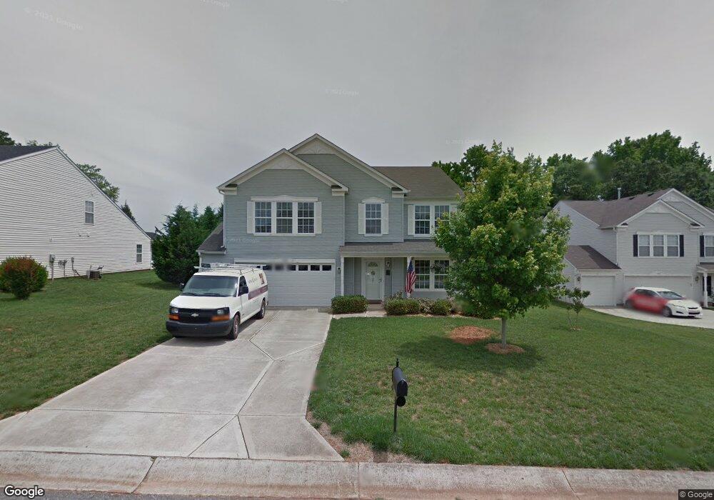
1989 Leesburg Dr Clover, SC 29710
Estimated Value: $358,000 - $399,000
--
Bed
--
Bath
2,840
Sq Ft
$137/Sq Ft
Est. Value
About This Home
This home is located at 1989 Leesburg Dr, Clover, SC 29710 and is currently estimated at $388,192, approximately $136 per square foot. 1989 Leesburg Dr is a home with nearby schools including Griggs Road Elementary School, Clover Middle School, and Clover High School.
Ownership History
Date
Name
Owned For
Owner Type
Purchase Details
Closed on
Jan 3, 2006
Sold by
The Matherson Co Inc
Bought by
C P Morgan Communities Of Charlotte Llc
Current Estimated Value
Purchase Details
Closed on
Mar 1, 2005
Sold by
C P Morgan Communities Of Charlotte Llc
Bought by
Tellier Alfred G and Tellier Anita L
Home Financials for this Owner
Home Financials are based on the most recent Mortgage that was taken out on this home.
Original Mortgage
$139,885
Interest Rate
6.19%
Mortgage Type
New Conventional
Create a Home Valuation Report for This Property
The Home Valuation Report is an in-depth analysis detailing your home's value as well as a comparison with similar homes in the area
Home Values in the Area
Average Home Value in this Area
Purchase History
| Date | Buyer | Sale Price | Title Company |
|---|---|---|---|
| C P Morgan Communities Of Charlotte Llc | $137,137 | -- | |
| Tellier Alfred G | $174,857 | None Available |
Source: Public Records
Mortgage History
| Date | Status | Borrower | Loan Amount |
|---|---|---|---|
| Previous Owner | Tellier Alfred G | $139,885 |
Source: Public Records
Tax History Compared to Growth
Tax History
| Year | Tax Paid | Tax Assessment Tax Assessment Total Assessment is a certain percentage of the fair market value that is determined by local assessors to be the total taxable value of land and additions on the property. | Land | Improvement |
|---|---|---|---|---|
| 2024 | $692 | $6,900 | $1,206 | $5,694 |
| 2023 | $710 | $6,900 | $1,210 | $5,690 |
| 2022 | $585 | $6,900 | $1,210 | $5,690 |
| 2021 | -- | $6,900 | $1,210 | $5,690 |
| 2020 | $781 | $6,900 | $0 | $0 |
| 2019 | $741 | $6,000 | $0 | $0 |
| 2018 | $745 | $6,000 | $0 | $0 |
| 2017 | $462 | $6,000 | $0 | $0 |
| 2016 | $436 | $6,000 | $0 | $0 |
| 2014 | $832 | $6,000 | $1,000 | $5,000 |
| 2013 | $832 | $7,300 | $1,200 | $6,100 |
Source: Public Records
Map
Nearby Homes
- 1958 Leesburg Dr
- 1965 Leesburg Dr
- 1961 Leesburg Dr
- 1909 Leesburg Dr
- 1300 Dunmore Ct
- 961 Poplar Forest Ridge
- 735 Langley Ct
- 3063 Riker St Unit 16
- 3079 Riker St
- 4306 Penrose Ct
- 1876 Tradd Ave
- 2599 Highway 557 None
- 1821 Tradd Ave
- 1817 Tradd Ave
- 2104 Gillette Dr
- 179 N Paraham Rd
- 1288 Century Dr
- 1280 Century Dr
- 1219 Century Dr
- 3039 S Paraham Rd
- 1985 Leesburg Dr
- 1985 Leesburg Dr Unit 188
- 1993 Leesburg Dr
- 1981 Leesburg Dr
- 1990 Leesburg Dr
- 1986 Leesburg Dr
- 1982 Leesburg Dr
- 1995 Leesburg Dr
- 1994 Leesburg Dr
- 1999 Leesburg Dr
- 1978 Leesburg Dr
- 1977 Leesburg Dr
- 1998 Leesburg Dr
- 2127 Drewman Place
- 2127 Drewman Place
- 1970 Leesburg Dr
- 2123 Drewman Place
- 2129 Drewman Place
- 1973 Leesburg Dr
- 1962 Leesburg Dr