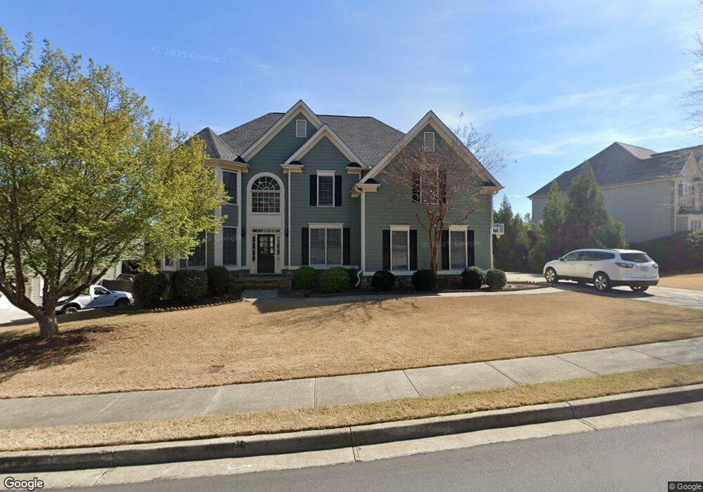
1989 Mapmaker Dr Unit 3 Dacula, GA 30019
Estimated Value: $615,000 - $665,000
4
Beds
4
Baths
3,868
Sq Ft
$168/Sq Ft
Est. Value
About This Home
This home is located at 1989 Mapmaker Dr Unit 3, Dacula, GA 30019 and is currently estimated at $649,193, approximately $167 per square foot. 1989 Mapmaker Dr Unit 3 is a home located in Gwinnett County with nearby schools including Fort Daniel Elementary School, Frank N. Osborne Middle School, and Mill Creek High School.
Ownership History
Date
Name
Owned For
Owner Type
Purchase Details
Closed on
Jun 24, 2014
Sold by
Blount Kelli D
Bought by
Blount Kelli D and Blount Robert M
Current Estimated Value
Home Financials for this Owner
Home Financials are based on the most recent Mortgage that was taken out on this home.
Original Mortgage
$274,550
Outstanding Balance
$207,980
Interest Rate
4.17%
Mortgage Type
New Conventional
Estimated Equity
$441,213
Purchase Details
Closed on
Jul 30, 2004
Sold by
Summerhill Homes Inc
Bought by
Neal Joel S and Neal Sharon
Home Financials for this Owner
Home Financials are based on the most recent Mortgage that was taken out on this home.
Original Mortgage
$160,000
Interest Rate
5.97%
Mortgage Type
New Conventional
Purchase Details
Closed on
Mar 30, 2004
Sold by
Suntrust Bk
Bought by
Summerhill Hms
Create a Home Valuation Report for This Property
The Home Valuation Report is an in-depth analysis detailing your home's value as well as a comparison with similar homes in the area
Home Values in the Area
Average Home Value in this Area
Purchase History
| Date | Buyer | Sale Price | Title Company |
|---|---|---|---|
| Blount Kelli D | $289,000 | -- | |
| Blount Kelli D | $289,000 | -- | |
| Neal Joel S | $313,200 | -- | |
| Summerhill Hms | -- | -- |
Source: Public Records
Mortgage History
| Date | Status | Borrower | Loan Amount |
|---|---|---|---|
| Open | Blount Kelli D | $274,550 | |
| Closed | Blount Kelli D | $274,550 | |
| Previous Owner | Neal Joel S | $160,000 |
Source: Public Records
Tax History
| Year | Tax Paid | Tax Assessment Tax Assessment Total Assessment is a certain percentage of the fair market value that is determined by local assessors to be the total taxable value of land and additions on the property. | Land | Improvement |
|---|---|---|---|---|
| 2025 | $7,625 | $286,640 | $44,000 | $242,640 |
| 2024 | $7,617 | $277,560 | $47,200 | $230,360 |
| 2023 | $7,617 | $256,000 | $47,200 | $208,800 |
| 2022 | $6,332 | $216,440 | $41,200 | $175,240 |
| 2021 | $5,238 | $161,360 | $29,400 | $131,960 |
| 2020 | $5,275 | $161,360 | $29,400 | $131,960 |
| 2019 | $4,483 | $131,560 | $21,600 | $109,960 |
| 2018 | $4,491 | $131,560 | $21,600 | $109,960 |
| 2016 | $4,556 | $133,560 | $21,600 | $111,960 |
| 2015 | $4,154 | $113,280 | $20,000 | $93,280 |
| 2014 | -- | $110,160 | $20,000 | $90,160 |
Source: Public Records
Map
Nearby Homes
- 1958 Mapmaker Dr
- 1838 Mapmaker Dr
- 2727 Captain Ct
- 1728 Scouts Walk NE
- 1720 Fort Daniels Trail
- 2755 Fort Daniels Dr
- 1515 Brisbane Dr
- 1714 Fort Shawnee Trace Unit 6
- 2461 Lance Ridge Way
- 2628 Adair Trail
- 1608 School House Run
- 2678 Adair Trail
- 1521 Rocky Knoll Ln
- 2159 Shin Ct
- 1458 Whitaker Park Place
- 1418 Wilkes Ive Dr
- 1405 La Maison Dr Unit I
- 2950 Belshire Trail
- 1455 Wilkes Crest Dr
- 1540 La Maison Dr
- 2009 Mapmaker Dr
- 1969 Mapmaker Dr
- 2029 Mapmaker Dr
- 2512 Hidden Path Trace
- 2039 Mapmaker Dr Unit 3
- 2502 Hidden Path Trace
- 1988 Mapmaker Dr
- 1988 Mapmaker Dr Unit 3
- 1998 Mapmaker Dr Unit 212
- 1998 Mapmaker Dr Unit 3
- 1604 Fort Mason Way Unit 3
- 1605 Fort Mason Way
- 1978 Mapmaker Dr
- 1769 Mapmaker Dr Unit 3
- 2525 Hidden Path Trace Unit 3
- 2008 Mapmaker Dr Unit 3
- 2018 Mapmaker Dr
- 2018 Mapmaker Dr Unit 3
- 2049 Mapmaker Dr
- 2049 Mapmaker Dr NE
Your Personal Tour Guide
Ask me questions while you tour the home.