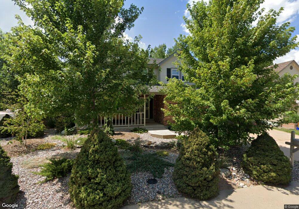
1989 S Lansing Ct Aurora, CO 80014
Village East NeighborhoodEstimated Value: $594,000 - $682,000
4
Beds
3
Baths
3,927
Sq Ft
$163/Sq Ft
Est. Value
About This Home
This home is located at 1989 S Lansing Ct, Aurora, CO 80014 and is currently estimated at $640,356, approximately $163 per square foot. 1989 S Lansing Ct is a home located in Arapahoe County with nearby schools including Ponderosa Elementary School, Prairie Middle School, and Overland High School.
Ownership History
Date
Name
Owned For
Owner Type
Purchase Details
Closed on
Aug 3, 2021
Sold by
Magriso Haim and Eisenberg Magriso Jena
Bought by
Hommes Kyle R and Hommes Anna K
Current Estimated Value
Home Financials for this Owner
Home Financials are based on the most recent Mortgage that was taken out on this home.
Original Mortgage
$440,000
Outstanding Balance
$400,693
Interest Rate
3%
Mortgage Type
New Conventional
Estimated Equity
$239,663
Purchase Details
Closed on
Aug 26, 2014
Sold by
Mesfin Ghenet
Bought by
Magriso Haim and Eisenberg Magriso Jenna Elissa
Home Financials for this Owner
Home Financials are based on the most recent Mortgage that was taken out on this home.
Original Mortgage
$265,600
Interest Rate
3.75%
Mortgage Type
Adjustable Rate Mortgage/ARM
Purchase Details
Closed on
Jun 5, 2007
Sold by
Teame Mesfin Ghenet and Teame Gebretinsae
Bought by
Not Provided
Purchase Details
Closed on
Jan 26, 2006
Sold by
Kennedy Rock L and Kennedy Andrea
Bought by
Mesfin Ghenet
Home Financials for this Owner
Home Financials are based on the most recent Mortgage that was taken out on this home.
Original Mortgage
$247,200
Interest Rate
6.24%
Mortgage Type
Fannie Mae Freddie Mac
Purchase Details
Closed on
Sep 5, 1997
Sold by
Kennedy Rock L
Bought by
Kennedy Rock L and Kennedy Andrea
Home Financials for this Owner
Home Financials are based on the most recent Mortgage that was taken out on this home.
Original Mortgage
$65,000
Interest Rate
6.5%
Purchase Details
Closed on
Apr 30, 1997
Sold by
Wedding Elaine M
Bought by
Kennedy Rock L
Home Financials for this Owner
Home Financials are based on the most recent Mortgage that was taken out on this home.
Original Mortgage
$164,000
Interest Rate
10.7%
Purchase Details
Closed on
Nov 16, 1994
Sold by
Kuhn Kevin J and Kuhn Margaret M
Bought by
Wedding Elaine M
Home Financials for this Owner
Home Financials are based on the most recent Mortgage that was taken out on this home.
Original Mortgage
$97,500
Interest Rate
5.87%
Purchase Details
Closed on
May 19, 1988
Sold by
Conversion Arapco
Bought by
Kuhn Kevin J Kuhn Margaret M
Purchase Details
Closed on
Jan 30, 1986
Bought by
Conversion Arapco
Create a Home Valuation Report for This Property
The Home Valuation Report is an in-depth analysis detailing your home's value as well as a comparison with similar homes in the area
Home Values in the Area
Average Home Value in this Area
Purchase History
| Date | Buyer | Sale Price | Title Company |
|---|---|---|---|
| Hommes Kyle R | $550,000 | Fidelity National Title | |
| Magriso Haim | $332,000 | None Available | |
| Not Provided | -- | None Available | |
| Mesfin Ghenet | $309,000 | Land Title | |
| Kennedy Rock L | -- | Stewart Title | |
| Kennedy Rock L | $205,000 | -- | |
| Wedding Elaine M | $194,000 | -- | |
| Kuhn Kevin J Kuhn Margaret M | -- | -- | |
| Conversion Arapco | -- | -- |
Source: Public Records
Mortgage History
| Date | Status | Borrower | Loan Amount |
|---|---|---|---|
| Open | Hommes Kyle R | $440,000 | |
| Previous Owner | Magriso Haim | $265,600 | |
| Previous Owner | Mesfin Ghenet | $247,200 | |
| Previous Owner | Kennedy Rock L | $65,000 | |
| Previous Owner | Kennedy Rock L | $164,000 | |
| Previous Owner | Wedding Elaine M | $97,500 |
Source: Public Records
Tax History Compared to Growth
Tax History
| Year | Tax Paid | Tax Assessment Tax Assessment Total Assessment is a certain percentage of the fair market value that is determined by local assessors to be the total taxable value of land and additions on the property. | Land | Improvement |
|---|---|---|---|---|
| 2024 | $2,680 | $38,739 | -- | -- |
| 2023 | $2,680 | $38,739 | $0 | $0 |
| 2022 | $2,301 | $31,762 | $0 | $0 |
| 2021 | $2,315 | $31,762 | $0 | $0 |
| 2020 | $2,407 | $33,513 | $0 | $0 |
| 2019 | $2,322 | $33,513 | $0 | $0 |
| 2018 | $2,312 | $31,363 | $0 | $0 |
| 2017 | $2,279 | $31,363 | $0 | $0 |
| 2016 | $2,145 | $27,677 | $0 | $0 |
| 2015 | $2,041 | $27,677 | $0 | $0 |
| 2014 | -- | $17,584 | $0 | $0 |
| 2013 | -- | $19,770 | $0 | $0 |
Source: Public Records
Map
Nearby Homes
- 1960 S Lansing Ct
- 1958 S Kingston Ct
- 1967 S Kingston Ct
- 1923 S Newark Way
- 2017 S Nome St
- 2213 S Kingston Ct
- 11457 E Warren Place
- 2237 S Kenton Way
- 11306 E Colorado Dr
- 2247 S Lima Ct
- 11196 E Baltic Dr
- 11742 E Jewell Place
- 2275 S Kenton St
- 2242 S Moline Ct
- 10594 E Jewell Ave
- 2216 S Nile Ct
- 2238 S Nile Ct
- 2324 S Kingston St
- 1977 S Oakland Way
- 2218 S Iola St
- 1979 S Lansing Ct
- 1988 S Kingston Ct
- 2001 S Lansing Ct
- 1959 S Lansing Ct
- 1978 S Kingston Ct
- 1990 S Lansing Ct
- 1980 S Lansing Ct
- 1968 S Kingston Ct
- 2000 S Kingston Ct
- 2011 S Lansing Ct
- 2002 S Lansing Ct
- 1949 S Lansing Ct
- 2012 S Lansing Ct
- 2010 S Kingston Ct
- 1950 S Lansing Ct
- 2021 S Lansing Ct
- 1939 S Lansing Ct
- 11101 E Asbury Ave
- 1940 S Lansing Ct
- 1977 S Kingston Ct