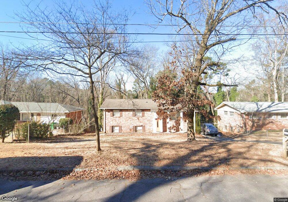
1989 Shannon Ridge Decatur, GA 30032
Estimated Value: $269,607 - $348,000
4
Beds
2
Baths
2,024
Sq Ft
$159/Sq Ft
Est. Value
About This Home
This home is located at 1989 Shannon Ridge, Decatur, GA 30032 and is currently estimated at $321,402, approximately $158 per square foot. 1989 Shannon Ridge is a home located in DeKalb County with nearby schools including Toney Elementary School, Columbia Middle School, and Columbia High School.
Ownership History
Date
Name
Owned For
Owner Type
Purchase Details
Closed on
Sep 13, 2016
Sold by
Atlanta Investments Services L
Bought by
Irwin Carlos A Soto
Current Estimated Value
Home Financials for this Owner
Home Financials are based on the most recent Mortgage that was taken out on this home.
Original Mortgage
$126,000
Outstanding Balance
$100,371
Interest Rate
3.43%
Mortgage Type
New Conventional
Estimated Equity
$221,031
Purchase Details
Closed on
Apr 29, 2016
Sold by
Johnson Trustee
Bought by
Atlanta Investments Svcs Llc
Purchase Details
Closed on
Nov 16, 2011
Sold by
Citifinancial Inc
Bought by
1989 Shannon Ridge Court Land Trust
Purchase Details
Closed on
Apr 5, 2011
Sold by
Armour Christine
Bought by
Citifinancial Inc
Create a Home Valuation Report for This Property
The Home Valuation Report is an in-depth analysis detailing your home's value as well as a comparison with similar homes in the area
Home Values in the Area
Average Home Value in this Area
Purchase History
| Date | Buyer | Sale Price | Title Company |
|---|---|---|---|
| Irwin Carlos A Soto | $157,500 | -- | |
| Atlanta Investments Svcs Llc | $58,500 | -- | |
| 1989 Shannon Ridge Court Land Trust | $15,900 | -- | |
| Citifinancial Inc | $25,856 | -- |
Source: Public Records
Mortgage History
| Date | Status | Borrower | Loan Amount |
|---|---|---|---|
| Open | Irwin Carlos A Soto | $126,000 |
Source: Public Records
Tax History Compared to Growth
Tax History
| Year | Tax Paid | Tax Assessment Tax Assessment Total Assessment is a certain percentage of the fair market value that is determined by local assessors to be the total taxable value of land and additions on the property. | Land | Improvement |
|---|---|---|---|---|
| 2025 | $2,969 | $108,640 | $23,320 | $85,320 |
| 2024 | $3,030 | $108,920 | $23,320 | $85,600 |
| 2023 | $3,030 | $115,320 | $23,320 | $92,000 |
| 2022 | $2,820 | $102,920 | $13,320 | $89,600 |
| 2021 | $2,455 | $87,120 | $13,320 | $73,800 |
| 2020 | $2,352 | $82,440 | $11,400 | $71,040 |
| 2019 | $2,196 | $76,320 | $11,400 | $64,920 |
| 2018 | $1,779 | $71,440 | $11,400 | $60,040 |
| 2017 | $1,495 | $43,920 | $3,040 | $40,880 |
| 2016 | $1,439 | $24,800 | $3,040 | $21,760 |
| 2014 | $631 | $6,360 | $600 | $5,760 |
Source: Public Records
Map
Nearby Homes
- 1973 Glendale Dr
- 2962 Mcafee Rd
- 2952 Mcafee Rd
- 3110 Mcafee Rd
- 2003 Rosewood Rd
- 2048 Glendale Dr
- 1968 Rosewood Rd
- 2922 Dale Place
- 1996 Meadow Ln
- 1932 Rosewood Rd
- 2024 Rosewood Rd
- 2917 Mcafee Rd
- 1923 Rosewood Rd
- 1875 Creekside Ct
- 1981 Meadow Ln
- 2099 Yucca Dr
- 1911 Rosewood Rd
- 2995 Katherine Valley Rd
- 3168 Mcafee Rd
- 1909 Meadow Ln
- 1989 Shannon Ridge Ct
- 1983 Shannon Ridge Ct
- 1995 Shannon Ridge Ct
- 0 Shannon Ridge Ct Unit 7527881
- 0 Shannon Ridge Ct Unit 3211904
- 0 Shannon Ridge Ct Unit 8506467
- 0 Shannon Ridge Ct Unit 3131256
- 0 Shannon Ridge Ct Unit 7193938
- 0 Shannon Ridge Ct Unit 7358629
- 0 Shannon Ridge Ct Unit 7334223
- 0 Shannon Ridge Ct Unit 7283954
- 0 Shannon Ridge Ct
- 1977 Shannon Ridge Ct
- 2003 Shannon Ridge Ct
- 1988 Shannon Ridge Ct
- 1982 Shannon Ridge Ct
- 1994 Shannon Ridge Ct
- 1969 Shannon
- 1969 Shannon Ridge Ct
- 1976 Shannon Ridge Ct