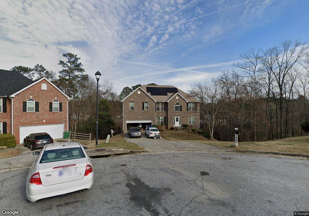
1989 Tuttle Ave Conley, GA 30288
Southwest DeKalb NeighborhoodEstimated Value: $349,000 - $434,000
4
Beds
4
Baths
3,248
Sq Ft
$121/Sq Ft
Est. Value
About This Home
This home is located at 1989 Tuttle Ave, Conley, GA 30288 and is currently estimated at $394,561, approximately $121 per square foot. 1989 Tuttle Ave is a home located in DeKalb County with nearby schools including Cedar Grove Elementary School, Cedar Grove Middle School, and Cedar Grove High School.
Ownership History
Date
Name
Owned For
Owner Type
Purchase Details
Closed on
Mar 15, 2024
Sold by
Stanford Deloris
Bought by
Stanford Deloris and Stanford Winston
Current Estimated Value
Purchase Details
Closed on
Dec 1, 2005
Sold by
Eastland Homes Inc
Bought by
Southern Residential Group
Home Financials for this Owner
Home Financials are based on the most recent Mortgage that was taken out on this home.
Original Mortgage
$231,063
Interest Rate
6.23%
Mortgage Type
Stand Alone Second
Create a Home Valuation Report for This Property
The Home Valuation Report is an in-depth analysis detailing your home's value as well as a comparison with similar homes in the area
Home Values in the Area
Average Home Value in this Area
Purchase History
| Date | Buyer | Sale Price | Title Company |
|---|---|---|---|
| Stanford Deloris | -- | -- | |
| Southern Residential Group | $243,300 | -- | |
| Stanford Deloris | -- | -- |
Source: Public Records
Mortgage History
| Date | Status | Borrower | Loan Amount |
|---|---|---|---|
| Previous Owner | Stanford Deloris | $231,063 |
Source: Public Records
Tax History
| Year | Tax Paid | Tax Assessment Tax Assessment Total Assessment is a certain percentage of the fair market value that is determined by local assessors to be the total taxable value of land and additions on the property. | Land | Improvement |
|---|---|---|---|---|
| 2025 | $4,798 | $151,320 | $26,280 | $125,040 |
| 2024 | $4,697 | $137,720 | $26,280 | $111,440 |
| 2023 | $4,697 | $159,920 | $26,280 | $133,640 |
Source: Public Records
Map
Nearby Homes
- 4375 Conley Landing
- 2328 Brookgate Way
- 2614 Brookgate Crossing
- 4167 Cedar Commons Way
- 4255 Old House Dr
- 2029 Cedar Grove Rd
- 4205 Old House Dr
- 1787 Janjolin Way
- 2264 Silver Maple Cir Unit 176
- 2089 Black Oak Ln
- 1983 Smithfield Ave
- 3819 Village Crossing Ln
- 3802 Village Crossing Ln
- 2123 Cedar Grove Rd
- 1677 Cedar Grove Rd
- 2698 Lower Village Dr
- 4290 Cedar Valley Ln
- 4135 Moore Rd
- 4310 Loveless Place
- 4179 Williamson Rd
- 1985 Tuttle Ave
- 1990 Tuttle Ave
- 1981 Tuttle Ave
- 1986 Tuttle Ave
- 1944 Waterfront Way
- 4486 Parmalee Path
- 1793 Cedar Walk Ln
- 4494 Parmalee Path
- 1797 Cedar Walk Ln
- 1789 Cedar Walk Ln
- 1785 Cedar Walk Ln
- 4348 Cedar Lake Cove
- 1943 Waterfront Way
- 4480 Parmalee Path
- 1781 Cedar Walk Ln
- 4485 Parmalee Path
- 4498 Parmalee Path
- 4493 Parmalee Path
- 1777 Cedar Walk Ln
Your Personal Tour Guide
Ask me questions while you tour the home.