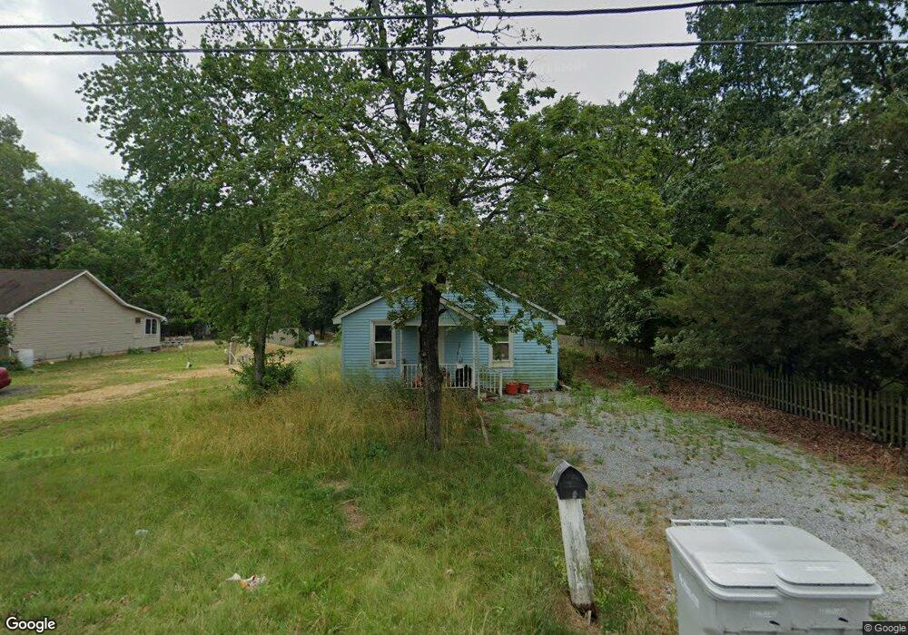
1989 W Oak Rd Vineland, NJ 08360
Estimated Value: $104,000 - $278,000
--
Bed
--
Bath
1,202
Sq Ft
$163/Sq Ft
Est. Value
About This Home
This home is located at 1989 W Oak Rd, Vineland, NJ 08360 and is currently estimated at $196,311, approximately $163 per square foot. 1989 W Oak Rd is a home located in Cumberland County with nearby schools including Marie D. Durand Elementary School, T.W. Wallace Middle School, and Vineland Senior High School.
Ownership History
Date
Name
Owned For
Owner Type
Purchase Details
Closed on
Jan 26, 2024
Sold by
Crispo Michael J and Crispo Tyra A
Bought by
Pinto Deanna
Current Estimated Value
Purchase Details
Closed on
Jun 17, 2020
Sold by
Crispo Josephine B Est
Bought by
Crispo Michael J and Crispo Tyra A
Purchase Details
Closed on
Feb 13, 2006
Sold by
Crispo Frank J
Bought by
Crispo Josephine
Purchase Details
Closed on
Nov 25, 1998
Sold by
Crispo Joseph
Bought by
Crispo Frank
Home Financials for this Owner
Home Financials are based on the most recent Mortgage that was taken out on this home.
Original Mortgage
$59,000
Interest Rate
6.84%
Create a Home Valuation Report for This Property
The Home Valuation Report is an in-depth analysis detailing your home's value as well as a comparison with similar homes in the area
Home Values in the Area
Average Home Value in this Area
Purchase History
| Date | Buyer | Sale Price | Title Company |
|---|---|---|---|
| Pinto Deanna | $70,000 | Fidelity National Title | |
| Pinto Deanna | $70,000 | Fidelity National Title | |
| Crispo Michael J | -- | None Available | |
| Crispo Josephine | -- | -- | |
| Crispo Frank | $59,000 | -- |
Source: Public Records
Mortgage History
| Date | Status | Borrower | Loan Amount |
|---|---|---|---|
| Previous Owner | Crispo Frank | $59,000 |
Source: Public Records
Tax History Compared to Growth
Tax History
| Year | Tax Paid | Tax Assessment Tax Assessment Total Assessment is a certain percentage of the fair market value that is determined by local assessors to be the total taxable value of land and additions on the property. | Land | Improvement |
|---|---|---|---|---|
| 2025 | $3,251 | $102,100 | $33,600 | $68,500 |
| 2024 | $3,251 | $102,100 | $33,600 | $68,500 |
| 2023 | $3,229 | $102,100 | $33,600 | $68,500 |
| 2022 | $3,133 | $102,100 | $33,600 | $68,500 |
| 2021 | $2,988 | $102,100 | $33,600 | $68,500 |
| 2020 | $2,988 | $102,100 | $33,600 | $68,500 |
| 2019 | $2,948 | $102,100 | $33,600 | $68,500 |
| 2018 | $2,870 | $102,100 | $33,600 | $68,500 |
| 2017 | $2,726 | $102,100 | $33,600 | $68,500 |
| 2016 | $2,630 | $102,100 | $33,600 | $68,500 |
| 2015 | $2,533 | $102,100 | $33,600 | $68,500 |
| 2014 | $2,395 | $102,100 | $33,600 | $68,500 |
Source: Public Records
Map
Nearby Homes
- 1469 N Mill Rd
- 1500 Venus Dr
- 1429 W Oak Rd
- 1252 W Oak Rd
- 1799 W Landis Ave
- 1489 N Delsea Dr
- 1535 W Landis Ave
- 1457 W Landis Ave
- 1811 N Delsea Dr Unit 4
- 663 Wayne Ave
- 829 W Garden Rd
- 834 Gershal Ave
- 0 Levishohn St
- 550 Northwest Ave
- 0 W Landis Ave
- 58 Wallace St
- 1887 N Delsea Dr Unit 39
- 1887 N Delsea Dr Unit 135 HOLLY HOCK DR.
- 1887 N Delsea Dr Unit 19
- 342 S Orchard Rd
- 1975 W Oak Rd
- 2019 W Oak Rd
- 1945 W Oak Rd
- 2051 W Oak Rd
- 1108 N Mill Rd
- 2067 W Oak Rd
- 1084 N Mill Rd
- 1064 N Mill Rd
- 2083 W Oak Rd
- 1050 N Mill Rd
- 2008 Pine Grove Ave
- 1881 W Oak Rd
- 1988 Pine Grove Ave
- 1026 N Mill Rd
- 1091 N Mill Rd
- 1972 Pine Grove Ave
- 1874 W Oak Rd
- 1067 N Mill Rd
- 1857 W Oak Rd
- 2117 W Oak Rd