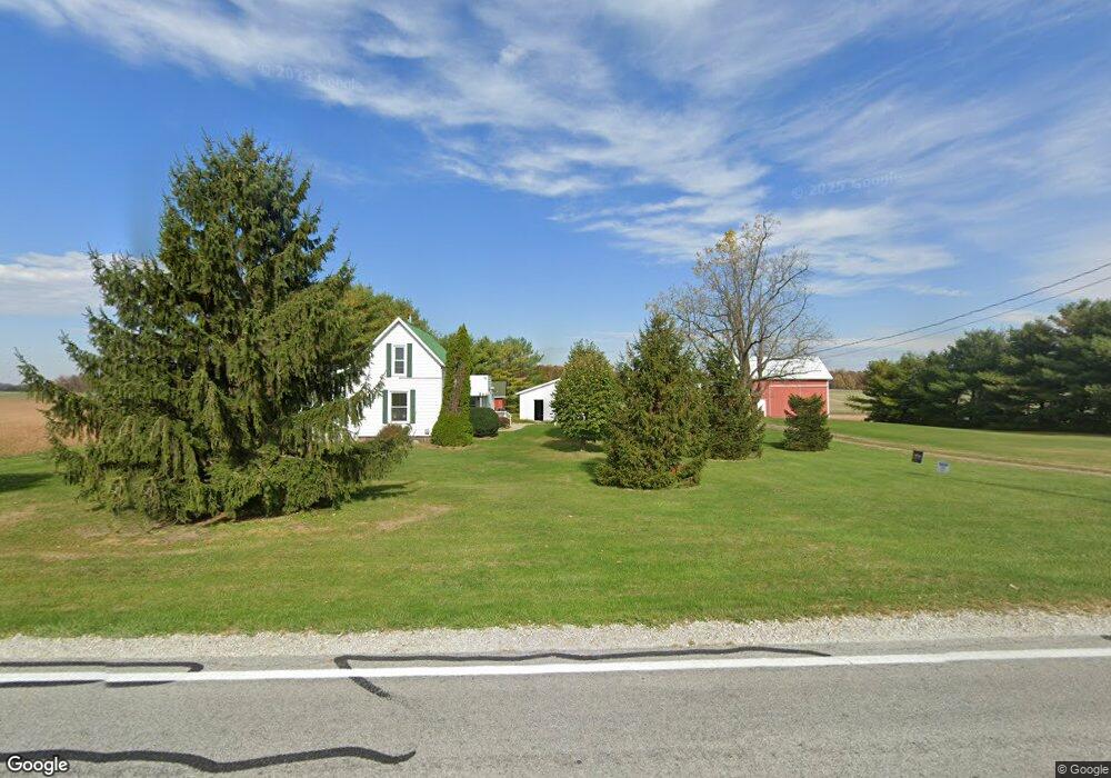
19891 State Route 67 Wapakoneta, OH 45895
Estimated Value: $133,000 - $227,000
3
Beds
1
Bath
1,716
Sq Ft
$105/Sq Ft
Est. Value
About This Home
This home is located at 19891 State Route 67, Wapakoneta, OH 45895 and is currently estimated at $180,130, approximately $104 per square foot. 19891 State Route 67 is a home located in Auglaize County with nearby schools including Wapakoneta Elementary School, Wapakoneta High School, and Wapakoneta Middle School.
Ownership History
Date
Name
Owned For
Owner Type
Purchase Details
Closed on
Oct 10, 2017
Sold by
Daffer Larry W O
Bought by
Daffer Larry W O and Daffer Sheila O
Current Estimated Value
Purchase Details
Closed on
Jul 23, 1999
Sold by
Bruns Ann E
Bought by
O'Daffer Larry W
Purchase Details
Closed on
Jan 4, 1999
Sold by
Bechdolt Chloene
Bought by
Bruns Ann E
Purchase Details
Closed on
Sep 25, 1995
Sold by
Bechdolt William
Bought by
Bechdolt Gary J
Create a Home Valuation Report for This Property
The Home Valuation Report is an in-depth analysis detailing your home's value as well as a comparison with similar homes in the area
Home Values in the Area
Average Home Value in this Area
Purchase History
| Date | Buyer | Sale Price | Title Company |
|---|---|---|---|
| Daffer Larry W O | -- | Attorney | |
| O'Daffer Larry W | $80,500 | -- | |
| Bruns Ann E | $16,500 | -- | |
| Bechdolt Gary J | -- | -- |
Source: Public Records
Tax History Compared to Growth
Tax History
| Year | Tax Paid | Tax Assessment Tax Assessment Total Assessment is a certain percentage of the fair market value that is determined by local assessors to be the total taxable value of land and additions on the property. | Land | Improvement |
|---|---|---|---|---|
| 2024 | $1,766 | $34,800 | $8,110 | $26,690 |
| 2023 | $1,210 | $34,800 | $8,110 | $26,690 |
| 2022 | $1,217 | $31,800 | $6,760 | $25,040 |
| 2021 | $1,197 | $31,800 | $6,760 | $25,040 |
| 2020 | $610 | $31,794 | $6,755 | $25,039 |
| 2019 | $1,038 | $26,548 | $5,632 | $20,916 |
| 2018 | $992 | $26,419 | $5,632 | $20,787 |
| 2017 | $986 | $26,419 | $5,632 | $20,787 |
| 2016 | $947 | $25,540 | $5,362 | $20,178 |
| 2015 | $944 | $25,540 | $5,362 | $20,178 |
| 2014 | $954 | $25,540 | $5,362 | $20,178 |
| 2013 | $980 | $25,540 | $5,362 | $20,178 |
Source: Public Records
Map
Nearby Homes
- 17 E Walnut St
- 80 Main St
- 20630 State Route 67
- 37 N Main St
- 0 Ohio 67
- 21015 Fairmount Rd
- 18258 Graham Rd
- 17946 National Rd
- 17092 Hauss Rd
- 5065 Amherst Rd
- 212 S Oak St
- 202 W Mulberry St
- 25836 Ohio 67
- 1805 Huntington Dr
- 1835 Huntington Dr
- 202 Karen St
- 5116 S Dixie Hwy
- 301 North Place
- 306 Shawnee Rd
- 0 Wapakoneta Cridersville Rd
- 19966 State Route 67
- 19792 State Route 67
- 19966 Ohio 67
- 19713 Ohio 67
- 19713 State Route 67
- 20055 State Route 67
- 20120 State Route 67
- 20149 Ohio 67
- 20149 State Route 67
- 19509 State Route 67
- 19445 State Route 67
- 19440 Ohio 67
- 20291 Ohio 67
- 19440 State Route 67
- 16633 Bigler Rd
- 20291 State Route 67
- 107 Waynesfield Pike
- 70 East St
- 88 East St