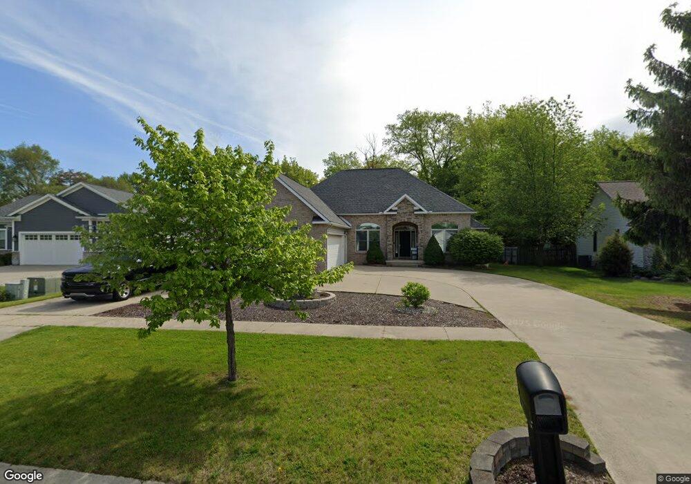
199 Brookside Dr Unit Bldg-Unit Flushing, MI 48433
Estimated Value: $368,000 - $382,000
Studio
3
Baths
2,015
Sq Ft
$185/Sq Ft
Est. Value
About This Home
This home is located at 199 Brookside Dr Unit Bldg-Unit, Flushing, MI 48433 and is currently estimated at $373,664, approximately $185 per square foot. 199 Brookside Dr Unit Bldg-Unit is a home located in Genesee County with nearby schools including Central Elementary School, Flushing Middle School, and Flushing High School.
Ownership History
Date
Name
Owned For
Owner Type
Purchase Details
Closed on
Nov 24, 2025
Sold by
Ramos Jared R and Ramos Allyson S
Bought by
Wood Austin C and Cameron Fawn L
Current Estimated Value
Home Financials for this Owner
Home Financials are based on the most recent Mortgage that was taken out on this home.
Original Mortgage
$292,000
Outstanding Balance
$292,000
Interest Rate
6.3%
Mortgage Type
New Conventional
Estimated Equity
$81,664
Purchase Details
Closed on
Mar 26, 2021
Sold by
Brisbin Leigh Ann
Bought by
Ramos Jared R and Ramos Allyson S
Home Financials for this Owner
Home Financials are based on the most recent Mortgage that was taken out on this home.
Original Mortgage
$212,000
Interest Rate
3.1%
Mortgage Type
New Conventional
Purchase Details
Closed on
May 23, 2000
Sold by
M & N Humanities Inc
Bought by
Reiner Wedel Custom Homes
Create a Home Valuation Report for This Property
The Home Valuation Report is an in-depth analysis detailing your home's value as well as a comparison with similar homes in the area
Home Values in the Area
Average Home Value in this Area
Purchase History
| Date | Buyer | Sale Price | Title Company |
|---|---|---|---|
| Wood Austin C | $365,000 | Cislo Title Company | |
| Ramos Jared R | $265,000 | Cislo Title Company | |
| Reiner Wedel Custom Homes | $39,900 | Sargents Title Company | |
| Jones John W | $39,900 | Sargents Title Company |
Source: Public Records
Mortgage History
| Date | Status | Borrower | Loan Amount |
|---|---|---|---|
| Open | Wood Austin C | $292,000 | |
| Previous Owner | Ramos Jared R | $212,000 |
Source: Public Records
Tax History
| Year | Tax Paid | Tax Assessment Tax Assessment Total Assessment is a certain percentage of the fair market value that is determined by local assessors to be the total taxable value of land and additions on the property. | Land | Improvement |
|---|---|---|---|---|
| 2025 | $7,563 | $187,300 | $0 | $0 |
| 2024 | $6,011 | $181,800 | $0 | $0 |
| 2023 | $5,768 | $156,100 | $0 | $0 |
| 2022 | $4,554 | $149,200 | $0 | $0 |
| 2021 | $4,554 | $141,600 | $0 | $0 |
| 2020 | $3,601 | $129,900 | $0 | $0 |
| 2019 | $3,561 | $121,200 | $0 | $0 |
| 2018 | $4,297 | $117,800 | $0 | $0 |
| 2017 | $3,989 | $116,300 | $0 | $0 |
| 2016 | $3,955 | $91,937 | $0 | $0 |
| 2015 | $3,943 | $0 | $0 | $0 |
| 2012 | -- | $88,600 | $88,600 | $0 |
Source: Public Records
Map
Nearby Homes
- 0 W Pierson Rd Unit 50141989
- 3500 Woodridge Ct
- 315 N Maple St
- 100 Aberdeen Dr Unit 36
- 6289 W River Rd
- 113 N Mckinley Rd
- 229 Aberdeen Ct
- 241 Aberdeen Ct Unit 11 bldg 6
- 10101 Carpenter Rd
- 501 Spring Ln
- 0 E River Rd Unit 50180952
- 0 Winters Eave Dr Unit 50117986
- 608 Autumn Dr
- 527 Oakbrook Cir Unit 14
- 530 Coutant St
- 5315 Chickasaw Trail
- Vacant Land Rd
- Vacant Land Rd
- Vacant Land Rd
- 200 Boman St
- 205 Brookside Dr
- 197 Brookside Dr
- 193 Brookside Dr
- 196 Brookside Dr
- 192 Brookside Dr
- 188 Brookside Dr
- 200 Brookside Dr
- 189 Brookside Dr
- 213 Brookside Dr
- 301 N Seymour Rd
- 204 Brookside Dr Unit Bldg-Unit
- 204 Brookside Dr
- 185 Brookside Dr
- 217 Brookside Dr
- 208 Brookside Dr
- 9119 Seymour Rd
- 2199 N Seymour Rd
- 181 Brookside Dr
- 221 Brookside Dr
- 23 Seymour Rd
Your Personal Tour Guide
Ask me questions while you tour the home.