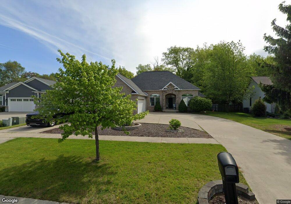
199 Brookside Dr Unit Bldg-Unit Flushing, MI 48433
Flushing Township AreaEstimated Value: $365,000 - $396,000
About This Home
This home is located at 199 Brookside Dr Unit Bldg-Unit, Flushing, MI 48433 and is currently estimated at $380,118, approximately $188 per square foot. 199 Brookside Dr Unit Bldg-Unit is a home located in Genesee County with nearby schools including Central Elementary School, Flushing Middle School, and Flushing High School.
Ownership History
We collect this data history from publicly available records. To have your information removed, we recommend requesting removal directly through your county’s website.
Purchase Details
Home Financials for this Owner
Home Financials are based on the most recent Mortgage that was taken out on this home.Purchase Details
Home Financials for this Owner
Home Financials are based on the most recent Mortgage that was taken out on this home.Purchase Details
Home Values in the Area
Average Home Value in this Area
Purchase History
We collect this data history from publicly available records. To have your information removed, we recommend requesting removal directly through your county’s website.
| Date | Buyer | Sale Price | Title Company |
|---|---|---|---|
| $365,000 | Cislo Title Company | ||
| $265,000 | Cislo Title Company | ||
| $39,900 | Sargents Title Company | ||
| $39,900 | Sargents Title Company |
Mortgage History
We collect this data history from publicly available records. To have your information removed, we recommend requesting removal directly through your county’s website.
| Date | Status | Borrower | Loan Amount |
|---|---|---|---|
| Open | $292,000 | ||
| Previous Owner | $50,000 | ||
| Previous Owner | $212,000 | ||
| Previous Owner | $187,425 | ||
| Previous Owner | $196,000 |
Tax History
We collect this data history from publicly available records. To have your information removed, we recommend requesting removal directly through your county’s website.
| Year | Tax Paid | Tax Assessment Tax Assessment Total Assessment is a certain percentage of the fair market value that is determined by local assessors to be the total taxable value of land and additions on the property. | Land | Improvement |
|---|---|---|---|---|
| 2025 | $6,170 | $187,300 | $0 | $0 |
| 2024 | $6,011 | $181,800 | $0 | $0 |
| 2023 | $5,768 | $156,100 | $0 | $0 |
| 2022 | $4,554 | $149,200 | $0 | $0 |
| 2021 | $4,554 | $141,600 | $0 | $0 |
| 2020 | $3,601 | $129,900 | $0 | $0 |
| 2019 | $3,561 | $121,200 | $0 | $0 |
| 2018 | $4,297 | $117,800 | $0 | $0 |
| 2017 | $3,989 | $116,300 | $0 | $0 |
| 2016 | $3,955 | $91,937 | $0 | $0 |
| 2015 | $3,943 | $0 | $0 | $0 |
| 2012 | -- | $88,600 | $88,600 | $0 |
Map
- 308 N Seymour Rd
- 232 Brookside Dr
- 6017 W Pierson Rd
- 308 Emily St
- 236 Lynn St
- 309 Windy Bluff
- 0 W Pierson Rd Unit 50141989
- 0 W Pierson Rd Unit 100005329
- 0 W Pierson Rd Unit 100005328
- 333 Windy Bluff
- 114 E Henry St
- 111 E Main St
- 221 N Cherry St
- 307 N Cherry St
- 100 Aberdeen Dr Unit 36
- 100 Aberdeen Dr Unit 36
- 3488 Woodridge Dr
- 4567 N Seymour Rd
- 218 S Cherry St
- 225 E Park Ave
- 205 Brookside Dr
- 197 Brookside Dr
- 193 Brookside Dr
- 196 Brookside Dr
- 209 Brookside Dr
- 192 Brookside Dr
- 188 Brookside Dr
- 200 Brookside Dr
- 189 Brookside Dr
- 213 Brookside Dr
- 301 N Seymour Rd
- 204 Brookside Dr Unit Bldg-Unit
- 204 Brookside Dr
- 185 Brookside Dr
- 217 Brookside Dr
- 208 Brookside Dr
- 9119 Seymour Rd
- 2199 N Seymour Rd
- 181 Brookside Dr
- 221 Brookside Dr
Ask me questions while you tour the home.