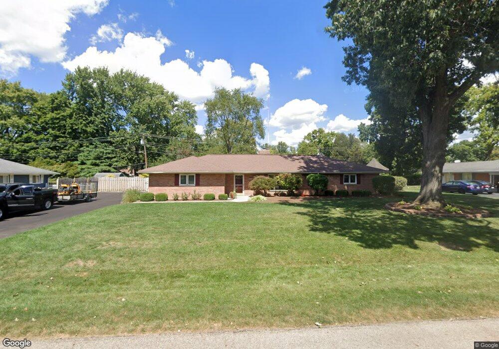
199 Cardigan Rd Dayton, OH 45459
Woodbourne-Hyde Park NeighborhoodEstimated Value: $286,356 - $312,000
3
Beds
2
Baths
1,593
Sq Ft
$190/Sq Ft
Est. Value
About This Home
This home is located at 199 Cardigan Rd, Dayton, OH 45459 and is currently estimated at $303,089, approximately $190 per square foot. 199 Cardigan Rd is a home located in Montgomery County with nearby schools including Primary Village North, John Hole Elementary, and Hadley E Watts Middle School.
Ownership History
Date
Name
Owned For
Owner Type
Purchase Details
Closed on
Apr 15, 2008
Sold by
Millard Jason C and Millard Maureen E
Bought by
Tokasey Anthony G
Current Estimated Value
Home Financials for this Owner
Home Financials are based on the most recent Mortgage that was taken out on this home.
Original Mortgage
$122,400
Outstanding Balance
$77,171
Interest Rate
5.88%
Mortgage Type
Purchase Money Mortgage
Estimated Equity
$225,918
Purchase Details
Closed on
May 31, 2001
Sold by
Thomas Mary C
Bought by
Millard Jason C and Millard Maureen E
Home Financials for this Owner
Home Financials are based on the most recent Mortgage that was taken out on this home.
Original Mortgage
$127,850
Interest Rate
7.18%
Mortgage Type
FHA
Create a Home Valuation Report for This Property
The Home Valuation Report is an in-depth analysis detailing your home's value as well as a comparison with similar homes in the area
Home Values in the Area
Average Home Value in this Area
Purchase History
| Date | Buyer | Sale Price | Title Company |
|---|---|---|---|
| Tokasey Anthony G | $153,000 | Attorney | |
| Millard Jason C | $129,900 | -- |
Source: Public Records
Mortgage History
| Date | Status | Borrower | Loan Amount |
|---|---|---|---|
| Open | Tokasey Anthony G | $122,400 | |
| Previous Owner | Millard Jason C | $127,850 |
Source: Public Records
Tax History Compared to Growth
Tax History
| Year | Tax Paid | Tax Assessment Tax Assessment Total Assessment is a certain percentage of the fair market value that is determined by local assessors to be the total taxable value of land and additions on the property. | Land | Improvement |
|---|---|---|---|---|
| 2024 | $4,430 | $71,780 | $14,680 | $57,100 |
| 2023 | $4,430 | $71,780 | $14,680 | $57,100 |
| 2022 | $4,032 | $51,660 | $10,560 | $41,100 |
| 2021 | $4,043 | $51,660 | $10,560 | $41,100 |
| 2020 | $4,037 | $51,660 | $10,560 | $41,100 |
| 2019 | $4,251 | $48,620 | $10,560 | $38,060 |
| 2018 | $3,797 | $48,620 | $10,560 | $38,060 |
| 2017 | $3,757 | $48,620 | $10,560 | $38,060 |
| 2016 | $3,712 | $45,280 | $10,560 | $34,720 |
| 2015 | $3,652 | $45,280 | $10,560 | $34,720 |
| 2014 | $3,652 | $45,280 | $10,560 | $34,720 |
| 2012 | -- | $44,490 | $10,630 | $33,860 |
Source: Public Records
Map
Nearby Homes
- 160 Ashford Dr
- 190 Winchcombe Dr
- 187 Cheltenham Dr
- 341 Cardigan Rd
- 129 Lamp Lighter Trail
- 152 Cheltenham Dr
- 40 Nicholson Ct Unit 4
- 5416 Landau Dr Unit 7
- 5416 Landau Dr Unit 5
- 24 Nicholson Ct Unit 10
- 5380 Landau Dr Unit 40
- 5328 Landau Dr Unit 49
- 5328 Landau Dr
- 215 Colonial Ln
- 5290 Wheaton St
- 5016 Far Hills Ave
- 194 Brookmount Rd
- 5095 Wheaton St
- 447 Greensboro Dr
- 4824 Far Hills Ave