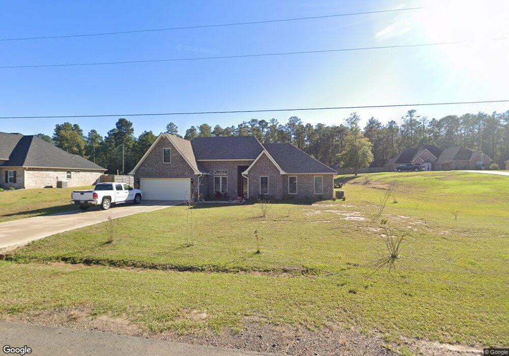
199 Kas Rd Leesville, LA 71446
Estimated Value: $275,311 - $340,000
Studio
--
Bath
--
Sq Ft
--
Built
About This Home
This home is located at 199 Kas Rd, Leesville, LA 71446 and is currently estimated at $310,828. 199 Kas Rd is a home.
Ownership History
Date
Name
Owned For
Owner Type
Purchase Details
Closed on
Jan 4, 2016
Sold by
Hi-Lo Builders Inc
Bought by
Cole John L and Cole Bobbie
Current Estimated Value
Home Financials for this Owner
Home Financials are based on the most recent Mortgage that was taken out on this home.
Original Mortgage
$219,900
Outstanding Balance
$172,894
Interest Rate
3.94%
Mortgage Type
VA
Estimated Equity
$137,934
Purchase Details
Closed on
Jun 24, 2015
Sold by
Smith Brook Hills Llc
Bought by
Hi Lo Builders Inc
Home Financials for this Owner
Home Financials are based on the most recent Mortgage that was taken out on this home.
Original Mortgage
$183,868
Interest Rate
3.91%
Mortgage Type
New Conventional
Create a Home Valuation Report for This Property
The Home Valuation Report is an in-depth analysis detailing your home's value as well as a comparison with similar homes in the area
Purchase History
| Date | Buyer | Sale Price | Title Company |
|---|---|---|---|
| Cole John L | $219,900 | Attorney | |
| Hi Lo Builders Inc | $19,710 | None Available |
Source: Public Records
Mortgage History
| Date | Status | Borrower | Loan Amount |
|---|---|---|---|
| Open | Cole John L | $219,900 | |
| Previous Owner | Hi Lo Builders Inc | $183,868 |
Source: Public Records
Tax History
| Year | Tax Paid | Tax Assessment Tax Assessment Total Assessment is a certain percentage of the fair market value that is determined by local assessors to be the total taxable value of land and additions on the property. | Land | Improvement |
|---|---|---|---|---|
| 2025 | $853 | $25,970 | $2,000 | $23,970 |
| 2024 | $860 | $25,970 | $2,000 | $23,970 |
| 2023 | $857 | $21,500 | $2,000 | $19,500 |
| 2022 | $2,415 | $21,500 | $2,000 | $19,500 |
| 2021 | $2,574 | $21,500 | $2,000 | $19,500 |
| 2020 | $2,663 | $21,500 | $2,000 | $19,500 |
| 2019 | $2,739 | $21,500 | $2,000 | $19,500 |
| 2018 | $2,728 | $21,500 | $2,000 | $19,500 |
| 2017 | $2,731 | $21,500 | $2,000 | $19,500 |
| 2015 | $223 | $1,800 | $1,800 | $0 |
Source: Public Records
Map
Nearby Homes
- 149 Methodist Landing Rd
- 0 Lot 7 Woodland Park Phase III Unit 29-1652
- 0 Hwy 8 & 464 Hwy Unit SWL22004749
- 0 Tbd Hwy 8 & 464 Unit 29-1650
- 0 Archie Wilbert Rd
- 588 Hickory Ridge Rd
- 0 Woods Rd Unit RD
- 0 Empire Point Rd
- TBD Driftwood Dr
- 579 Lake Vernon Rd
- 0 Tbd Driftwood Dr
- 148 Brentwood Dr
- 707 W Hawthorne Rd
- 617 W Hawthorne Rd
- 708 Woodland Dr
- 0 Lotus Ln
- 0 Unit Lots 8, 9 & 10
- 0 Tbd West Hawthorne Rd Unit RD
- 0 Nolan Trace
- 102 Hidden Trail
Your Personal Tour Guide
Ask me questions while you tour the home.