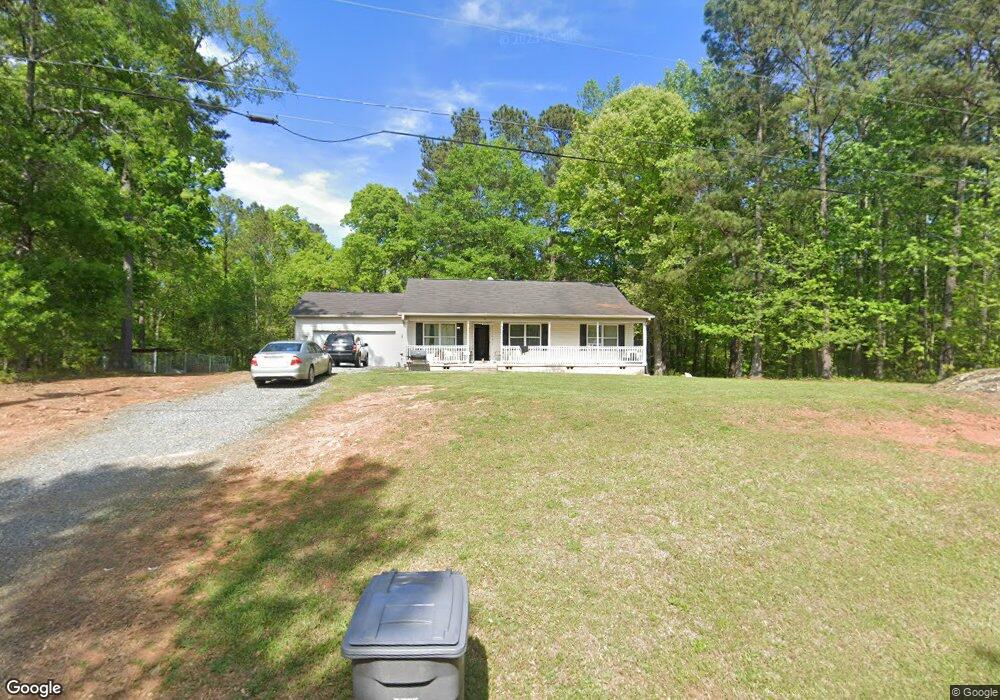
199 Lindsey Rd Barnesville, GA 30204
Estimated Value: $252,076 - $293,000
3
Beds
2
Baths
1,452
Sq Ft
$184/Sq Ft
Est. Value
About This Home
This home is located at 199 Lindsey Rd, Barnesville, GA 30204 and is currently estimated at $266,519, approximately $183 per square foot. 199 Lindsey Rd is a home located in Lamar County with nearby schools including Lamar County Primary School, Lamar County Elementary School, and Lamar County Middle School.
Ownership History
Date
Name
Owned For
Owner Type
Purchase Details
Closed on
Apr 30, 2020
Sold by
English Shanna Mcnaughton
Bought by
Lummus Katie Scarlett Ohara
Current Estimated Value
Home Financials for this Owner
Home Financials are based on the most recent Mortgage that was taken out on this home.
Original Mortgage
$140,303
Outstanding Balance
$123,508
Interest Rate
3.3%
Mortgage Type
New Conventional
Estimated Equity
$143,011
Purchase Details
Closed on
Nov 6, 2002
Sold by
Pippin Geeraldine Tax Comm
Bought by
English Arthur 1V
Create a Home Valuation Report for This Property
The Home Valuation Report is an in-depth analysis detailing your home's value as well as a comparison with similar homes in the area
Purchase History
We collect this data history from publicly available records. To have your information removed, we recommend requesting removal directly through your county’s website.
| Date | Buyer | Sale Price | Title Company |
|---|---|---|---|
| Lummus Katie Scarlett Ohara | $138,900 | -- | |
| English Arthur 1V | $1,100 | -- |
Source: Public Records
Mortgage History
We collect this data history from publicly available records. To have your information removed, we recommend requesting removal directly through your county’s website.
| Date | Status | Borrower | Loan Amount |
|---|---|---|---|
| Open | Lummus Katie Scarlett Ohara | $140,303 |
Source: Public Records
Tax History
| Year | Tax Paid | Tax Assessment Tax Assessment Total Assessment is a certain percentage of the fair market value that is determined by local assessors to be the total taxable value of land and additions on the property. | Land | Improvement |
|---|---|---|---|---|
| 2025 | $2,028 | $83,632 | $5,206 | $78,426 |
| 2024 | $1,779 | $69,516 | $5,206 | $64,310 |
| 2023 | $1,859 | $67,324 | $5,206 | $62,118 |
| 2022 | $1,612 | $58,400 | $3,116 | $55,284 |
| 2021 | $1,414 | $47,044 | $3,116 | $43,928 |
| 2020 | $1,123 | $35,458 | $2,866 | $32,592 |
| 2019 | $1,125 | $35,458 | $2,866 | $32,592 |
| 2018 | $1,080 | $35,458 | $2,866 | $32,592 |
| 2017 | $1,075 | $35,458 | $2,866 | $32,592 |
| 2016 | $1,075 | $35,458 | $2,866 | $32,592 |
| 2015 | $1,074 | $35,458 | $2,866 | $32,592 |
| 2014 | $1,041 | $35,458 | $2,866 | $32,592 |
| 2013 | -- | $35,863 | $3,271 | $32,592 |
Source: Public Records
Map
Nearby Homes
- 0 Perkins Rd Unit 10754289
- 0 Perkins Rd Unit 253616
- 0 Perkins Rd Unit 10770855
- 0 Barnesville Hwy Unit 10548523
- 166 Midway Rd
- 916 Highway 36 W
- 1972 Rest Haven Rd
- 00 Ruffner Rd
- 98 Mud Bridge Rd
- 148 Berry Rd Unit LOT 12A
- 144 Berry Rd Unit LOT 13
- 146 Berry Rd Unit LOT 12B
- 839 Cannafax Rd
- 63 Alabama Rd
- 885 Turner Bridge Rd
- 0 Vega Rd Unit 10766610
- 935 Cannafax Rd
- 1961 Rocky Bottom Rd
- 2200 Rest Haven Rd
- 0 Potato Creek Rd Unit 26867391
- 0 Lindsey Rd Unit 8403737
- 0 Lindsey Rd Unit 8401287
- 0 Lindsey Rd Unit 3015866
- 0 Lindsey Rd Unit 7087858
- 0 Lindsey Rd Unit 7208197
- 0 Lindsey Rd Unit 7492895
- 0 Lindsey Rd Unit 8153029
- 0 Lindsey Rd Unit 9020875
- 193 Lindsey Rd
- 212 Lindsey Rd
- 225 Lindsey Rd
- 257 Lindsey Rd
- 263 Lindsey Rd
- 721 Willis Rd
- 632 Willis Rd
- 692 Willis Rd
- 278 Mccollum Rd
- 178 Perdue Rd
- 242 Willis Rd
- 730 Willis Rd
Your Personal Tour Guide
Ask me questions while you tour the home.