Estimated Value: $386,000 - $429,000
2
Beds
2
Baths
1,600
Sq Ft
$254/Sq Ft
Est. Value
About This Home
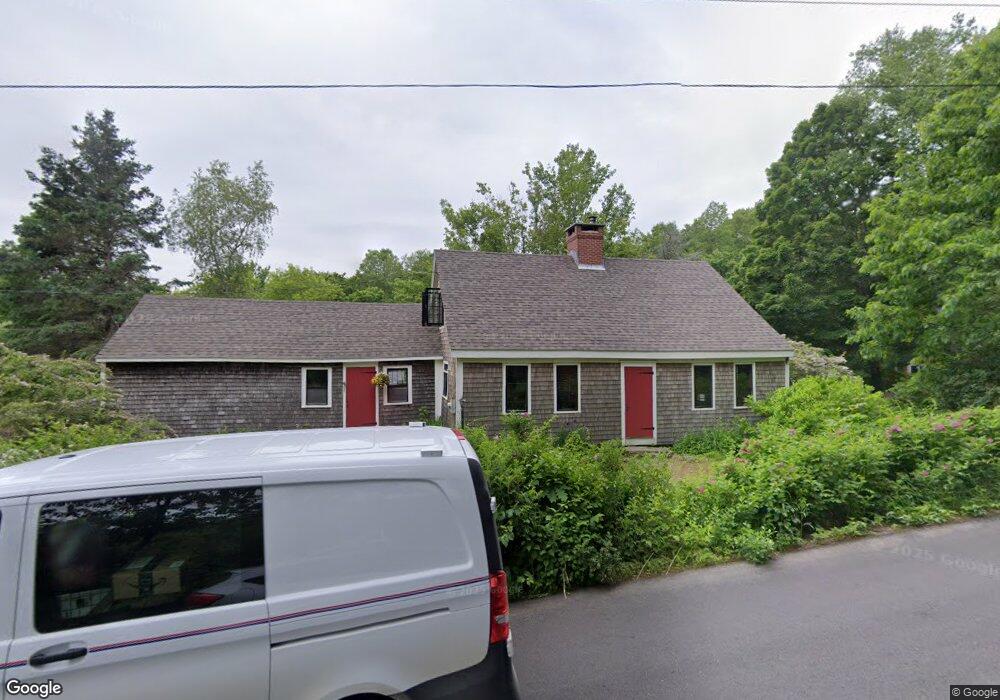
This home is located at 199 Rabbit Farm Rd, Union, ME 04862 and is currently estimated at $405,734, approximately $253 per square foot. 199 Rabbit Farm Rd is a home located in Knox County with nearby schools including Medomak Valley High School.
Ownership History
Date
Name
Owned For
Owner Type
Purchase Details
Closed on
Aug 3, 2021
Sold by
Allens Blueberry Freezer
Bought by
Orlandello Joseph and Orlandello Sarah
Current Estimated Value
Home Financials for this Owner
Home Financials are based on the most recent Mortgage that was taken out on this home.
Original Mortgage
$152,000
Outstanding Balance
$111,627
Interest Rate
2.24%
Mortgage Type
New Conventional
Estimated Equity
$294,107
Purchase Details
Closed on
Jun 27, 2007
Sold by
Grund Steven W and Heyer Nancy E
Bought by
Potter Thomas W and Potter Kara E
Home Financials for this Owner
Home Financials are based on the most recent Mortgage that was taken out on this home.
Original Mortgage
$188,000
Interest Rate
6.24%
Mortgage Type
Purchase Money Mortgage
Create a Home Valuation Report for This Property
The Home Valuation Report is an in-depth analysis detailing your home's value as well as a comparison with similar homes in the area
Home Values in the Area
Average Home Value in this Area
Purchase History
| Date | Buyer | Sale Price | Title Company |
|---|---|---|---|
| Orlandello Joseph | -- | None Available | |
| Orlandello Joseph | -- | None Available | |
| Orlandello Joseph | -- | None Available | |
| Potter Thomas W | -- | -- | |
| Potter Thomas W | -- | -- | |
| Potter Thomas W | -- | -- |
Source: Public Records
Mortgage History
| Date | Status | Borrower | Loan Amount |
|---|---|---|---|
| Open | Orlandello Joseph | $152,000 | |
| Closed | Orlandello Joseph | $152,000 | |
| Previous Owner | Potter Thomas W | $188,000 |
Source: Public Records
Tax History
| Year | Tax Paid | Tax Assessment Tax Assessment Total Assessment is a certain percentage of the fair market value that is determined by local assessors to be the total taxable value of land and additions on the property. | Land | Improvement |
|---|---|---|---|---|
| 2025 | $4,445 | $334,200 | $62,500 | $271,700 |
| 2024 | $5,595 | $325,300 | $51,900 | $273,400 |
| 2023 | $4,996 | $322,300 | $51,900 | $270,400 |
| 2022 | $4,770 | $322,300 | $51,900 | $270,400 |
| 2021 | $3,720 | $205,500 | $51,900 | $153,600 |
| 2020 | $2,547 | $205,500 | $51,900 | $153,600 |
| 2019 | $3,415 | $205,500 | $51,900 | $153,600 |
| 2018 | $3,292 | $205,500 | $51,900 | $153,600 |
| 2017 | $5,236 | $205,500 | $51,900 | $153,600 |
| 2016 | $3,225 | $190,800 | $51,900 | $138,900 |
| 2015 | $3,091 | $190,800 | $51,900 | $138,900 |
| 2014 | $3,034 | $190,800 | $51,900 | $138,900 |
Source: Public Records
Map
Nearby Homes
- 3 Clarry Hill Ln
- 00 Clarry Hill Rd
- Lot #1 Millay Ln
- 110 Jackson Rd
- 33 Robbins Rd
- 90 Come Spring Ln
- 122 Oak Point Ln
- 38 Jasmine Ln
- 273 Feylers Corner Rd
- 2529 Heald Hwy
- 261 S Union Rd
- 1443 Old Augusta Rd
- 1941 Eastern Rd
- 1515 Old Augusta Rd
- 21 Shepard Hill Rd
- 2545 Washington Rd
- U7 3E Washington Rd
- 1641 Washington Rd
- 49 Balsam Dr
- 380 Wottons Mill Rd
- 100 Rabbit Farm Rd
- 45 Rabbit Farm Rd
- 80 Rabbit Farm Rd
- 397 Rabbit Farm Rd
- 0 Rabbit Farm
- 0 Rabbit Farm Rd
- 29 Rabbit Farm Rd
- 132 Clarry Hill Ln
- 1797 Clarry Hill Rd
- 1797 Clarry Hill Rd
- 0 Clarry Hill Ln
- 0 Clary Hill Ln
- 1485 Clarry Hill Rd
- 131 Clarry Hill Ln
- 25 Clarry Hill Ln
- 1505 Clarry Hill Rd
- Map 4 Lot Clarry Hill Rd
- 63 Clarry Hill Ln
- 00 Clary Hill Rd
- 1510 Clarry Hill Rd
Your Personal Tour Guide
Ask me questions while you tour the home.