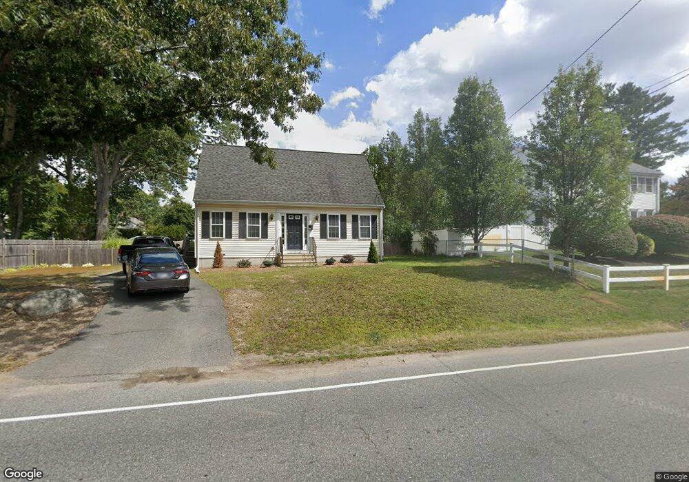
199 Raynor Ave Whitman, MA 02382
Estimated Value: $534,000 - $602,000
3
Beds
2
Baths
1,428
Sq Ft
$395/Sq Ft
Est. Value
About This Home
This home is located at 199 Raynor Ave, Whitman, MA 02382 and is currently estimated at $564,368, approximately $395 per square foot. 199 Raynor Ave is a home located in Plymouth County with nearby schools including St Bridget School.
Ownership History
Date
Name
Owned For
Owner Type
Purchase Details
Closed on
Sep 24, 2001
Sold by
L & J Corp
Bought by
Walsh Joseph J and Walsh Lisa M
Current Estimated Value
Home Financials for this Owner
Home Financials are based on the most recent Mortgage that was taken out on this home.
Original Mortgage
$199,900
Outstanding Balance
$77,893
Interest Rate
6.98%
Mortgage Type
Purchase Money Mortgage
Estimated Equity
$486,475
Purchase Details
Closed on
Apr 24, 2001
Sold by
Nicholson Jeffrey S and Nicholson Kristine M
Bought by
L&J Corp
Create a Home Valuation Report for This Property
The Home Valuation Report is an in-depth analysis detailing your home's value as well as a comparison with similar homes in the area
Home Values in the Area
Average Home Value in this Area
Purchase History
| Date | Buyer | Sale Price | Title Company |
|---|---|---|---|
| Walsh Joseph J | $249,900 | -- | |
| L&J Corp | $80,000 | -- |
Source: Public Records
Mortgage History
| Date | Status | Borrower | Loan Amount |
|---|---|---|---|
| Open | L&J Corp | $199,900 |
Source: Public Records
Tax History Compared to Growth
Tax History
| Year | Tax Paid | Tax Assessment Tax Assessment Total Assessment is a certain percentage of the fair market value that is determined by local assessors to be the total taxable value of land and additions on the property. | Land | Improvement |
|---|---|---|---|---|
| 2025 | $6,601 | $503,100 | $214,600 | $288,500 |
| 2024 | $6,128 | $481,000 | $210,500 | $270,500 |
| 2023 | $5,877 | $433,100 | $182,500 | $250,600 |
| 2022 | $5,799 | $398,300 | $165,900 | $232,400 |
| 2021 | $5,634 | $363,500 | $152,400 | $211,100 |
| 2020 | $5,530 | $348,900 | $145,200 | $203,700 |
| 2019 | $5,137 | $334,000 | $145,200 | $188,800 |
| 2018 | $4,989 | $311,600 | $136,900 | $174,700 |
| 2017 | $4,699 | $311,600 | $136,900 | $174,700 |
| 2016 | $4,495 | $288,300 | $129,600 | $158,700 |
| 2015 | $4,168 | $267,000 | $114,000 | $153,000 |
Source: Public Records
Map
Nearby Homes
- 40 Lazel St
- 170 Pleasant St
- 23 Reed Place
- 608 Plymouth St
- 679 Plymouth St
- 684 South Ave
- 110 South Ave Unit 14
- 54-56 Stetson St
- 63 Dewey Ave
- 48 Day St
- 35 Dana St
- 20 Elm Place
- 214 Winter St
- 137 Peregrine Rd
- 131 Holly Ridge Dr
- 532 Washington St
- 55 Plymouth St Unit A5
- 53 Temple St
- 135-137 Temple St
- 164 Warren Ave
- 211 Raynor Ave
- 189 Raynor Ave
- 67 Whidden Ave
- 67 Whidden Ave Unit 2LR
- 68 Carleton St
- 57 Whidden Ave Unit 59
- 204 Raynor Ave
- 210 Raynor Ave
- 190 Raynor Ave
- 87 Carleton St
- 62 Carleton St
- 51 Whidden Ave
- 167 Raynor Ave
- 70 Whidden Ave
- 69 Carleton St
- 228 Raynor Ave
- 106 Carleton Street Extension
- 106 Carleton St
- 60 Whidden Ave
- 54 Carleton St