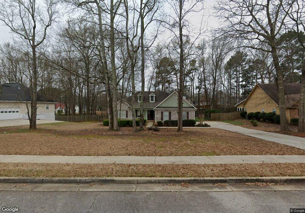
199 Rockport Dr McDonough, GA 30253
Estimated Value: $277,731 - $301,000
3
Beds
2
Baths
1,505
Sq Ft
$195/Sq Ft
Est. Value
About This Home
This home is located at 199 Rockport Dr, McDonough, GA 30253 and is currently estimated at $292,933, approximately $194 per square foot. 199 Rockport Dr is a home located in Henry County with nearby schools including Union Grove Middle School, Union Grove High School, and Hickory Flat Elementary School.
Ownership History
Date
Name
Owned For
Owner Type
Purchase Details
Closed on
Jun 24, 2004
Sold by
Woodmansee Mark and Woodmansee Shelley
Bought by
Hansford Michele A
Current Estimated Value
Home Financials for this Owner
Home Financials are based on the most recent Mortgage that was taken out on this home.
Original Mortgage
$149,159
Outstanding Balance
$74,134
Interest Rate
6.25%
Mortgage Type
VA
Estimated Equity
$218,799
Purchase Details
Closed on
Jan 24, 2000
Sold by
Simon Scottt W and Simon Mmiriam B
Bought by
Woodmansee Mark and Woodmansee Shelley
Home Financials for this Owner
Home Financials are based on the most recent Mortgage that was taken out on this home.
Original Mortgage
$126,854
Interest Rate
8.02%
Mortgage Type
FHA
Purchase Details
Closed on
Jun 14, 1996
Sold by
Mnw Constr
Bought by
Simon Scott Miriam
Create a Home Valuation Report for This Property
The Home Valuation Report is an in-depth analysis detailing your home's value as well as a comparison with similar homes in the area
Home Values in the Area
Average Home Value in this Area
Purchase History
| Date | Buyer | Sale Price | Title Company |
|---|---|---|---|
| Hansford Michele A | $151,500 | -- | |
| Woodmansee Mark | $127,900 | -- | |
| Simon Scott Miriam | $108,500 | -- |
Source: Public Records
Mortgage History
| Date | Status | Borrower | Loan Amount |
|---|---|---|---|
| Open | Hansford Michele A | $149,159 | |
| Previous Owner | Woodmansee Mark | $126,854 | |
| Closed | Simon Scott Miriam | $0 |
Source: Public Records
Tax History Compared to Growth
Tax History
| Year | Tax Paid | Tax Assessment Tax Assessment Total Assessment is a certain percentage of the fair market value that is determined by local assessors to be the total taxable value of land and additions on the property. | Land | Improvement |
|---|---|---|---|---|
| 2025 | $3,239 | $116,120 | $16,000 | $100,120 |
| 2024 | $3,239 | $112,360 | $16,000 | $96,360 |
| 2023 | $2,753 | $112,840 | $14,000 | $98,840 |
| 2022 | $2,588 | $84,480 | $14,000 | $70,480 |
| 2021 | $2,277 | $71,320 | $14,000 | $57,320 |
| 2020 | $2,122 | $64,760 | $12,000 | $52,760 |
| 2019 | $2,014 | $60,200 | $10,000 | $50,200 |
| 2018 | $1,941 | $57,120 | $10,000 | $47,120 |
| 2016 | $1,669 | $48,560 | $8,000 | $40,560 |
| 2015 | $1,599 | $45,760 | $8,000 | $37,760 |
| 2014 | $1,605 | $45,520 | $8,000 | $37,520 |
Source: Public Records
Map
Nearby Homes
- 401 Crosshaven Way
- 1401 Aberdeen Ct
- 212 Himalaya Way
- 248 Cranapple Ln
- 146 Himalaya Way
- 312 Wichita Way
- 153 Rockport Dr
- 733 Stonehaven Chase
- 941 Arbor Way
- 1102 Strath Clyde Way
- 1008 Carlyle Place
- 1181 Paramount Dr
- 176 Cranapple Ln
- 337 Inverness Ave
- 441 Aviemore Loop
- 273 Summit View Dr
- 479 Sawtooth Ln
- 271 Mckinley Loop
- 113 Glenmore Ln
- 601 Sawgrass Walk
- 205 Rockport Dr
- 191 Rockport Dr
- 1006 Arbor Way Unit 419
- 1006 Arbor Way
- 1000 Arbor Way
- 1016 Arbor Way
- 198 Rockport Dr
- 189 Rockport Dr
- 996 Arbor Way
- 206 Rockport Dr
- 185 Rockport Dr
- 184 Rockport Dr
- 992 Arbor Way
- 0 Rockport Dr Unit 8713813
- 0 Rockport Dr Unit 8623189
- 0 Rockport Dr Unit 8609440
- 0 Rockport Dr Unit 8473151
- 0 Rockport Dr Unit 8183059
- 0 Rockport Dr Unit 8499585
- 0 Rockport Dr Unit 8296594