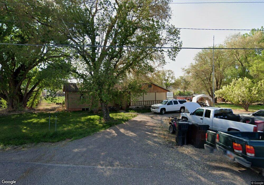
199 S Canal Rd Sigurd, UT 84657
Estimated Value: $281,000 - $398,000
--
Bed
--
Bath
1,755
Sq Ft
$201/Sq Ft
Est. Value
About This Home
This home is located at 199 S Canal Rd, Sigurd, UT 84657 and is currently estimated at $352,131, approximately $200 per square foot. 199 S Canal Rd is a home with nearby schools including Pahvant School, Ashman School, and Red Hills Middle School.
Ownership History
Date
Name
Owned For
Owner Type
Purchase Details
Closed on
Dec 9, 2020
Sold by
Harvey Travis M and Harvey Robbi K
Bought by
Harvey Robbi K and Harvey Travis M
Current Estimated Value
Home Financials for this Owner
Home Financials are based on the most recent Mortgage that was taken out on this home.
Original Mortgage
$141,500
Outstanding Balance
$102,930
Interest Rate
2.8%
Mortgage Type
New Conventional
Estimated Equity
$249,201
Purchase Details
Closed on
Oct 30, 2015
Sold by
Harvey Cheyenne
Bought by
Harvey Travis M and Harvey Robbi K
Home Financials for this Owner
Home Financials are based on the most recent Mortgage that was taken out on this home.
Original Mortgage
$149,100
Interest Rate
3.87%
Purchase Details
Closed on
Sep 23, 2008
Sold by
Warnock Phyl
Bought by
Harvey Cheyenne
Purchase Details
Closed on
Aug 28, 2007
Sold by
Warnock Robert E and Warnock Phyllis P
Bought by
Warnock Phyl and Warnock Robert E
Create a Home Valuation Report for This Property
The Home Valuation Report is an in-depth analysis detailing your home's value as well as a comparison with similar homes in the area
Home Values in the Area
Average Home Value in this Area
Purchase History
| Date | Buyer | Sale Price | Title Company |
|---|---|---|---|
| Harvey Robbi K | -- | First American Ttl Richfield | |
| Harvey Travis M | -- | First American Title Insuran | |
| Harvey Cheyenne | -- | None Available | |
| Warnock Phyl | -- | None Available | |
| Warnock Phyl | -- | Utah Title & Abstract |
Source: Public Records
Mortgage History
| Date | Status | Borrower | Loan Amount |
|---|---|---|---|
| Open | Harvey Robbi K | $141,500 | |
| Closed | Harvey Travis M | $149,100 |
Source: Public Records
Tax History Compared to Growth
Tax History
| Year | Tax Paid | Tax Assessment Tax Assessment Total Assessment is a certain percentage of the fair market value that is determined by local assessors to be the total taxable value of land and additions on the property. | Land | Improvement |
|---|---|---|---|---|
| 2024 | $1,362 | $172,156 | $29,320 | $142,836 |
| 2023 | $1,503 | $192,558 | $28,227 | $164,331 |
| 2022 | $1,526 | $152,347 | $26,486 | $125,861 |
| 2021 | $1,762 | $147,735 | $26,486 | $121,249 |
| 2020 | $1,169 | $91,389 | $17,167 | $74,222 |
| 2019 | $1,076 | $89,860 | $17,160 | $72,700 |
| 2018 | $895 | $66,600 | $16,350 | $50,250 |
| 2017 | $883 | $62,870 | $16,350 | $46,520 |
| 2016 | $699 | $58,730 | $0 | $0 |
| 2015 | $699 | $58,730 | $0 | $0 |
| 2014 | $699 | $57,560 | $0 | $0 |
Source: Public Records
Map
Nearby Homes
- 180 N State St
- 1800 N Vermillion Canal Rd
- 2220 N State St Unit 14
- 305 E 2690 N
- 575 S 205 W
- 1526 N Black Knoll Rd
- 154 E 950 N
- 2330 2650 E
- 110 N 400 E
- 140 N 200 E
- 61 E 100 North St
- 330 W 800 S Unit 105
- 680 E 300 S Unit 110
- 310 W 800 S Unit 106
- 2200 N Hwy 260 (Approximately) W
- 2203 S 1770 W Unit 1
- 79 S 250 E
- 931 N 2270 E
- 60 S Main St
- 155 W 350 S