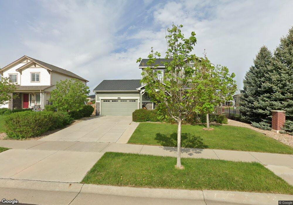
199 S Millbrook St Aurora, CO 80018
Estimated Value: $456,000 - $472,326
3
Beds
3
Baths
1,365
Sq Ft
$341/Sq Ft
Est. Value
About This Home
This home is located at 199 S Millbrook St, Aurora, CO 80018 and is currently estimated at $464,832, approximately $340 per square foot. 199 S Millbrook St is a home located in Arapahoe County with nearby schools including Vista Peak Exploratory and Vista Peak 9-12 Preparatory.
Ownership History
Date
Name
Owned For
Owner Type
Purchase Details
Closed on
Jan 29, 2016
Sold by
Roberts Robert M and Roberts Marlene M
Bought by
Liermann Jenny Sanchez
Current Estimated Value
Home Financials for this Owner
Home Financials are based on the most recent Mortgage that was taken out on this home.
Original Mortgage
$280,976
Outstanding Balance
$224,279
Interest Rate
3.99%
Mortgage Type
VA
Estimated Equity
$240,553
Purchase Details
Closed on
Mar 13, 2013
Sold by
Lennar Colorado Llc
Bought by
Roberts Robert M and Roberts Marlene M
Home Financials for this Owner
Home Financials are based on the most recent Mortgage that was taken out on this home.
Original Mortgage
$169,900
Interest Rate
3.59%
Mortgage Type
New Conventional
Create a Home Valuation Report for This Property
The Home Valuation Report is an in-depth analysis detailing your home's value as well as a comparison with similar homes in the area
Home Values in the Area
Average Home Value in this Area
Purchase History
| Date | Buyer | Sale Price | Title Company |
|---|---|---|---|
| Liermann Jenny Sanchez | $272,000 | None Available | |
| Roberts Robert M | $217,900 | North American Title |
Source: Public Records
Mortgage History
| Date | Status | Borrower | Loan Amount |
|---|---|---|---|
| Open | Liermann Jenny Sanchez | $280,976 | |
| Previous Owner | Roberts Robert M | $169,900 |
Source: Public Records
Tax History Compared to Growth
Tax History
| Year | Tax Paid | Tax Assessment Tax Assessment Total Assessment is a certain percentage of the fair market value that is determined by local assessors to be the total taxable value of land and additions on the property. | Land | Improvement |
|---|---|---|---|---|
| 2024 | $4,618 | $32,267 | -- | -- |
| 2023 | $4,618 | $32,267 | $0 | $0 |
| 2022 | $3,843 | $25,027 | $0 | $0 |
| 2021 | $3,961 | $25,027 | $0 | $0 |
| 2020 | $4,226 | $24,096 | $0 | $0 |
| 2019 | $4,285 | $24,096 | $0 | $0 |
| 2018 | $3,810 | $20,599 | $0 | $0 |
| 2017 | $3,527 | $20,599 | $0 | $0 |
| 2016 | $3,031 | $18,045 | $0 | $0 |
| 2015 | $2,972 | $18,045 | $0 | $0 |
| 2014 | $2,672 | $15,888 | $0 | $0 |
| 2013 | -- | $4,070 | $0 | $0 |
Source: Public Records
Map
Nearby Homes
- 25526 E Maple Ave
- 26116 E Byers Place
- 240 S Oak Hill St
- 35 N Newcastle Ct
- 237 S Old Hammer St
- 27887 E 9th Ln
- 27877 E 9th Ln
- 27853 E 8th Ave
- 27837 E 9th Ln
- 951 N Vandriver Way
- 27895 E 7th Place
- 27646 E 10th Dr
- 27790 E 9th Place
- 784 White Crow St
- 27902 E 10th Dr
- 2167 S Jackson Gap Way
- 25525 E 1st Ave
- 2144 S Ider Way
- 2165 S Ider Way
- 158 N Kellerman St
- 209 S Millbrook St
- 219 S Millbrook St
- 179 S Millbrook St
- 25774 E Maple Dr
- 229 S Millbrook St
- 25773 E Cedar Place
- 169 S Millbrook St
- 25775 E Maple Dr
- 25794 E Maple Dr
- 190 S Langdale Ct
- 200 S Langdale Ct
- 25793 E Cedar Place
- 180 N Langdale Ct
- 180 S Langdale Ct
- 25660 E Maple Place
- 170 S Langdale Ct
- 159 S Millbrook St
- 25795 E Maple Dr
- 249 S Millbrook St
- 25803 E Cedar Place