Estimated Value: $480,818 - $492,000
Studio
--
Bath
2,905
Sq Ft
$167/Sq Ft
Est. Value
About This Home
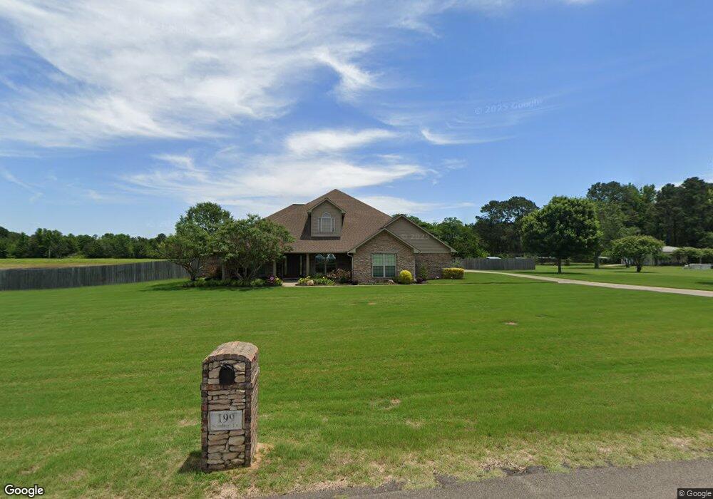
This home is located at 199 Sambug Ln, Hooks, TX 75561 and is currently estimated at $485,273, approximately $167 per square foot. 199 Sambug Ln is a home with nearby schools including Hooks Elementary School, Hooks Junior High School, and Hooks High School.
Ownership History
Date
Name
Owned For
Owner Type
Purchase Details
Closed on
Oct 5, 2009
Sold by
Knight Meadows Properties Llp
Bought by
Smith Michael and Smith Amanda
Current Estimated Value
Home Financials for this Owner
Home Financials are based on the most recent Mortgage that was taken out on this home.
Original Mortgage
$15,000
Interest Rate
5.12%
Mortgage Type
Future Advance Clause Open End Mortgage
Create a Home Valuation Report for This Property
The Home Valuation Report is an in-depth analysis detailing your home's value as well as a comparison with similar homes in the area
Home Values in the Area
Average Home Value in this Area
Purchase History
| Date | Buyer | Sale Price | Title Company |
|---|---|---|---|
| Smith Michael | -- | None Available |
Source: Public Records
Mortgage History
| Date | Status | Borrower | Loan Amount |
|---|---|---|---|
| Closed | Smith Michael | $15,000 |
Source: Public Records
Tax History
| Year | Tax Paid | Tax Assessment Tax Assessment Total Assessment is a certain percentage of the fair market value that is determined by local assessors to be the total taxable value of land and additions on the property. | Land | Improvement |
|---|---|---|---|---|
| 2025 | $5,604 | $462,240 | -- | -- |
| 2024 | $5,604 | $420,218 | -- | -- |
| 2023 | $5,101 | $382,016 | $0 | $0 |
| 2022 | $6,175 | $378,322 | $24,000 | $354,322 |
| 2021 | $5,784 | $315,715 | $24,000 | $291,715 |
| 2020 | $5,503 | $298,167 | $20,000 | $278,167 |
| 2019 | $5,541 | $285,252 | $20,000 | $265,252 |
| 2018 | $5,349 | $275,357 | $20,000 | $255,357 |
| 2017 | $5,436 | $280,924 | $20,000 | $260,924 |
| 2016 | $5,294 | $273,565 | $20,000 | $253,565 |
| 2015 | $4,879 | $271,118 | $20,000 | $251,118 |
| 2014 | $4,879 | $268,746 | $20,000 | $248,746 |
Source: Public Records
Map
Nearby Homes
- 2517 County Road 2110
- 2517 Cr 2110
- Tbd Knight Ln
- 439 Avenue P
- 1257 County Road 2111
- TBD Farm To Market 560
- 138 Weatherby Dr Unit 7 Weatherby
- 138 Weatherby Dr
- 10 Weatherby Dr
- TBD I-30 Frontage
- 12 Lacey St
- 11 Lacey St
- 800 E 9th St
- 204 Browning Ln
- 203 Main St
- 1001 E Ave I E 13th
- 603 E Avenue D
- 704 E Avenue E
- 5 Kennedy Cir
- 6625 Fm 1398
- 235 Sambug Ln
- 156 Sambug Ln
- 230 Sambug Ln
- 115 Sambug Ln
- 18 Sambug Ln
- 0 Sambug Ln
- 0 Sambug Ln
- 269 Sambug Ln
- 88 Sambug Ln
- 266 Sambug Ln
- 77 Private Road 21102
- 403 Cr 2107
- 571 County Road 2107
- 00 Sambug Ln
- 2107 Knight Ln
- 0 Knight Ln
- 430 County Road 2107
- 410 County Road 2107
- 181 County Road 2107
- 728 County Road 2107
Your Personal Tour Guide
Ask me questions while you tour the home.