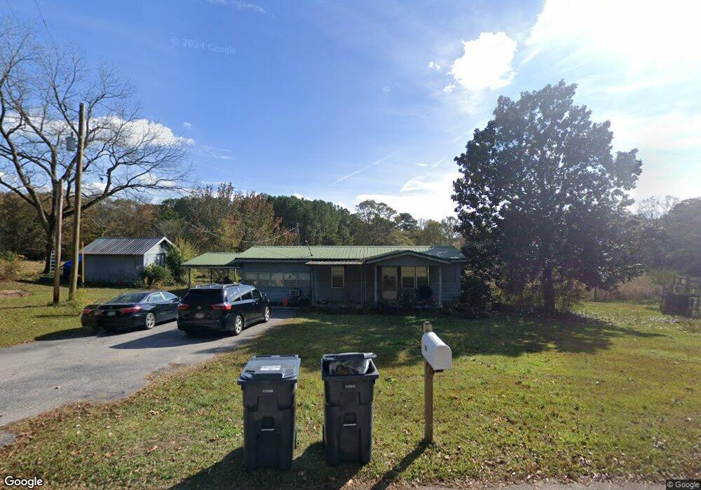
199 Scott Rd Lagrange, GA 30241
Estimated Value: $179,100 - $295,000
2
Beds
1
Bath
1,440
Sq Ft
$173/Sq Ft
Est. Value
About This Home
This home is located at 199 Scott Rd, Lagrange, GA 30241 and is currently estimated at $248,775, approximately $172 per square foot. 199 Scott Rd is a home located in Troup County with nearby schools including Rosemont Elementary School, Whitesville Road Elementary School, and Berta Weathersbee Elementary School.
Ownership History
Date
Name
Owned For
Owner Type
Purchase Details
Closed on
Jan 15, 2016
Sold by
Kenerley Lessie
Bought by
Soto Armando James and Soto Kathryn
Current Estimated Value
Home Financials for this Owner
Home Financials are based on the most recent Mortgage that was taken out on this home.
Original Mortgage
$85,500
Outstanding Balance
$67,521
Interest Rate
3.99%
Mortgage Type
New Conventional
Estimated Equity
$181,254
Purchase Details
Closed on
Dec 30, 2002
Sold by
Mary Kenerley Bolt Etal
Bought by
Kenerley Lessie
Purchase Details
Closed on
Feb 6, 1996
Sold by
Lessie Kenerley
Bought by
Mary Kenerley Bolt Etal
Purchase Details
Closed on
Mar 8, 1969
Sold by
Kenerly R E
Bought by
Lessie Kenerley
Purchase Details
Closed on
Jan 1, 1960
Sold by
Jim Oneal
Bought by
Kenerly R E
Create a Home Valuation Report for This Property
The Home Valuation Report is an in-depth analysis detailing your home's value as well as a comparison with similar homes in the area
Purchase History
| Date | Buyer | Sale Price | Title Company |
|---|---|---|---|
| Soto Armando James | $90,000 | -- | |
| Kenerley Lessie | -- | -- | |
| Mary Kenerley Bolt Etal | -- | -- | |
| Lessie Kenerley | -- | -- | |
| Kenerly R E | -- | -- |
Source: Public Records
Mortgage History
| Date | Status | Borrower | Loan Amount |
|---|---|---|---|
| Open | Soto Armando James | $85,500 |
Source: Public Records
Tax History
| Year | Tax Paid | Tax Assessment Tax Assessment Total Assessment is a certain percentage of the fair market value that is determined by local assessors to be the total taxable value of land and additions on the property. | Land | Improvement |
|---|---|---|---|---|
| 2025 | $1,231 | $48,388 | $16,720 | $31,668 |
| 2024 | $1,167 | $44,788 | $16,720 | $28,068 |
| 2023 | $1,066 | $41,068 | $16,720 | $24,348 |
| 2022 | $1,029 | $38,868 | $16,720 | $22,148 |
| 2021 | $1,099 | $38,416 | $16,600 | $21,816 |
| 2020 | $1,099 | $38,416 | $16,600 | $21,816 |
| 2019 | $1,005 | $35,296 | $13,280 | $22,016 |
| 2018 | $943 | $33,268 | $13,280 | $19,988 |
| 2017 | $943 | $33,268 | $13,280 | $19,988 |
| 2016 | $605 | $30,026 | $11,600 | $18,426 |
| 2015 | $737 | $34,361 | $12,000 | $22,361 |
| 2014 | $705 | $33,296 | $12,000 | $21,296 |
| 2013 | -- | $38,670 | $12,000 | $26,670 |
Source: Public Records
Map
Nearby Homes
- 11.59+/- AC Hunt Rd
- 246 S Smith Rd
- 113 Glenn Eagle Point
- 1820 Salem Rd
- 3913 Whitesville Rd
- 137 Robertson Rd
- 130 Hamilton Lake Dr
- 0 Salem Lot 3 Rd Unit LOT 3
- 0 Salem Lot 1 Rd Unit LOT 1
- 1605 Bartley Rd
- 2851 & 2891 Hamilton Rd
- 0 Robert Hodnett Rd Unit 10709308
- 0 Briley Rd Unit 10582531
- 0 Briley Rd Unit 214353
- 0 Whitesville Rd Unit 10496838
- 950 John Lovelace Rd
- 15.01 +/- AC White Rd
- 12.35 +/- AC White Rd
- 830 John Lovelace Rd
- 209 Grace Ct
Your Personal Tour Guide
Ask me questions while you tour the home.