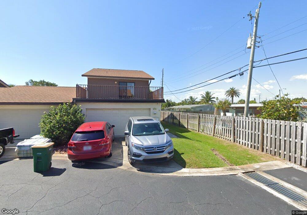
199 Seawind Dr Unit 11 Satellite Beach, FL 32937
Estimated Value: $363,000 - $379,591
3
Beds
3
Baths
1,749
Sq Ft
$212/Sq Ft
Est. Value
About This Home
This home is located at 199 Seawind Dr Unit 11, Satellite Beach, FL 32937 and is currently estimated at $371,398, approximately $212 per square foot. 199 Seawind Dr Unit 11 is a home located in Brevard County with nearby schools including Satellite Senior High School, Surfside Elementary School, and DeLaura Middle School.
Ownership History
Date
Name
Owned For
Owner Type
Purchase Details
Closed on
May 8, 2023
Sold by
Ader Joseph V
Bought by
Ader Family Revocable Living Trust
Current Estimated Value
Purchase Details
Closed on
Jan 15, 2003
Sold by
Brunt Gregory A
Bought by
Ader Joseph V and Ader Jacqueline E
Home Financials for this Owner
Home Financials are based on the most recent Mortgage that was taken out on this home.
Original Mortgage
$107,200
Interest Rate
6.01%
Mortgage Type
Purchase Money Mortgage
Purchase Details
Closed on
Mar 23, 2001
Sold by
Aldridge Barbara S
Bought by
Brunt Gregory A
Home Financials for this Owner
Home Financials are based on the most recent Mortgage that was taken out on this home.
Original Mortgage
$78,700
Interest Rate
7.02%
Mortgage Type
Purchase Money Mortgage
Create a Home Valuation Report for This Property
The Home Valuation Report is an in-depth analysis detailing your home's value as well as a comparison with similar homes in the area
Home Values in the Area
Average Home Value in this Area
Purchase History
| Date | Buyer | Sale Price | Title Company |
|---|---|---|---|
| Ader Family Revocable Living Trust | $100 | None Listed On Document | |
| Ader Joseph V | $134,000 | -- | |
| Brunt Gregory A | $98,400 | -- |
Source: Public Records
Mortgage History
| Date | Status | Borrower | Loan Amount |
|---|---|---|---|
| Previous Owner | Ader Joseph V | $107,200 | |
| Previous Owner | Brunt Gregory A | $78,700 |
Source: Public Records
Tax History Compared to Growth
Tax History
| Year | Tax Paid | Tax Assessment Tax Assessment Total Assessment is a certain percentage of the fair market value that is determined by local assessors to be the total taxable value of land and additions on the property. | Land | Improvement |
|---|---|---|---|---|
| 2025 | $1,291 | $125,460 | -- | -- |
| 2024 | $1,241 | $121,930 | -- | -- |
| 2023 | $1,241 | $118,380 | $0 | $0 |
| 2022 | $1,108 | $114,940 | $0 | $0 |
| 2021 | $1,112 | $111,600 | $0 | $0 |
| 2020 | $1,495 | $110,060 | $0 | $0 |
| 2019 | $1,475 | $107,590 | $0 | $0 |
| 2018 | $1,469 | $105,590 | $0 | $0 |
| 2017 | $1,375 | $103,420 | $0 | $0 |
| 2016 | $1,372 | $101,300 | $30,000 | $71,300 |
| 2015 | $1,402 | $100,600 | $30,000 | $70,600 |
| 2014 | $1,400 | $99,810 | $30,000 | $69,810 |
Source: Public Records
Map
Nearby Homes
- 130 Roosevelt Ave Unit 207
- 129 Seawind Dr Unit 25
- 240 Sheridan Ave
- 200 Jason Ct
- 348 Sherwood Ave
- 1125 Highway A1a Unit 903
- 1125 Highway A1a Unit 501
- 1273 Highway A1a Unit 308
- 325 Park Ave
- 310 Glenwood Ave
- 320 Glenwood Ave
- 1303 Highway A1a Unit 401
- 230 Harwood Ave
- 298 Harwood Ave
- 1326 Highway A1a
- 170 Norwood Ave
- 295 Cinnamon Dr
- 225 Hedgecock Ct
- 1025 Highway A1a Unit 402
- 1025 Highway A1a Unit 902
- 195 Seawind Dr Unit 12
- 189 Seawind Dr Unit 13
- 185 Seawind Dr Unit 14
- 225 Magnolia St
- 215 Magnolia St
- 235 Magnolia St
- 179 Seawind Dr Unit 15
- 190 Seawind Dr Unit 10
- 186 Seawind Dr Unit 9
- 180 Seawind Dr Unit 8
- 180 Seawind Dr
- 175 Seawind Dr Unit 16
- 176 Seawind Dr Unit 7
- 169 Seawind Dr
- 169 Seawind Dr
- 245 Magnolia St
- 170 Seawind Dr Unit 6
- 205 Magnolia St
- 165 Seawind Dr Unit 18
- 166 Seawind Dr Unit 5