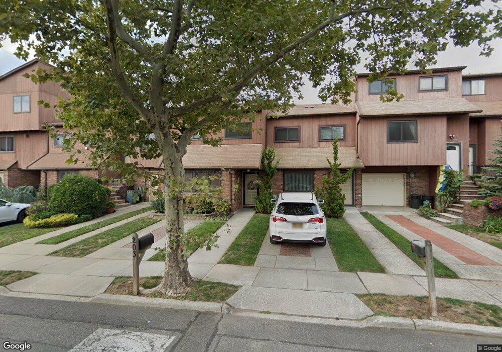
199 Stonegate Dr Unit 13 Staten Island, NY 10304
Concord NeighborhoodEstimated Value: $701,527 - $774,000
3
Beds
2
Baths
2,044
Sq Ft
$362/Sq Ft
Est. Value
About This Home
This home is located at 199 Stonegate Dr Unit 13, Staten Island, NY 10304 and is currently estimated at $739,632, approximately $361 per square foot. 199 Stonegate Dr Unit 13 is a home located in Richmond County with nearby schools including P.S. 48 - William C. Wilcox, I.S. 49 Berta A Dreyfus, and New Dorp High School.
Ownership History
Date
Name
Owned For
Owner Type
Purchase Details
Closed on
Jan 31, 2008
Sold by
Cardello John and Cardello Marylou
Bought by
Dembitsky Andrey and Dembitska Irina
Current Estimated Value
Home Financials for this Owner
Home Financials are based on the most recent Mortgage that was taken out on this home.
Original Mortgage
$339,200
Outstanding Balance
$212,160
Interest Rate
5.9%
Mortgage Type
Purchase Money Mortgage
Estimated Equity
$527,472
Create a Home Valuation Report for This Property
The Home Valuation Report is an in-depth analysis detailing your home's value as well as a comparison with similar homes in the area
Home Values in the Area
Average Home Value in this Area
Purchase History
| Date | Buyer | Sale Price | Title Company |
|---|---|---|---|
| Dembitsky Andrey | $424,000 | None Available |
Source: Public Records
Mortgage History
| Date | Status | Borrower | Loan Amount |
|---|---|---|---|
| Open | Dembitsky Andrey | $339,200 |
Source: Public Records
Tax History
| Year | Tax Paid | Tax Assessment Tax Assessment Total Assessment is a certain percentage of the fair market value that is determined by local assessors to be the total taxable value of land and additions on the property. | Land | Improvement |
|---|---|---|---|---|
| 2025 | $6,105 | $42,415 | $3,868 | $38,547 |
| 2024 | $6,105 | $34,670 | $4,697 | $29,973 |
| 2023 | $5,824 | $28,675 | $4,756 | $23,919 |
| 2022 | $5,400 | $28,758 | $5,357 | $23,401 |
| 2021 | $5,068 | $25,521 | $5,357 | $20,164 |
| 2020 | $5,673 | $28,582 | $5,357 | $23,225 |
| 2019 | $5,369 | $27,064 | $5,357 | $21,707 |
| 2018 | $5,064 | $26,304 | $5,233 | $21,071 |
| 2017 | $4,759 | $24,816 | $5,357 | $19,459 |
| 2016 | $4,460 | $23,862 | $5,357 | $18,505 |
| 2015 | $4,143 | $23,499 | $5,358 | $18,141 |
| 2014 | $4,143 | $23,176 | $4,936 | $18,240 |
Source: Public Records
Map
Nearby Homes
- 31 Alan Loop Unit 65
- 164 Stonegate Dr
- 56 Stonegate Dr
- 7 Gateway Dr
- 31 Stonegate Dr
- 24 Roosevelt St
- 89 Columbus Ave
- 929 W Fingerboard Rd
- 911 W Fingerboard Rd Unit 258
- 909 W Fingerboard Rd
- 7 Spring St
- 15 Roosevelt St
- 100 N Railroad Ave
- 0 Douglas Rd
- 84 Sheridan Ave
- 1 Neckar Ave
- 6 Eltinge St
- 1 Douglas Ct
- 19 Woodlawn Ave
- 325 Oder Ave
- 197 Stonegate Dr Unit 14
- 201 Stonegate Dr
- 203 Stonegate Dr Unit 11
- 193 Stonegate Dr Unit 16
- 205 Stonegate Dr
- 191 Stonegate Dr Unit 17
- 191 Stonegate Dr
- 207 Stonegate Dr Unit 9
- 189 Stonegate Dr Unit 18
- 209 Stonegate Dr Unit 8
- 106 Alan Loop
- 106 Alan Loop Unit 1
- 104 Alan Loop Unit 31
- 108 Alan Loop Unit 33
- 47 Pamela Ln Unit 114
- 103 Stanwich St
- 105 Stanwich St Unit 110
- 196 Stonegate Dr
- 109 Stanwich St Unit 109
- 102 Alan Loop Unit 30
Your Personal Tour Guide
Ask me questions while you tour the home.