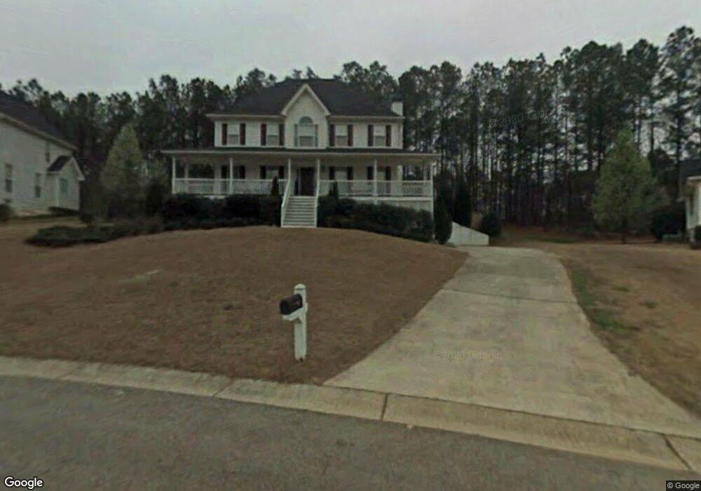
199 Waburn Walk Dallas, GA 30132
East Paulding County NeighborhoodEstimated Value: $347,000 - $384,815
3
Beds
3
Baths
2,064
Sq Ft
$176/Sq Ft
Est. Value
About This Home
This home is located at 199 Waburn Walk, Dallas, GA 30132 and is currently estimated at $363,204, approximately $175 per square foot. 199 Waburn Walk is a home located in Paulding County with nearby schools including W.C. Abney Elementary School, Lena Mae Moses Middle School, and North Paulding High School.
Ownership History
Date
Name
Owned For
Owner Type
Purchase Details
Closed on
Sep 30, 2004
Sold by
Yother William P and Yother Tracia
Bought by
Webb Joushua P and Webb Kristy
Current Estimated Value
Home Financials for this Owner
Home Financials are based on the most recent Mortgage that was taken out on this home.
Original Mortgage
$172,000
Outstanding Balance
$88,643
Interest Rate
6.38%
Mortgage Type
New Conventional
Estimated Equity
$274,561
Create a Home Valuation Report for This Property
The Home Valuation Report is an in-depth analysis detailing your home's value as well as a comparison with similar homes in the area
Home Values in the Area
Average Home Value in this Area
Purchase History
| Date | Buyer | Sale Price | Title Company |
|---|---|---|---|
| Webb Joushua P | $172,000 | -- |
Source: Public Records
Mortgage History
| Date | Status | Borrower | Loan Amount |
|---|---|---|---|
| Open | Webb Joushua P | $172,000 |
Source: Public Records
Tax History Compared to Growth
Tax History
| Year | Tax Paid | Tax Assessment Tax Assessment Total Assessment is a certain percentage of the fair market value that is determined by local assessors to be the total taxable value of land and additions on the property. | Land | Improvement |
|---|---|---|---|---|
| 2024 | $3,634 | $146,072 | $14,000 | $132,072 |
| 2023 | $3,863 | $148,180 | $14,000 | $134,180 |
| 2022 | $3,370 | $129,284 | $14,000 | $115,284 |
| 2021 | $2,804 | $96,492 | $14,000 | $82,492 |
| 2020 | $2,621 | $88,248 | $14,000 | $74,248 |
| 2019 | $2,492 | $82,700 | $14,000 | $68,700 |
| 2018 | $2,310 | $76,676 | $12,000 | $64,676 |
| 2017 | $2,332 | $76,320 | $12,000 | $64,320 |
| 2016 | $2,172 | $71,840 | $12,000 | $59,840 |
| 2015 | $1,888 | $61,360 | $12,000 | $49,360 |
| 2014 | $1,787 | $56,600 | $12,000 | $44,600 |
| 2013 | -- | $50,200 | $12,000 | $38,200 |
Source: Public Records
Map
Nearby Homes
- 67 Severn Way
- 18 Ardmore Place
- 169 Kipling Dr
- 836 Stable View Loop
- 345 Stable View Loop
- 251 Eagle Lake Dr
- 359 Westridge Cir
- 345 Westridge Cir
- 104 Jones Ridge Dr
- 265 Jabo Carter Rd
- 103 Cyrilla Walk
- 24 Cannon Ridge View
- 176 Deven Dr
- The Coleman Plan at Victoria Heights
- The McGinnis Plan at Victoria Heights
- 601 Victoria Heights Dr
- 761 Victoria Heights Dr
- 751 Victoria Heights Dr
- 578 Victoria Heights Dr
- 360 Crimson Dr
- 217 Waburn Walk
- 185 Waburn Walk
- 186 Severn Way
- 163 Waburn Walk
- 233 Waburn Walk
- 190 Severn Way
- 220 Waburn Walk
- 174 Waburn Walk
- 142 Ardmore Place
- 459 Waburn Walk
- 247 Waburn Walk
- 129 Waburn Walk
- 170 Severn Way
- 154 Waburn Walk
- 124 Ardmore Place
- 183 Severn Way
- 282 Waburn Walk
- 103 Waburn Walk
- 265 Waburn Walk
- 104 Ardmore Place