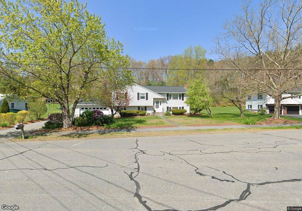
199 Wright Rd Concord, MA 01742
Estimated Value: $925,000 - $1,384,000
3
Beds
3
Baths
1,208
Sq Ft
$890/Sq Ft
Est. Value
About This Home
This home is located at 199 Wright Rd, Concord, MA 01742 and is currently estimated at $1,074,919, approximately $889 per square foot. 199 Wright Rd is a home located in Middlesex County with nearby schools including Thoreau Elementary School, Concord Middle School, and Concord Carlisle High School.
Ownership History
Date
Name
Owned For
Owner Type
Purchase Details
Closed on
Jul 1, 1994
Sold by
Klibanoff Elton B and Klibanoff Susan L
Bought by
Kaplan Peter S and Kaplan Katherine A
Current Estimated Value
Home Financials for this Owner
Home Financials are based on the most recent Mortgage that was taken out on this home.
Original Mortgage
$134,000
Interest Rate
8.55%
Mortgage Type
Purchase Money Mortgage
Create a Home Valuation Report for This Property
The Home Valuation Report is an in-depth analysis detailing your home's value as well as a comparison with similar homes in the area
Home Values in the Area
Average Home Value in this Area
Purchase History
| Date | Buyer | Sale Price | Title Company |
|---|---|---|---|
| Kaplan Peter S | $294,800 | -- |
Source: Public Records
Mortgage History
| Date | Status | Borrower | Loan Amount |
|---|---|---|---|
| Open | Kaplan Peter S | $109,000 | |
| Closed | Kaplan Peter S | $130,800 | |
| Closed | Kaplan Peter S | $134,000 |
Source: Public Records
Tax History
| Year | Tax Paid | Tax Assessment Tax Assessment Total Assessment is a certain percentage of the fair market value that is determined by local assessors to be the total taxable value of land and additions on the property. | Land | Improvement |
|---|---|---|---|---|
| 2025 | $118 | $887,900 | $511,100 | $376,800 |
| 2024 | $11,254 | $857,100 | $511,100 | $346,000 |
| 2023 | $10,505 | $810,600 | $464,600 | $346,000 |
| 2022 | $9,681 | $655,900 | $371,600 | $284,300 |
| 2021 | $9,506 | $645,800 | $371,600 | $274,200 |
| 2020 | $8,944 | $628,500 | $371,600 | $256,900 |
| 2019 | $9,093 | $640,800 | $383,900 | $256,900 |
| 2018 | $8,574 | $600,000 | $352,300 | $247,700 |
| 2017 | $7,816 | $555,500 | $327,200 | $228,300 |
| 2016 | $7,865 | $565,000 | $327,200 | $237,800 |
| 2015 | $7,384 | $516,700 | $303,000 | $213,700 |
Source: Public Records
Map
Nearby Homes
- 245 Oak Hill Cir
- 42 Sunnyside Ln
- 65 Summit St
- 303 School St
- 67 Conant St
- 116 Conant St
- 66 Old Stow Rd
- 95 Conant St Unit 320
- 59 Lexington Dr
- 54 Maple St
- 22 Center Village Dr
- 37 Water St
- 27 Water St
- 20 Westvale Meadows Unit C
- 102 Highland St
- 32 Highland St
- 1 Bayberry Rd
- 70 McCallar Ln
- 79-81 Assabet Ave
- 111 Central St
- 209 Wright Rd
- 187 Wright Rd
- 204 Oak Hill Cir
- 173 Wright Rd
- 196 Wright Rd
- 186 Wright Rd
- 216 Oak Hill Cir
- 208 Wright Rd
- 194 Oak Hill Cir
- 174 Wright Rd
- 157 Wright Rd
- 228 Oak Hill Cir
- 158 Wright Rd
- 182 Oak Hill Cir
- 215 Oak Hill Cir
- 199 Oak Hill Cir
- 147 Wright Rd
- 187 Oak Hill Cir
- 144 Wright Rd
- 168 Oak Hill Cir
Your Personal Tour Guide
Ask me questions while you tour the home.