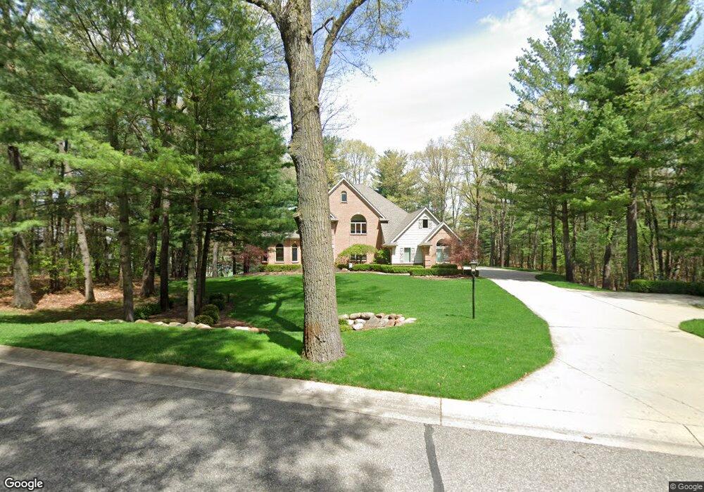
1990 Deer Path Trail Oxford, MI 48371
Estimated Value: $751,089 - $931,000
4
Beds
4
Baths
3,500
Sq Ft
$244/Sq Ft
Est. Value
About This Home
This home is located at 1990 Deer Path Trail, Oxford, MI 48371 and is currently estimated at $855,522, approximately $244 per square foot. 1990 Deer Path Trail is a home located in Oakland County with nearby schools including Paint Creek Elementary School, Scripps Middle School, and Lake Orion Community High School.
Ownership History
Date
Name
Owned For
Owner Type
Purchase Details
Closed on
Aug 27, 2021
Sold by
West Michael E and West Susan M
Bought by
Stolzenfeld James and Stolzenfeld Jean
Current Estimated Value
Purchase Details
Closed on
Jun 24, 2020
Sold by
West Michale E and West Susan M
Bought by
West Michael E and West Susan M
Purchase Details
Closed on
Mar 1, 2019
Sold by
Glowiak Brian G and Glowiak Alicja
Bought by
West Michael and West Susan
Create a Home Valuation Report for This Property
The Home Valuation Report is an in-depth analysis detailing your home's value as well as a comparison with similar homes in the area
Home Values in the Area
Average Home Value in this Area
Purchase History
| Date | Buyer | Sale Price | Title Company |
|---|---|---|---|
| Stolzenfeld James | $824,000 | Visionary Title Agency Llc | |
| Stolzenfeld James | $824,000 | Visionary Title Agency Llc | |
| West Michael E | -- | None Available | |
| West Michael | $595,000 | None Available |
Source: Public Records
Tax History
| Year | Tax Paid | Tax Assessment Tax Assessment Total Assessment is a certain percentage of the fair market value that is determined by local assessors to be the total taxable value of land and additions on the property. | Land | Improvement |
|---|---|---|---|---|
| 2025 | $12,272 | $318,430 | $0 | $0 |
| 2024 | $7,658 | $319,580 | $0 | $0 |
| 2023 | $7,312 | $315,910 | $0 | $0 |
| 2022 | $10,838 | $290,150 | $0 | $0 |
| 2021 | $9,636 | $277,910 | $0 | $0 |
| 2020 | $6,227 | $257,500 | $0 | $0 |
| 2019 | $7,305 | $269,290 | $0 | $0 |
| 2018 | $7,167 | $253,860 | $0 | $0 |
| 2017 | $7,039 | $237,140 | $0 | $0 |
| 2016 | $7,025 | $216,510 | $0 | $0 |
| 2015 | -- | $211,860 | $0 | $0 |
| 2014 | -- | $211,570 | $0 | $0 |
| 2011 | -- | $187,470 | $0 | $0 |
Source: Public Records
Map
Nearby Homes
- 599 Nakomis Trail
- 1672 Deer Path Trail
- 1753 Deer Path Trail
- 573 Nakomis Trail
- 1486 Chestnut Trail
- 1680 Seminole Trail
- 108 Menasha Trail
- 801 Watersmeet Dr
- 1628 Royal Birkdale Dr Unit 76
- 1550 Dakota Ct
- 92 Kirksway Ln
- 1906 Indianwood Rd
- 1963 Turnberry Ct
- 1117 Woodbriar Ct
- 512 Fernhurst Ct
- 850 Glenmoor Dr
- 311 Teelin Dr
- 1 Pinery Ct
- 767 Pinery Blvd
- 90 Creekwood Dr
- 1960 Deer Path Trail
- 1955 Deer Path Trail
- 1975 Deer Path Trail
- 1930 Deer Path Trail
- 1651 Deer Path Trail
- 1629 Deer Path Trail
- 1999 Deer Path Trail
- 1925 Deer Path Trail
- 1607 Deer Path Trail
- 1673 Deer Path Trail
- 2020 Deer Path Trail
- 1801 Deer Path Trail
- 1821 Deer Path Trail
- 1620 Deer Path Trail
- 1585 Deer Path Trail
- 1445 Nakomis Trail
- 1779 Deer Path Trail
- 1697 Deer Path Trail
- 1843 Deer Path Trail
- 1430 Nakomis Trail
Your Personal Tour Guide
Ask me questions while you tour the home.