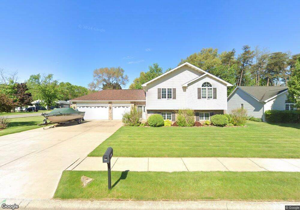
1990 Greentree St Portage, IN 46368
Estimated Value: $303,000 - $348,883
4
Beds
3
Baths
2,513
Sq Ft
$129/Sq Ft
Est. Value
About This Home
This home is located at 1990 Greentree St, Portage, IN 46368 and is currently estimated at $324,471, approximately $129 per square foot. 1990 Greentree St is a home located in Porter County with nearby schools including Crisman Elementary School, Willowcreek Middle School, and Portage High School.
Ownership History
Date
Name
Owned For
Owner Type
Purchase Details
Closed on
Aug 25, 2017
Sold by
Bryan John and Bryan Ii John J
Bought by
Bryan John J and Bryan Jnnifer L
Current Estimated Value
Purchase Details
Closed on
Dec 16, 2008
Sold by
Bryan John J and Bryan Jennifer L
Bought by
Bryan John
Home Financials for this Owner
Home Financials are based on the most recent Mortgage that was taken out on this home.
Original Mortgage
$207,824
Interest Rate
6.19%
Mortgage Type
FHA
Create a Home Valuation Report for This Property
The Home Valuation Report is an in-depth analysis detailing your home's value as well as a comparison with similar homes in the area
Home Values in the Area
Average Home Value in this Area
Purchase History
| Date | Buyer | Sale Price | Title Company |
|---|---|---|---|
| Bryan John J | -- | None Available | |
| Bryan John | -- | None Available |
Source: Public Records
Mortgage History
| Date | Status | Borrower | Loan Amount |
|---|---|---|---|
| Closed | Bryan John | $207,824 |
Source: Public Records
Tax History Compared to Growth
Tax History
| Year | Tax Paid | Tax Assessment Tax Assessment Total Assessment is a certain percentage of the fair market value that is determined by local assessors to be the total taxable value of land and additions on the property. | Land | Improvement |
|---|---|---|---|---|
| 2024 | $2,789 | $285,400 | $46,200 | $239,200 |
| 2023 | $2,500 | $276,900 | $44,000 | $232,900 |
| 2022 | $2,480 | $248,000 | $44,000 | $204,000 |
| 2021 | $2,223 | $220,300 | $44,000 | $176,300 |
| 2020 | $2,158 | $213,800 | $38,300 | $175,500 |
| 2019 | $2,082 | $206,200 | $38,300 | $167,900 |
| 2018 | $2,069 | $204,900 | $38,300 | $166,600 |
| 2017 | $1,905 | $188,500 | $38,300 | $150,200 |
| 2016 | $1,970 | $195,000 | $38,400 | $156,600 |
| 2014 | $1,904 | $188,400 | $36,500 | $151,900 |
| 2013 | -- | $181,800 | $37,300 | $144,500 |
Source: Public Records
Map
Nearby Homes
- 2065 Jefferson St
- 6698 Monument Ave
- 6540 Monument Ave
- 6490 Old Porter Rd
- 1935 Samuelson Rd
- 1902 Driftwood St
- 2191 Hamilton St
- 1766 Samuelson Rd
- 6697 Federal Ave
- 2262 Rodeo St
- 1848 Truman St
- 6340 Melton Rd
- 0 Northwood Trail Unit NRA811704
- 6281 Old Porter Rd
- 2183 Foley St
- 2230 Foley St
- 2182 Foley St
- 2168 Austin St
- 1980 Crisman Rd
- 2176 Mccool Rd
- 6610 Old Porter Rd
- 1983 Tonia St
- 1974 Greentree St
- 6621 Old Porter Rd
- 1991 Greentree St
- 1975 Tonia St
- 1983 Greentree St
- 6603 Old Porter Rd
- 1966 Greentree St
- 1975 Greentree St
- 6629 Old Porter Rd
- 1967 Tonia St
- 1967 Greentree St
- 6590 Old Porter Rd
- 1958 Greentree St
- 1959 Tonia St
- 6641 Old Porter Rd
- 1982 Tonia St
- 1992 Hamilton St
- 1984 Hamilton St