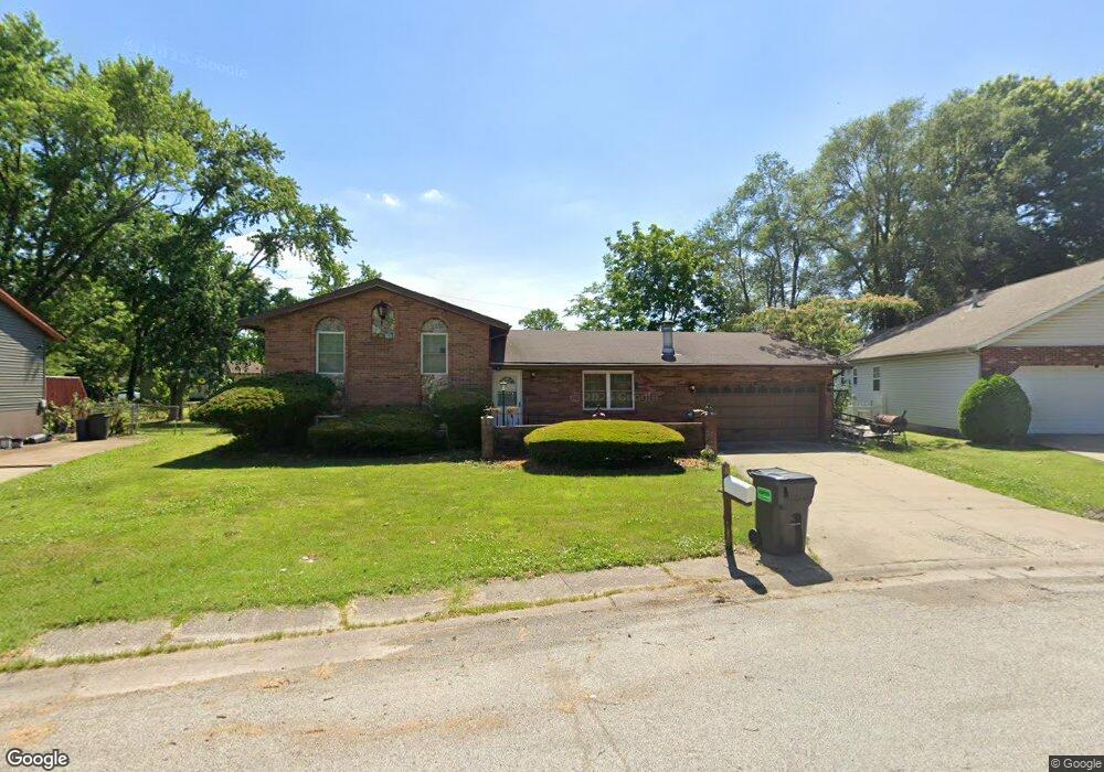
1990 Maple Tree Ln East Saint Louis, IL 62206
Estimated Value: $69,167 - $135,000
--
Bed
--
Bath
616
Sq Ft
$173/Sq Ft
Est. Value
About This Home
This home is located at 1990 Maple Tree Ln, East Saint Louis, IL 62206 and is currently estimated at $106,542, approximately $172 per square foot. 1990 Maple Tree Ln is a home located in St. Clair County.
Ownership History
Date
Name
Owned For
Owner Type
Purchase Details
Closed on
Jun 29, 2015
Sold by
Lee Frances R and Lee Nina B
Bought by
Lee Nina B
Current Estimated Value
Purchase Details
Closed on
Dec 16, 2009
Sold by
Lee Frances R
Bought by
Lee Frances R and Lee Nina B
Purchase Details
Closed on
Nov 26, 2005
Sold by
Lee Frances R and Lee I
Bought by
Lee Frances R
Home Financials for this Owner
Home Financials are based on the most recent Mortgage that was taken out on this home.
Original Mortgage
$77,050
Interest Rate
6.2%
Mortgage Type
New Conventional
Create a Home Valuation Report for This Property
The Home Valuation Report is an in-depth analysis detailing your home's value as well as a comparison with similar homes in the area
Home Values in the Area
Average Home Value in this Area
Purchase History
| Date | Buyer | Sale Price | Title Company |
|---|---|---|---|
| Lee Nina B | -- | None Available | |
| Lee Nina B | -- | None Available | |
| Lee Frances R | -- | None Available | |
| Lee Frances R | -- | Netco |
Source: Public Records
Mortgage History
| Date | Status | Borrower | Loan Amount |
|---|---|---|---|
| Previous Owner | Lee Frances R | $77,050 |
Source: Public Records
Tax History Compared to Growth
Tax History
| Year | Tax Paid | Tax Assessment Tax Assessment Total Assessment is a certain percentage of the fair market value that is determined by local assessors to be the total taxable value of land and additions on the property. | Land | Improvement |
|---|---|---|---|---|
| 2024 | $2,932 | $21,416 | $1,870 | $19,546 |
| 2023 | $2,538 | $19,356 | $1,690 | $17,666 |
| 2022 | $2,176 | $16,964 | $1,481 | $15,483 |
| 2021 | $3,452 | $16,075 | $1,403 | $14,672 |
| 2020 | $2,525 | $16,840 | $1,470 | $15,370 |
| 2019 | $2,530 | $16,840 | $1,470 | $15,370 |
| 2018 | $2,538 | $17,086 | $1,491 | $15,595 |
| 2017 | $2,304 | $16,673 | $1,455 | $15,218 |
| 2016 | $2,289 | $16,421 | $1,450 | $14,971 |
| 2014 | $1,072 | $16,242 | $1,434 | $14,808 |
| 2013 | -- | $15,235 | $1,345 | $13,890 |
Source: Public Records
Map
Nearby Homes
- 1997 Oak Tree Ln
- 2013 Maple Tree Ln
- 2014 Florence St
- 2 Margie Dr
- 1713 Loretta Ave
- 2025 Sandy Ridge Rd
- 1128 Saint Benedict Dr
- 2016 Lynn St
- 2005 Louise Ave
- 1106 Saint Boniface Dr
- 2274 Carol St
- 1426 Richard Dr
- 1505 Camp Jackson Rd
- 34 Marilyn Ln
- 17 Hanover Ln
- 10 E Adams Dr
- 913 Joliet Dr Unit 1
- 30 Marilyn Ln
- 16 Helen Ct
- 22 Marilyn Ln
- 1992 Maple Tree Ln
- 1988 Maple Tree Ln
- 1903 Florence St
- 1907 Florence St
- 1994 Maple Tree Ln
- 1203 Pine Tree Ln
- 1991 Maple Tree Ln
- 1913 Florence St
- 1993 Maple Tree Ln
- 1205 Pine Tree Ln
- 1996 Maple Tree Ln
- 1995 Maple Tree Ln
- 1915 Florence St
- 1990 Oak Tree Ln
- 1207 Pine Tree Ln
- 1997 Maple Tree Ln
- 1906 Florence St
- 1992 Oak Tree Ln
- 2000 Maple Tree Ln
- 1919 Florence St