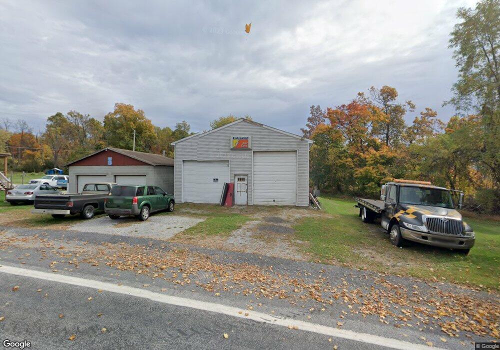
1990 Pinetown Rd Wellsville, PA 17365
Warrington Township NeighborhoodEstimated Value: $192,584 - $307,000
2
Beds
1
Bath
1,075
Sq Ft
$216/Sq Ft
Est. Value
About This Home
This home is located at 1990 Pinetown Rd, Wellsville, PA 17365 and is currently estimated at $231,896, approximately $215 per square foot. 1990 Pinetown Rd is a home located in York County with nearby schools including Northern Middle School and Northern High School.
Ownership History
Date
Name
Owned For
Owner Type
Purchase Details
Closed on
Aug 8, 2024
Sold by
Ross Ricky
Bought by
Ross Ricky and Ross Timothy
Current Estimated Value
Purchase Details
Closed on
Mar 8, 2016
Sold by
Dawson Winifred L and Dawson William R
Bought by
Dawson Winifred L and Ross Ricky
Purchase Details
Closed on
Mar 11, 2013
Sold by
Dawson Winifred L
Bought by
Dawson Winifred L and Dawson William R
Purchase Details
Closed on
Aug 8, 2001
Sold by
Dawson William Russell
Bought by
Dawson Winifred L
Create a Home Valuation Report for This Property
The Home Valuation Report is an in-depth analysis detailing your home's value as well as a comparison with similar homes in the area
Home Values in the Area
Average Home Value in this Area
Purchase History
| Date | Buyer | Sale Price | Title Company |
|---|---|---|---|
| Ross Ricky | -- | None Listed On Document | |
| Dawson Winifred L | -- | None Available | |
| Dawson Winifred L | -- | None Available | |
| Dawson Winifred L | -- | -- |
Source: Public Records
Tax History Compared to Growth
Tax History
| Year | Tax Paid | Tax Assessment Tax Assessment Total Assessment is a certain percentage of the fair market value that is determined by local assessors to be the total taxable value of land and additions on the property. | Land | Improvement |
|---|---|---|---|---|
| 2025 | $2,215 | $81,320 | $37,030 | $44,290 |
| 2024 | $2,191 | $81,320 | $37,030 | $44,290 |
| 2023 | $2,147 | $81,320 | $37,030 | $44,290 |
| 2022 | $2,102 | $81,320 | $37,030 | $44,290 |
| 2021 | $1,965 | $81,320 | $37,030 | $44,290 |
| 2020 | $1,918 | $81,320 | $37,030 | $44,290 |
| 2019 | $1,869 | $81,320 | $37,030 | $44,290 |
| 2018 | $1,829 | $81,320 | $37,030 | $44,290 |
| 2017 | $1,829 | $81,320 | $37,030 | $44,290 |
| 2016 | $0 | $81,320 | $37,030 | $44,290 |
| 2015 | -- | $81,320 | $37,030 | $44,290 |
| 2014 | -- | $81,320 | $37,030 | $44,290 |
Source: Public Records
Map
Nearby Homes
- 1967 Pinetown Rd
- 480 Mount Airy Rd Unit 13
- 329 Mount Airy Rd
- 450 Stone Jug Rd
- 25 Rocky Wood Ln
- 859 Pinetown Rd
- 814 Moores Mountain Rd
- 200 Mountain Rd
- 910 Emanuel Rd
- 708 Bencru Ave
- 833 Stonybrook Ln
- 0 W Camping Area Rd
- 855 Garriston Rd
- 6 Glencarron Ct
- 5 Glencarron Ct
- Tract #1 Carlisle Rd
- 375 Mount Zion Rd
- 0 Silver Lake Rd Unit PAYK2089288
- 302 W Front St
- 320 E Front St
- 15 Lisburn Rd
- 45 Lisburn Rd
- 1 Lisburn Rd
- 1985 Pinetown Rd
- 65 Lisburn Rd
- 95 Lisburn Rd
- 1955 Pinetown Rd
- 1950 Pinetown Rd
- 1965 Pinetown Rd
- 650 Mount Airy Rd
- 165 Lisburn Rd
- 630 Mount Airy Rd
- 1630 Roundtop Rd
- 645 Mount Airy Rd
- 1845 Pinetown Rd
- 715 Mt Airy Rd Unit 5
- 715 Mt Airy Rd Unit 6
- 715 Mt Airy Rd Unit 7
- 2125 Pinetown Rd
- 775 Stone Jug Rd