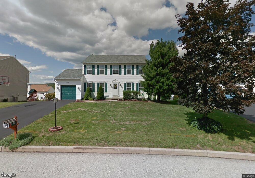
1990 Quail Ln Pottstown, PA 19464
Estimated Value: $428,000 - $478,000
4
Beds
3
Baths
2,042
Sq Ft
$222/Sq Ft
Est. Value
About This Home
This home is located at 1990 Quail Ln, Pottstown, PA 19464 and is currently estimated at $453,518, approximately $222 per square foot. 1990 Quail Ln is a home located in Montgomery County with nearby schools including Lower Pottsgrove Elementary School, Pottsgrove Middle School, and Pottsgrove Senior High School.
Ownership History
Date
Name
Owned For
Owner Type
Purchase Details
Closed on
Mar 31, 2016
Sold by
Czerpak Steven W and Ckerpak Joanne F
Bought by
Czerpak Joanne F
Current Estimated Value
Home Financials for this Owner
Home Financials are based on the most recent Mortgage that was taken out on this home.
Original Mortgage
$190,400
Outstanding Balance
$151,062
Interest Rate
3.64%
Mortgage Type
New Conventional
Estimated Equity
$302,456
Purchase Details
Closed on
Aug 23, 1994
Sold by
Dewey Properties Inc
Bought by
Czerpak Steven W and Czerpak Joanne F
Create a Home Valuation Report for This Property
The Home Valuation Report is an in-depth analysis detailing your home's value as well as a comparison with similar homes in the area
Home Values in the Area
Average Home Value in this Area
Purchase History
| Date | Buyer | Sale Price | Title Company |
|---|---|---|---|
| Czerpak Joanne F | -- | None Available | |
| Czerpak Steven W | $144,435 | -- |
Source: Public Records
Mortgage History
| Date | Status | Borrower | Loan Amount |
|---|---|---|---|
| Open | Czerpak Joanne F | $190,400 |
Source: Public Records
Tax History Compared to Growth
Tax History
| Year | Tax Paid | Tax Assessment Tax Assessment Total Assessment is a certain percentage of the fair market value that is determined by local assessors to be the total taxable value of land and additions on the property. | Land | Improvement |
|---|---|---|---|---|
| 2025 | $6,580 | $133,880 | $33,590 | $100,290 |
| 2024 | $6,580 | $133,880 | $33,590 | $100,290 |
| 2023 | $6,376 | $133,880 | $33,590 | $100,290 |
| 2022 | $6,281 | $133,880 | $33,590 | $100,290 |
| 2021 | $6,157 | $133,880 | $33,590 | $100,290 |
| 2020 | $6,101 | $133,880 | $33,590 | $100,290 |
| 2019 | $6,069 | $133,880 | $33,590 | $100,290 |
| 2018 | $6,068 | $133,880 | $33,590 | $100,290 |
| 2017 | $6,016 | $133,880 | $33,590 | $100,290 |
| 2016 | $5,963 | $133,880 | $33,590 | $100,290 |
| 2015 | $5,896 | $133,880 | $33,590 | $100,290 |
| 2014 | $5,828 | $133,880 | $33,590 | $100,290 |
Source: Public Records
Map
Nearby Homes
- 2126 Deer Ridge Dr
- 3605 Walnut Ridge Dr
- 1103 Walnut Ridge Dr
- 1876 Glen Eagles Dr
- 1532 Briarwood Ln
- 1527 Cedar Hill Rd
- 1769 Clearview Rd
- 1240 Wooded Way
- 1330 N Sanatoga Rd
- 17 Doe Run Ln
- 1871 Linda Ln
- 1814 N Keim St
- 277 N Pleasantview Rd
- 260 Hause Ave
- 1267 Ringing Rocks Park
- 1108 Bleim Rd
- 62 Brookview Ln
- 2600 Allison Dr Unit 5
- 233 Creekside Dr
- 2917 E High St Unit 47
- 1992 Quail Ln
- 1988 Quail Ln
- 2020 Deer Ridge Dr
- 2018 Deer Ridge Dr
- 2022 Deer Ridge Dr
- 1994 Quail Ln
- 1986 Quail Ln
- 1976 Quail Ln
- 1974 Quail Ln
- 2016 Deer Ridge Dr
- 1972 Quail Ln
- 2026 Deer Ridge Dr
- 1978 Quail Ln
- 2014 Deer Ridge Dr
- 1996 Quail Ln
- 1984 Quail Ln
- 2028 Deer Ridge Dr
- 1962 Mallard Ct
- 1980 Quail Ln
- 1960 Mallard Ct