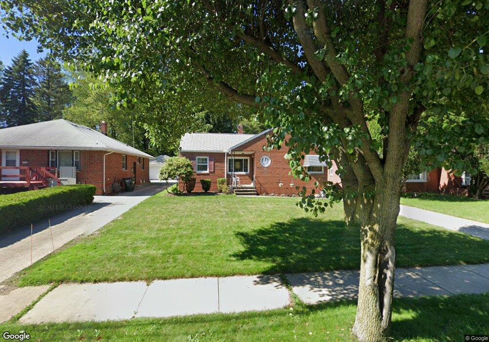
19909 Gladstone Rd Beachwood, OH 44122
Estimated Value: $119,000 - $143,000
3
Beds
1
Bath
1,064
Sq Ft
$125/Sq Ft
Est. Value
About This Home
This home is located at 19909 Gladstone Rd, Beachwood, OH 44122 and is currently estimated at $133,110, approximately $125 per square foot. 19909 Gladstone Rd is a home located in Cuyahoga County with nearby schools including John Dewey Elementary School, Warrensville Heights Middle School, and Warrensville Heights High School.
Ownership History
Date
Name
Owned For
Owner Type
Purchase Details
Closed on
Oct 8, 2009
Sold by
Sherman Rommie A and Sherman Donna Nichols
Bought by
Sherman Patricia A
Current Estimated Value
Home Financials for this Owner
Home Financials are based on the most recent Mortgage that was taken out on this home.
Original Mortgage
$50,500
Outstanding Balance
$33,160
Interest Rate
5.19%
Mortgage Type
Purchase Money Mortgage
Estimated Equity
$99,950
Purchase Details
Closed on
Jan 1, 1975
Bought by
Sherman Allie A
Create a Home Valuation Report for This Property
The Home Valuation Report is an in-depth analysis detailing your home's value as well as a comparison with similar homes in the area
Home Values in the Area
Average Home Value in this Area
Purchase History
| Date | Buyer | Sale Price | Title Company |
|---|---|---|---|
| Sherman Patricia A | $50,000 | Emerald Glen Title Agency | |
| Sherman Allie A | -- | -- |
Source: Public Records
Mortgage History
| Date | Status | Borrower | Loan Amount |
|---|---|---|---|
| Open | Sherman Patricia A | $50,500 |
Source: Public Records
Tax History Compared to Growth
Tax History
| Year | Tax Paid | Tax Assessment Tax Assessment Total Assessment is a certain percentage of the fair market value that is determined by local assessors to be the total taxable value of land and additions on the property. | Land | Improvement |
|---|---|---|---|---|
| 2024 | $2,120 | $42,245 | $9,310 | $32,935 |
| 2023 | $1,415 | $25,620 | $7,140 | $18,480 |
| 2022 | $1,457 | $25,620 | $7,140 | $18,480 |
| 2021 | $1,433 | $25,620 | $7,140 | $18,480 |
| 2020 | $1,284 | $21,880 | $6,090 | $15,790 |
| 2019 | $2,009 | $62,500 | $17,400 | $45,100 |
| 2018 | $1,896 | $21,880 | $6,090 | $15,790 |
| 2017 | $1,805 | $19,190 | $4,310 | $14,880 |
| 2016 | $1,780 | $19,190 | $4,310 | $14,880 |
| 2015 | $1,979 | $19,190 | $4,310 | $14,880 |
| 2014 | $1,979 | $22,300 | $5,010 | $17,290 |
Source: Public Records
Map
Nearby Homes
- 19912 Lanbury Ave
- 19901 Lanbury Ave
- 19708 Sunset Dr
- 20511 Balfour Rd
- 20516 Amherst Rd
- 19302 Shakerwood Rd
- 19615 Harvard Ave
- 19207 Kings Hwy
- 19110 Lanbury Ave
- 20614 Kings Hwy
- 20715 E Ridgewood Ave
- 19207 Harvard Ave
- 3676 Rawnsdale Rd
- 19102 Ridgewood Ave
- 3696 Tolland Rd
- 3665 Sutherland Rd
- 4043 Township Pkwy
- 3651 Rawnsdale Rd
- 3683 Stoer Rd
- 3635 Tolland Rd
- 19905 Gladstone Rd
- 19915 Gladstone Rd
- 19901 Gladstone Rd
- 20001 Gladstone Rd
- 20005 Gladstone Rd
- 19815 Gladstone Rd
- 19809 Gladstone Rd
- 19910 Shakerwood Rd
- 20009 Gladstone Rd
- 19906 Shakerwood Rd
- 19916 Shakerwood Rd
- 19902 Shakerwood Rd
- 20002 Shakerwood Rd
- 19910 Gladstone Rd
- 19906 Gladstone Rd
- 19916 Gladstone Rd
- 19816 Shakerwood Rd
- 20006 Shakerwood Rd
- 20000 Gladstone Rd
- 19805 Gladstone Rd