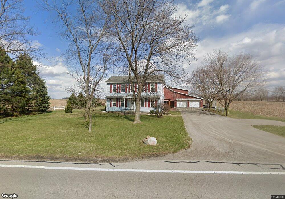
19909 State Route 115 Columbus Grove, OH 45830
Estimated Value: $182,399 - $266,000
--
Bed
2
Baths
1,136
Sq Ft
$185/Sq Ft
Est. Value
About This Home
This home is located at 19909 State Route 115, Columbus Grove, OH 45830 and is currently estimated at $210,100, approximately $184 per square foot. 19909 State Route 115 is a home located in Putnam County with nearby schools including Columbus Grove Elementary School, Columbus Grove Middle School, and Columbus Grove High School.
Ownership History
Date
Name
Owned For
Owner Type
Purchase Details
Closed on
Mar 31, 2011
Sold by
Sturgis Tommy L and Sturgis Becky A
Bought by
Graham Keith Alan and Lesavage Gail Ellen
Current Estimated Value
Home Financials for this Owner
Home Financials are based on the most recent Mortgage that was taken out on this home.
Original Mortgage
$107,100
Outstanding Balance
$74,713
Interest Rate
5.04%
Mortgage Type
Purchase Money Mortgage
Estimated Equity
$135,387
Create a Home Valuation Report for This Property
The Home Valuation Report is an in-depth analysis detailing your home's value as well as a comparison with similar homes in the area
Home Values in the Area
Average Home Value in this Area
Purchase History
| Date | Buyer | Sale Price | Title Company |
|---|---|---|---|
| Graham Keith Alan | $119,000 | None Available |
Source: Public Records
Mortgage History
| Date | Status | Borrower | Loan Amount |
|---|---|---|---|
| Open | Graham Keith Alan | $107,100 |
Source: Public Records
Tax History Compared to Growth
Tax History
| Year | Tax Paid | Tax Assessment Tax Assessment Total Assessment is a certain percentage of the fair market value that is determined by local assessors to be the total taxable value of land and additions on the property. | Land | Improvement |
|---|---|---|---|---|
| 2024 | $1,491 | $49,440 | $4,140 | $45,300 |
| 2023 | $1,587 | $37,240 | $3,230 | $34,010 |
| 2022 | $1,366 | $37,241 | $3,231 | $34,010 |
| 2021 | $1,364 | $36,750 | $3,230 | $33,520 |
| 2020 | $1,365 | $29,110 | $2,690 | $26,420 |
| 2019 | $1,186 | $32,690 | $3,230 | $29,460 |
| 2018 | $1,175 | $32,690 | $3,230 | $29,460 |
| 2017 | $1,025 | $32,690 | $3,230 | $29,460 |
| 2016 | $1,025 | $29,110 | $2,690 | $26,420 |
| 2015 | $1,031 | $29,110 | $2,690 | $26,420 |
| 2014 | $1,016 | $28,440 | $2,690 | $25,750 |
| 2013 | $1,032 | $28,440 | $2,690 | $25,750 |
Source: Public Records
Map
Nearby Homes
- 148 S Water St
- 147 Elm St
- 4150 W Lincoln Hwy
- 2525 W Lincoln Hwy
- 11059 Ottawa Rd
- 15105 Road 15m
- 308 Delphos Rd
- 6585 Ottawa Rd
- 209 Willow Bend Dr
- 300 Sweaney Ave
- 205 S Broadway St
- 204 S Broadway St
- 309 Wall St
- 201 Wall St
- 220 Parklane Dr
- 3798 Kissing Hollow Dr
- 17736 Road 20p
- 5550 Hartman Rd
- 6585 Huffer Rd
- 0 Fraunfelter Unit 307817
- 19909 St Route
- 19829 State Route 115
- 19829 Ohio 115
- 19728 State Route 115
- 20095 State Route 115
- 19635 State Route 115
- 19620 State Route 115
- 19497 State Route 115
- 256 Center St
- 246 Center St
- 237 Center St
- 244 Center St
- 303B E Cross St
- 227 Center St
- 236 Center St
- 303 W Cross St
- 19398 State Route 115
- 226 Center St
- 15461 State Route 189
- 216 Center St