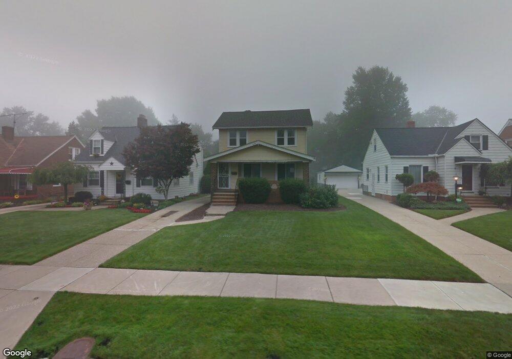
1991 E 224th St Euclid, OH 44117
Estimated Value: $160,655 - $197,000
3
Beds
1
Bath
1,130
Sq Ft
$153/Sq Ft
Est. Value
About This Home
This home is located at 1991 E 224th St, Euclid, OH 44117 and is currently estimated at $173,414, approximately $153 per square foot. 1991 E 224th St is a home located in Cuyahoga County with nearby schools including Thomas Jefferson Elementary School, Euclid Middle School, and Euclid High School.
Ownership History
Date
Name
Owned For
Owner Type
Purchase Details
Closed on
Jun 26, 2012
Sold by
Kossman Linda L and Schonhiutt Linda L
Bought by
Schonhiutt Stuart A
Current Estimated Value
Purchase Details
Closed on
Aug 27, 2002
Sold by
Ciora Roberto C and Ciora Andrea J
Bought by
Schonhiutt Stuart A and Schonhiutt Linda L
Home Financials for this Owner
Home Financials are based on the most recent Mortgage that was taken out on this home.
Original Mortgage
$91,200
Outstanding Balance
$38,986
Interest Rate
6.56%
Estimated Equity
$134,428
Purchase Details
Closed on
Aug 14, 1989
Sold by
Templeton Roderick and Templeton R
Bought by
Ciora Roberto C
Purchase Details
Closed on
Jan 1, 1975
Bought by
Templeton Roderick and Templeton R
Create a Home Valuation Report for This Property
The Home Valuation Report is an in-depth analysis detailing your home's value as well as a comparison with similar homes in the area
Home Values in the Area
Average Home Value in this Area
Purchase History
| Date | Buyer | Sale Price | Title Company |
|---|---|---|---|
| Schonhiutt Stuart A | -- | None Available | |
| Schonhiutt Stuart A | $114,000 | Real Living Title Agency Ltd | |
| Ciora Roberto C | $51,500 | -- | |
| Templeton Roderick | -- | -- |
Source: Public Records
Mortgage History
| Date | Status | Borrower | Loan Amount |
|---|---|---|---|
| Open | Schonhiutt Stuart A | $91,200 |
Source: Public Records
Tax History Compared to Growth
Tax History
| Year | Tax Paid | Tax Assessment Tax Assessment Total Assessment is a certain percentage of the fair market value that is determined by local assessors to be the total taxable value of land and additions on the property. | Land | Improvement |
|---|---|---|---|---|
| 2024 | $3,262 | $47,390 | $10,395 | $36,995 |
| 2023 | $2,975 | $34,440 | $8,120 | $26,320 |
| 2022 | $2,907 | $34,440 | $8,120 | $26,320 |
| 2021 | $3,239 | $34,440 | $8,120 | $26,320 |
| 2020 | $3,070 | $29,680 | $7,000 | $22,680 |
| 2019 | $2,761 | $84,800 | $20,000 | $64,800 |
| 2018 | $2,735 | $29,680 | $7,000 | $22,680 |
| 2017 | $2,909 | $25,870 | $5,600 | $20,270 |
| 2016 | $2,916 | $25,870 | $5,600 | $20,270 |
| 2015 | $2,654 | $25,870 | $5,600 | $20,270 |
| 2014 | $2,654 | $25,870 | $5,600 | $20,270 |
Source: Public Records
Map
Nearby Homes
- 2075 E 226th St
- 22261 Chardon Rd
- 22601 Harms Rd
- 1775 E 228th St
- 1774 E 236th St
- 21950 Euclid Ave
- 1765 E 238th St
- 1696 E 236th St
- 1554 E 221st St
- 1545 E 214th St
- 2111 Aberdeen Dr
- 23751 Glenbrook Blvd
- 1860 Glenridge Rd
- 24105 Chardon Rd
- 24 Washington Square
- 363 Balmoral Dr
- 23795 Greenwood Rd
- 2093 Newcome St
- 1556 Dille Rd
- 24720 Dundee Dr
- 1995 E 224th St
- 1985 E 224th St
- 2005 E 224th St
- 1981 E 224th St
- 1977 E 224th St
- 2007 E 224th St
- 2011 E 224th St
- 1975 E 224th St
- 1984 E 226th St
- 1990 E 226th St
- 1996 E 226th St
- 1980 E 226th St
- 2021 E 224th St
- 1971 E 224th St
- 1976 E 226th St
- 2004 E 226th St
- 1990 E 224th St
- 1994 E 224th St
- 1984 E 224th St
- 2010 E 226th St