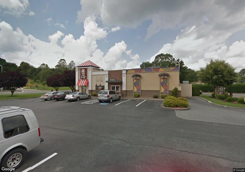
1991 Memorial Dr Pulaski, VA 24301
Estimated Value: $3,003,564
--
Bed
--
Bath
--
Sq Ft
1.42
Acres
About This Home
This home is located at 1991 Memorial Dr, Pulaski, VA 24301 and is currently estimated at $3,003,564. 1991 Memorial Dr is a home located in Pulaski County with nearby schools including Critzer Elementary School, Pulaski County Middle School, and Pulaski County High School.
Ownership History
Date
Name
Owned For
Owner Type
Purchase Details
Closed on
May 1, 2025
Sold by
Wong Trust and Wong Frank M
Bought by
Wong Trust and Wong
Current Estimated Value
Purchase Details
Closed on
Jan 11, 2022
Sold by
Quick Service Realco Llc
Bought by
Wong Trust
Purchase Details
Closed on
Nov 2, 2021
Sold by
Bacon Enterprises Inc
Bought by
Quick Service Realco Llc
Create a Home Valuation Report for This Property
The Home Valuation Report is an in-depth analysis detailing your home's value as well as a comparison with similar homes in the area
Home Values in the Area
Average Home Value in this Area
Purchase History
| Date | Buyer | Sale Price | Title Company |
|---|---|---|---|
| Wong Trust | -- | None Listed On Document | |
| Wong Trust | $2,444,000 | None Listed On Document | |
| Quick Service Realco Llc | $2,000,000 | Attorney |
Source: Public Records
Tax History Compared to Growth
Tax History
| Year | Tax Paid | Tax Assessment Tax Assessment Total Assessment is a certain percentage of the fair market value that is determined by local assessors to be the total taxable value of land and additions on the property. | Land | Improvement |
|---|---|---|---|---|
| 2025 | $6,323 | $854,500 | $247,400 | $607,100 |
| 2024 | $6,323 | $854,500 | $247,400 | $607,100 |
| 2023 | $6,323 | $854,500 | $247,400 | $607,100 |
| 2022 | $6,323 | $854,500 | $247,400 | $607,100 |
| 2021 | $6,323 | $854,500 | $247,400 | $607,100 |
| 2020 | $6,023 | $782,200 | $247,400 | $534,800 |
| 2019 | $6,023 | $782,200 | $247,400 | $534,800 |
| 2018 | $5,056 | $717,100 | $247,400 | $469,700 |
| 2017 | $4,589 | $717,100 | $247,400 | $469,700 |
| 2016 | $4,589 | $717,100 | $247,400 | $469,700 |
| 2015 | $4,589 | $717,100 | $247,400 | $469,700 |
| 2014 | $4,031 | $683,200 | $278,300 | $404,900 |
| 2013 | $4,031 | $683,200 | $278,300 | $404,900 |
Source: Public Records
Map
Nearby Homes
- 1224 Macgill St
- 1116 Macgill St
- 1600 Claremont Ct
- 1960 Peakland Dr
- 1612 Claremont Ct
- 1116 Taylor St
- 1217 Allison Ln
- 1217 Memorial Dr
- 1310 Hopkins Dr
- 1405 Grove Dr
- 820 Newbern Rd
- Lot 4 Kensington Ln
- 616 Newbern Rd
- Lot 1 Peppers Ferry Rd
- 0 Peppers Ferry Rd
- 2074 Twin Oaks Ave
- 0 Beth Scott Dr
- TBD Beth Scott Dr
- 2070 Twin Oaks Ave
- Lot 3 Beck Ln
- 1918 Monte Vista Dr
- 1351 Bob White Blvd
- 1510 Bob White Blvd
- 1936 Memorial Dr
- 1508 Bob White Blvd
- 1919 Monte Vista Dr
- 1912 Monte Vista Dr
- 2015 Monte Vista Dr
- 1920 Memorial Dr
- 1520 Bob White Blvd
- 1908 Monte Vista Dr
- 1601 Bob White Blvd
- 1400 Hix St
- 1404 Hix St
- 1911 Monte Vista Dr
- 1904 Monte Vista Dr
- 1900 Memorial Dr
- 1300 Bob White Blvd
- 1400 Bob White Blvd
- 1907 Monte Vista Dr
