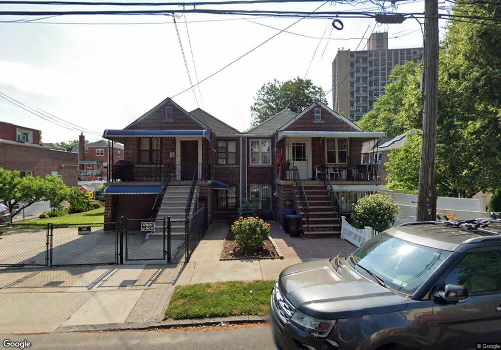
1991 Muliner Ave Bronx, NY 10462
Morris Park NeighborhoodEstimated Value: $690,044 - $920,000
--
Bed
--
Bath
1,852
Sq Ft
$443/Sq Ft
Est. Value
About This Home
This home is located at 1991 Muliner Ave, Bronx, NY 10462 and is currently estimated at $820,011, approximately $442 per square foot. 1991 Muliner Ave is a home located in Bronx County with nearby schools including P.S. 083 The Donald Hertz School, Bronx Excellence 2, and Bronx Charter School For Excellence 2.
Ownership History
Date
Name
Owned For
Owner Type
Purchase Details
Closed on
Jan 17, 2012
Sold by
Liotti Anthony and Liotti Elisa
Bought by
Caccavale Elena and Liotti Anthony J
Current Estimated Value
Purchase Details
Closed on
Jan 29, 2004
Sold by
Liotti Elisa
Bought by
Liotti Anthony and Liotti Elisa
Create a Home Valuation Report for This Property
The Home Valuation Report is an in-depth analysis detailing your home's value as well as a comparison with similar homes in the area
Home Values in the Area
Average Home Value in this Area
Purchase History
| Date | Buyer | Sale Price | Title Company |
|---|---|---|---|
| Caccavale Elena | -- | -- | |
| Caccavale Elena | -- | -- | |
| Liotti Anthony | -- | -- | |
| Liotti Anthony | -- | -- |
Source: Public Records
Tax History Compared to Growth
Tax History
| Year | Tax Paid | Tax Assessment Tax Assessment Total Assessment is a certain percentage of the fair market value that is determined by local assessors to be the total taxable value of land and additions on the property. | Land | Improvement |
|---|---|---|---|---|
| 2025 | $6,142 | $32,413 | $6,943 | $25,470 |
| 2024 | $6,142 | $30,578 | $7,481 | $23,097 |
| 2023 | $5,859 | $28,848 | $6,065 | $22,783 |
| 2022 | $5,433 | $43,080 | $9,600 | $33,480 |
| 2021 | $5,728 | $39,300 | $9,600 | $29,700 |
| 2020 | $5,717 | $38,880 | $9,600 | $29,280 |
| 2019 | $5,331 | $35,340 | $9,600 | $25,740 |
| 2018 | $4,901 | $24,040 | $7,326 | $16,714 |
| 2017 | $4,623 | $22,680 | $9,600 | $13,080 |
| 2016 | $4,541 | $25,821 | $9,284 | $16,537 |
| 2015 | $2,676 | $24,360 | $10,680 | $13,680 |
| 2014 | $2,676 | $23,640 | $10,680 | $12,960 |
Source: Public Records
Map
Nearby Homes
- 1925 Bogart Ave
- 1904 Bronxdale Ave
- 953 Rhinelander Ave
- 928 Rhinelander Ave
- 1916 Barnes Ave
- 1869 Muliner Ave
- 2037 Radcliff Ave
- 1907 Barnes Ave
- 1961 Wallace Ave
- 1945 Paulding Ave
- 762 Brady Ave Unit 221
- 762 Brady Ave Unit 621
- 2090 Barnes Ave Unit 4D
- 2090 Barnes Ave Unit 6A
- 2090 Barnes Ave Unit 2H
- 2080 Barnes Ave Unit 5C
- 2080 Barnes Ave Unit 5B
- 2080 Barnes Ave Unit 4C
- 2080 Barnes Ave Unit 4A
- 2080 Barnes Ave Unit 3H
- 1989 Muliner Ave
- 1947 Muliner Ave
- 1943 Muliner Ave
- 836 Neill Ave
- 840 Neill Ave
- 834 Neill Ave
- 842 Neill Ave
- 1984 Matthews Ave
- 1986 Matthews Ave
- 1982 Matthews Ave
- 1980 Matthews Ave
- 1980 Matthews Ave Unit 1
- 1980 Matthews Ave Unit 2
- 1939 Muliner Ave
- 828 Neill Ave
- 830 Neill Ave
- 1980 Mathews Ave
- 1976 Matthews Ave
- 1958 Muliner Ave
- 1962 Muliner Ave