Estimated Value: $135,000 - $163,899
3
Beds
1
Bath
1,050
Sq Ft
$146/Sq Ft
Est. Value
About This Home
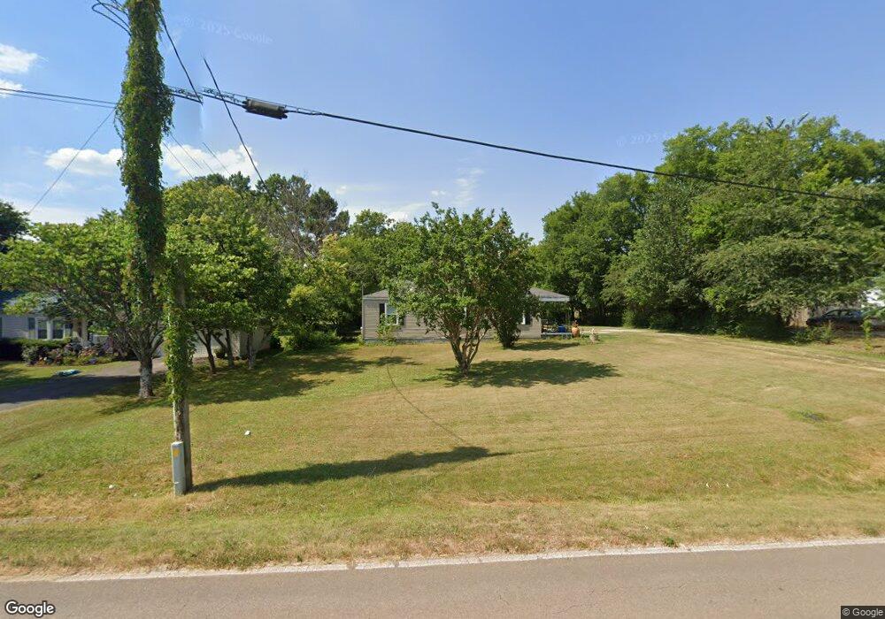
This home is located at 1991 Opp Reynolds Rd, Toney, AL 35773 and is currently estimated at $153,475, approximately $146 per square foot. 1991 Opp Reynolds Rd is a home located in Madison County with nearby schools including Madison Cross Roads Elementary School, Sparkman Middle School, and Sparkman High School.
Ownership History
Date
Name
Owned For
Owner Type
Purchase Details
Closed on
Sep 2, 2008
Sold by
Hsbc Mortgage Services Inc
Bought by
Neal Carol
Current Estimated Value
Home Financials for this Owner
Home Financials are based on the most recent Mortgage that was taken out on this home.
Original Mortgage
$37,600
Interest Rate
6.49%
Mortgage Type
New Conventional
Purchase Details
Closed on
Aug 19, 2005
Sold by
Crutch Misty D and Crutch Thomas
Bought by
Hsbc Mortgage Service Inc
Home Financials for this Owner
Home Financials are based on the most recent Mortgage that was taken out on this home.
Original Mortgage
$67,000
Interest Rate
9.9%
Mortgage Type
Adjustable Rate Mortgage/ARM
Create a Home Valuation Report for This Property
The Home Valuation Report is an in-depth analysis detailing your home's value as well as a comparison with similar homes in the area
Home Values in the Area
Average Home Value in this Area
Purchase History
| Date | Buyer | Sale Price | Title Company |
|---|---|---|---|
| Neal Carol | $49,000 | -- | |
| Hsbc Mortgage Service Inc | $54,877 | -- | |
| Crutch Misty D | -- | -- |
Source: Public Records
Mortgage History
| Date | Status | Borrower | Loan Amount |
|---|---|---|---|
| Closed | Neal Carol | $37,600 | |
| Previous Owner | Crutch Misty D | $67,000 |
Source: Public Records
Tax History Compared to Growth
Tax History
| Year | Tax Paid | Tax Assessment Tax Assessment Total Assessment is a certain percentage of the fair market value that is determined by local assessors to be the total taxable value of land and additions on the property. | Land | Improvement |
|---|---|---|---|---|
| 2024 | $497 | $13,980 | $4,400 | $9,580 |
| 2023 | $497 | $13,980 | $4,400 | $9,580 |
| 2022 | $385 | $10,740 | $2,280 | $8,460 |
| 2021 | $356 | $9,940 | $2,280 | $7,660 |
| 2020 | $337 | $9,420 | $2,280 | $7,140 |
| 2019 | $328 | $9,160 | $2,280 | $6,880 |
| 2018 | $311 | $8,680 | $0 | $0 |
| 2017 | $311 | $8,680 | $0 | $0 |
| 2016 | $311 | $8,680 | $0 | $0 |
| 2015 | $311 | $8,680 | $0 | $0 |
| 2014 | $308 | $8,600 | $0 | $0 |
Source: Public Records
Map
Nearby Homes
- 224 Purple Martin Dr
- AUBURN Plan at Kendall Glades
- DUPONT Plan at Kendall Glades
- BEAUMONT Plan at Kendall Glades
- GARDNER Plan at Kendall Glades
- CABOT Plan at Kendall Glades
- 220 Jamie Ln
- 152 Jamie Ln
- 103 Coral Bells Rd
- 104 Coral Bells Rd
- 102 Compass Hill Cir
- 238 Faded Rose Ln
- 522 Carter Grove Rd
- 100 Coral Bells Rd
- RC Magnolia Plan at Kendall Trails
- RC Raleigh Plan at Kendall Trails
- RC Baltimore Plan at Kendall Trails
- RC Fenway Plan at Kendall Trails
- RC Ashton Plan at Kendall Trails
- RC Ross Plan at Kendall Trails
- 1981 Opp Reynolds Rd
- 1999 Opp Reynolds Rd
- 1961 Opp Reynolds Rd
- o Opp Reynolds Rd
- 106 Caroline Rd
- 116 Caroline Rd
- 138 Caroline Rd
- 11441 Pulaski Pike
- 11433 Pulaski Pike
- 109 Caroline Rd
- 11421 Pulaski Pike
- 109 Comet Dr
- 11384 Pulaski Pike
- 131 Caroline Rd
- 11473 Pulaski Pike
- 11459 Pulaski Pike
- 120 Comet Dr
- 121 Comet Dr
- 176 Caroline Rd
- 155 Caroline Rd