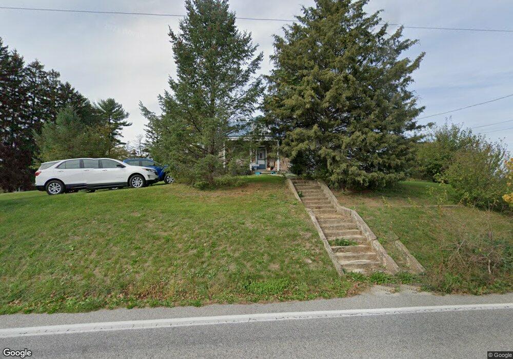
1991 Walnut Bottom Rd Carlisle, PA 17015
Estimated Value: $237,000 - $313,000
2
Beds
1
Bath
1,332
Sq Ft
$208/Sq Ft
Est. Value
About This Home
This home is located at 1991 Walnut Bottom Rd, Carlisle, PA 17015 and is currently estimated at $277,326, approximately $208 per square foot. 1991 Walnut Bottom Rd is a home located in Cumberland County with nearby schools including North Dickinson Elementary School, Lamberton Middle School, and Carlisle Area High School.
Ownership History
Date
Name
Owned For
Owner Type
Purchase Details
Closed on
May 14, 2012
Sold by
Bowermaster Robert L
Bought by
Shotts Brian K
Current Estimated Value
Home Financials for this Owner
Home Financials are based on the most recent Mortgage that was taken out on this home.
Original Mortgage
$130,000
Outstanding Balance
$90,492
Interest Rate
4%
Mortgage Type
New Conventional
Estimated Equity
$186,834
Create a Home Valuation Report for This Property
The Home Valuation Report is an in-depth analysis detailing your home's value as well as a comparison with similar homes in the area
Home Values in the Area
Average Home Value in this Area
Purchase History
| Date | Buyer | Sale Price | Title Company |
|---|---|---|---|
| Shotts Brian K | $133,000 | -- |
Source: Public Records
Mortgage History
| Date | Status | Borrower | Loan Amount |
|---|---|---|---|
| Open | Shotts Brian K | $130,000 |
Source: Public Records
Tax History Compared to Growth
Tax History
| Year | Tax Paid | Tax Assessment Tax Assessment Total Assessment is a certain percentage of the fair market value that is determined by local assessors to be the total taxable value of land and additions on the property. | Land | Improvement |
|---|---|---|---|---|
| 2025 | $3,766 | $181,600 | $95,200 | $86,400 |
| 2024 | $3,643 | $181,600 | $95,200 | $86,400 |
| 2023 | $3,511 | $181,600 | $95,200 | $86,400 |
| 2022 | $3,318 | $181,600 | $95,200 | $86,400 |
| 2021 | $3,262 | $181,600 | $95,200 | $86,400 |
| 2020 | $3,181 | $181,600 | $95,200 | $86,400 |
| 2019 | $2,964 | $173,500 | $95,200 | $78,300 |
| 2018 | $2,710 | $162,800 | $95,200 | $67,600 |
| 2017 | $2,646 | $162,800 | $95,200 | $67,600 |
| 2016 | -- | $162,800 | $95,200 | $67,600 |
| 2015 | -- | $162,800 | $95,200 | $67,600 |
| 2014 | -- | $162,800 | $95,200 | $67,600 |
Source: Public Records
Map
Nearby Homes
- 68 N Dickinson School Rd
- 0 W Linden Dr
- 100 Richland Rd
- 7 Beverly Ct
- 19 Sandy Bottom Rd
- 2452 Ritner Hwy
- 9 Montsera Rd
- 99 Garfield Dr
- 00 Church Ln
- Church Ln
- 399 Barnstable Rd
- 986 Pine Rd
- 6 Morgan Dr Unit 12-03
- 310 Touchstone Dr
- 1011 Stonehill Ln
- 984 Pine Rd
- 55 Chelsea Ln
- 1001 Stonehill Ln
- 1016 Stonehill Ln
- 1006 Stonehill Ln
- 1990 Walnut Bottom Rd
- 1986 Walnut Bottom Rd
- 353 Richland Rd
- 349 Richland Rd
- 1972 Walnut Bottom Rd
- 2007 Walnut Bottom Rd
- 347 Richland Rd
- 1966 Walnut Bottom Rd
- 1962 Walnut Bottom Rd
- 1956 Walnut Bottom Rd
- 338 Richland Rd
- 1942 Walnut Bottom Rd
- 2037 Walnut Bottom Rd
- 2043 Walnut Bottom Rd
- 2030 Walnut Bottom Rd
- 2051 Walnut Bottom Rd
- 1930 Walnut Bottom Rd
- 2047 Walnut Bottom Rd
- 1954 Walnut Bottom Rd Unit A
- 1954 Walnut Bottom Rd Unit B