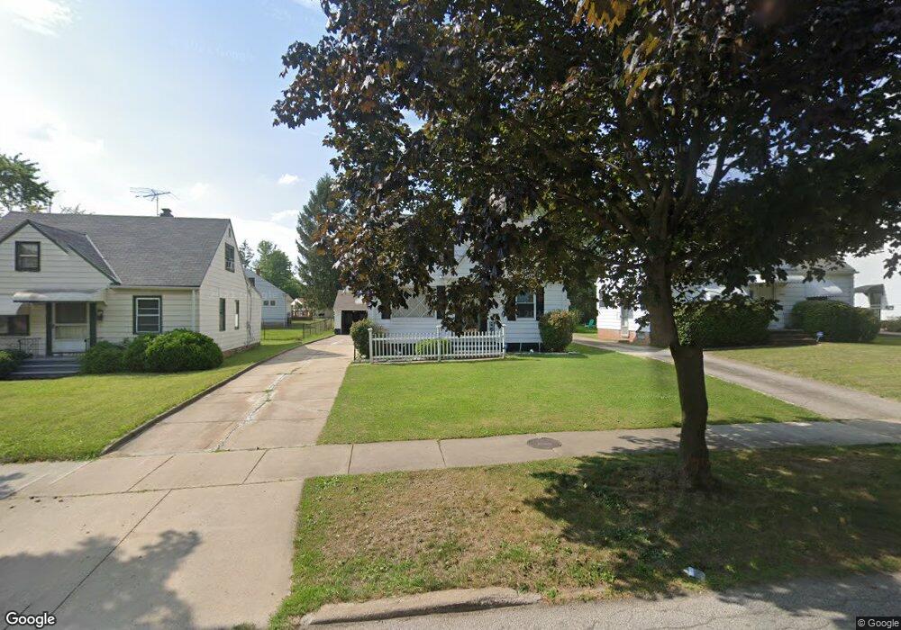
19911 Maple Heights Blvd Maple Heights, OH 44137
Estimated Value: $119,000 - $136,406
3
Beds
1
Bath
1,092
Sq Ft
$117/Sq Ft
Est. Value
About This Home
This home is located at 19911 Maple Heights Blvd, Maple Heights, OH 44137 and is currently estimated at $127,352, approximately $116 per square foot. 19911 Maple Heights Blvd is a home located in Cuyahoga County with nearby schools including Abraham Lincoln Elementary School, Rockside/ J.F. Kennedy School, and Barack Obama School.
Ownership History
Date
Name
Owned For
Owner Type
Purchase Details
Closed on
Aug 1, 2006
Sold by
Cammon Joe
Bought by
Cammon Joe and Cammon Shirley
Current Estimated Value
Purchase Details
Closed on
Sep 29, 2004
Sold by
Simon Jeanette A
Bought by
Cammon Joe
Home Financials for this Owner
Home Financials are based on the most recent Mortgage that was taken out on this home.
Original Mortgage
$80,900
Outstanding Balance
$43,634
Interest Rate
7.12%
Mortgage Type
Stand Alone First
Estimated Equity
$83,718
Purchase Details
Closed on
Sep 9, 1992
Sold by
Simon Jeanette A
Bought by
Simon Jeanette
Purchase Details
Closed on
Dec 12, 1978
Sold by
Simon Joseph A and Simon Jeanette A
Bought by
Simon Jeanette A
Purchase Details
Closed on
Jan 1, 1975
Bought by
Simon Joseph A and Simon Jeanette A
Create a Home Valuation Report for This Property
The Home Valuation Report is an in-depth analysis detailing your home's value as well as a comparison with similar homes in the area
Home Values in the Area
Average Home Value in this Area
Purchase History
| Date | Buyer | Sale Price | Title Company |
|---|---|---|---|
| Cammon Joe | -- | None Available | |
| Cammon Joe | $89,000 | Suntrust Title Agency | |
| Simon Jeanette | -- | -- | |
| Simon Jeanette A | -- | -- | |
| Simon Joseph A | -- | -- |
Source: Public Records
Mortgage History
| Date | Status | Borrower | Loan Amount |
|---|---|---|---|
| Open | Cammon Joe | $80,900 |
Source: Public Records
Tax History
| Year | Tax Paid | Tax Assessment Tax Assessment Total Assessment is a certain percentage of the fair market value that is determined by local assessors to be the total taxable value of land and additions on the property. | Land | Improvement |
|---|---|---|---|---|
| 2024 | $2,396 | $36,120 | $8,505 | $27,615 |
| 2023 | $1,276 | $20,125 | $5,145 | $14,980 |
| 2022 | $1,309 | $20,125 | $5,145 | $14,980 |
| 2021 | $1,389 | $20,130 | $5,150 | $14,980 |
| 2020 | $974 | $15,230 | $3,890 | $11,340 |
| 2019 | $961 | $43,500 | $11,100 | $32,400 |
| 2018 | $953 | $15,230 | $3,890 | $11,340 |
| 2017 | $827 | $13,930 | $3,640 | $10,290 |
| 2016 | $794 | $13,930 | $3,640 | $10,290 |
| 2015 | $861 | $13,930 | $3,640 | $10,290 |
| 2014 | $861 | $15,300 | $3,990 | $11,310 |
Source: Public Records
Map
Nearby Homes
- 19931 Raymond St
- 20600 Watson Rd
- 20517 Raymond St
- 5147 Warrensville Center Rd
- 5165 Camden Rd
- 20705 Hansen Rd
- 20715 Watson Rd
- 19520 Maple Heights Blvd
- 18990 Raymond St
- 18851 Raymond St
- 5194 Homewood Ave
- 20806 Clare Ave
- 20905 Clare Ave
- 18704 Longview Ave
- 19289 Stafford Ave
- 21207 Franklin Rd
- 21202 Hillgrove Ave
- 18715 Libby Rd
- 21202 Gardenview Dr
- 5100 Erwin St
- 19907 Maple Heights Blvd
- 19919 Maple Heights Blvd
- 19631 Longview Ave
- 19904 Fairway Ave
- 19923 Maple Heights Blvd
- 19625 Longview Ave
- 19900 Fairway Ave
- 19823 Maple Heights Blvd
- 19810 Fairway Ave
- 19621 Longview Ave
- 19819 Maple Heights Blvd
- 19804 Fairway Ave
- 19925 Raymond St
- 19620 Longview Ave
- 19617 Longview Ave
- 19913 Fairway Ave
- 19800 Fairway Ave
- 19941 Raymond St
- 19616 Longview Ave
- 19815 Maple Heights Blvd
Your Personal Tour Guide
Ask me questions while you tour the home.