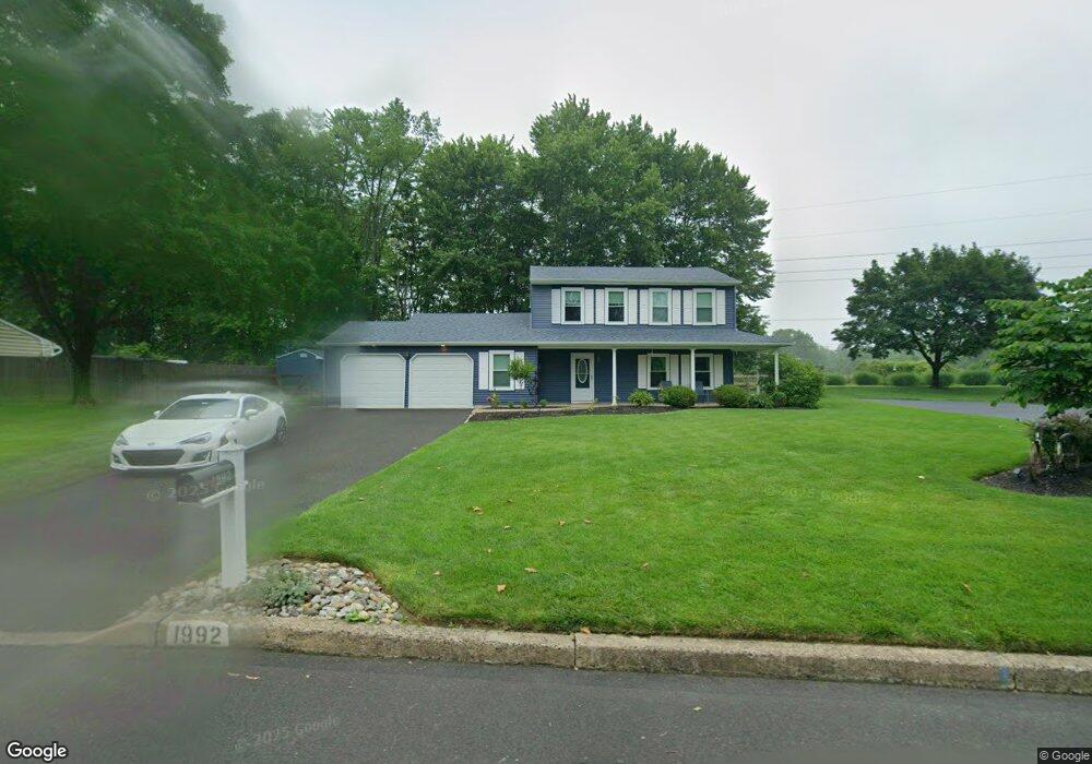
1992 Brook Ln Jamison, PA 18929
Estimated Value: $515,000 - $604,000
3
Beds
3
Baths
1,766
Sq Ft
$321/Sq Ft
Est. Value
About This Home
This home is located at 1992 Brook Ln, Jamison, PA 18929 and is currently estimated at $567,297, approximately $321 per square foot. 1992 Brook Ln is a home located in Bucks County with nearby schools including Jamison Elementary School, Tamanend Middle School, and Central Bucks High School - South.
Ownership History
Date
Name
Owned For
Owner Type
Purchase Details
Closed on
Aug 28, 2003
Sold by
Tomkiel Walter W and Tomkiel Nancy M
Bought by
Arnold Michael and Arnold Michele
Current Estimated Value
Home Financials for this Owner
Home Financials are based on the most recent Mortgage that was taken out on this home.
Original Mortgage
$215,920
Interest Rate
6.43%
Mortgage Type
Purchase Money Mortgage
Purchase Details
Closed on
May 24, 1996
Sold by
Hilferty James V and Hilferty Alicia
Bought by
Tomkiel Ii Walter W and Tomkiel Nancy M
Home Financials for this Owner
Home Financials are based on the most recent Mortgage that was taken out on this home.
Original Mortgage
$148,500
Interest Rate
7.91%
Create a Home Valuation Report for This Property
The Home Valuation Report is an in-depth analysis detailing your home's value as well as a comparison with similar homes in the area
Home Values in the Area
Average Home Value in this Area
Purchase History
| Date | Buyer | Sale Price | Title Company |
|---|---|---|---|
| Arnold Michael | $269,900 | -- | |
| Tomkiel Ii Walter W | $165,000 | -- | |
| Tomkiel Ii Walter W | $165,000 | -- |
Source: Public Records
Mortgage History
| Date | Status | Borrower | Loan Amount |
|---|---|---|---|
| Previous Owner | Arnold Michael | $215,920 | |
| Previous Owner | Tomkiel Ii Walter W | $148,500 | |
| Closed | Arnold Michael | $13,495 |
Source: Public Records
Tax History Compared to Growth
Tax History
| Year | Tax Paid | Tax Assessment Tax Assessment Total Assessment is a certain percentage of the fair market value that is determined by local assessors to be the total taxable value of land and additions on the property. | Land | Improvement |
|---|---|---|---|---|
| 2025 | $5,507 | $31,640 | $8,040 | $23,600 |
| 2024 | $5,507 | $31,640 | $8,040 | $23,600 |
| 2023 | $5,333 | $31,640 | $8,040 | $23,600 |
| 2022 | $5,273 | $31,640 | $8,040 | $23,600 |
| 2021 | $5,214 | $31,640 | $8,040 | $23,600 |
| 2020 | $5,214 | $31,640 | $8,040 | $23,600 |
| 2019 | $5,183 | $31,640 | $8,040 | $23,600 |
| 2018 | $5,183 | $31,640 | $8,040 | $23,600 |
| 2017 | $5,143 | $31,640 | $8,040 | $23,600 |
| 2016 | $5,143 | $31,640 | $8,040 | $23,600 |
| 2015 | -- | $31,640 | $8,040 | $23,600 |
| 2014 | -- | $31,640 | $8,040 | $23,600 |
Source: Public Records
Map
Nearby Homes
- 1877 Brook Ln
- 2018 Buckingham Dr
- 2127 York Rd
- 1554 Park Dr
- 1620 Rockcress Dr
- 1504 Springfield Ct Unit 37
- 1618 Mayfield Cir
- Northbrook Plan at Jamison Place
- Westmont Plan at Jamison Place
- Faraday Plan at Jamison Place
- 1990 York Rd
- Homesite 102 Marquis Ln
- Homesite 10103 Marquis Ln
- Homesite 10102 Marquis Ln
- 2158 Green Ridge Dr
- 5005 Quartermaster Ln
- 5011 Quartermaster Ln
- Homesite 11903 Quartermaster Ln
- 3020 Marquis Ln
- 3014 Marquis Ln
- 2002 Brook Ln
- 1982 Brook Ln
- 2012 Brook Ln
- 1997 Brook Ln
- 1981 Brook Ln
- 1972 Brook Ln
- 2011 Brook Ln
- 1971 Brook Ln
- 2070 Sunrise Way
- 1962 Brook Ln
- 2052 Pheasant Run
- 2021 Brook Ln
- 2050 Pheasant Run
- 1960 Heather Cir
- 2054 Pheasant Run
- 1957 Brook Ln
- 1952 Brook Ln
- 1962 Heather Cir
- 2075 Greentree Cir
- 2063 Greentree Cir