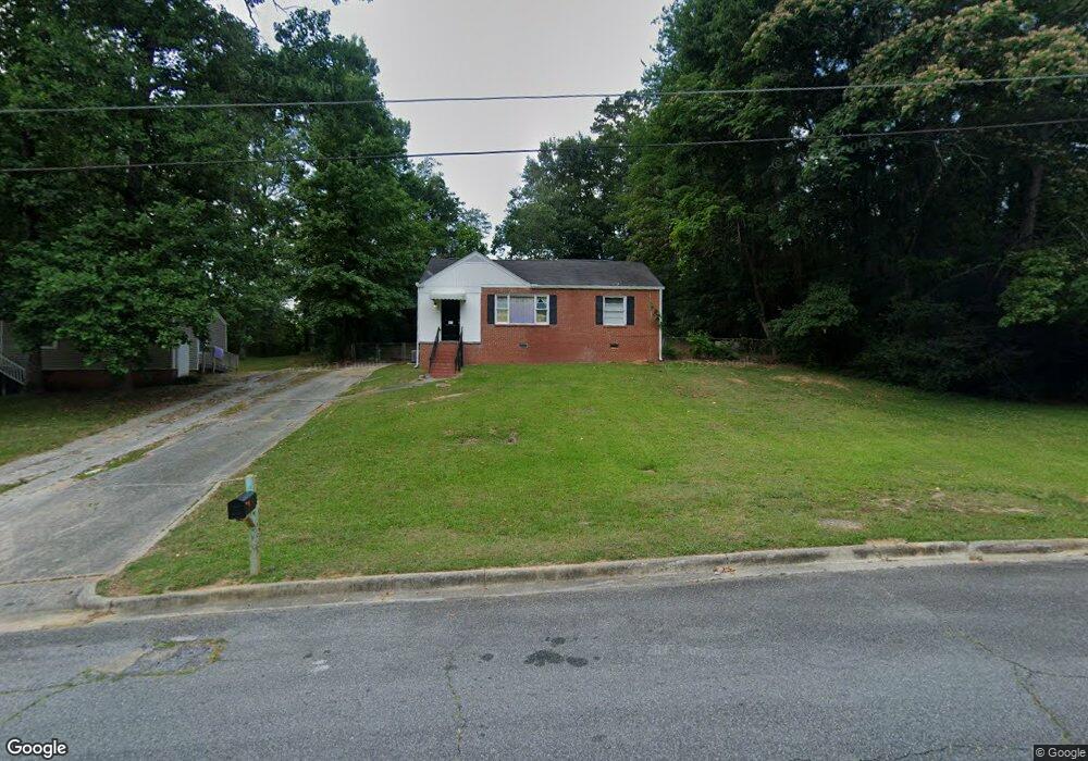
1992 Knightsbridge Rd Macon, GA 31211
Estimated Value: $73,020 - $123,000
3
Beds
1
Bath
965
Sq Ft
$92/Sq Ft
Est. Value
About This Home
This home is located at 1992 Knightsbridge Rd, Macon, GA 31211 and is currently estimated at $88,505, approximately $91 per square foot. 1992 Knightsbridge Rd is a home located in Bibb County with nearby schools including Martin Luther King Jr. Elementary School, Appling Middle School, and Northeast High School.
Ownership History
Date
Name
Owned For
Owner Type
Purchase Details
Closed on
Dec 19, 2018
Sold by
Harley Jack and Harley Glenna
Bought by
Colt Properties Llc
Current Estimated Value
Purchase Details
Closed on
Oct 25, 2011
Sold by
Federal Home Loan Mortgage Corporation
Bought by
Harley Jack and Harley Glenna
Purchase Details
Closed on
Jul 5, 2011
Sold by
Ocwen Loan Servicing Llc
Bought by
Federal Home Loan Mortgage Corporation
Purchase Details
Closed on
Apr 25, 2002
Bought by
Whitworth Properties Llc
Create a Home Valuation Report for This Property
The Home Valuation Report is an in-depth analysis detailing your home's value as well as a comparison with similar homes in the area
Purchase History
| Date | Buyer | Sale Price | Title Company |
|---|---|---|---|
| Colt Properties Llc | $12,000 | None Available | |
| Harley Jack | $17,000 | None Available | |
| Federal Home Loan Mortgage Corporation | $16,000 | None Available | |
| Ocwen Loan Servicing Llc | $16,000 | None Available | |
| Whitworth Properties Llc | $24,000 | -- |
Source: Public Records
Tax History
| Year | Tax Paid | Tax Assessment Tax Assessment Total Assessment is a certain percentage of the fair market value that is determined by local assessors to be the total taxable value of land and additions on the property. | Land | Improvement |
|---|---|---|---|---|
| 2025 | $734 | $29,875 | $4,640 | $25,235 |
| 2024 | $661 | $26,039 | $2,900 | $23,139 |
| 2023 | $579 | $22,782 | $1,740 | $21,042 |
| 2022 | $560 | $16,173 | $2,864 | $13,309 |
| 2021 | $460 | $12,110 | $1,826 | $10,284 |
| 2020 | $370 | $9,539 | $1,826 | $7,713 |
| 2019 | $373 | $9,539 | $1,826 | $7,713 |
| 2018 | $745 | $9,420 | $1,826 | $7,594 |
| 2017 | $353 | $9,420 | $1,826 | $7,594 |
| 2016 | $326 | $9,420 | $1,826 | $7,594 |
| 2015 | $461 | $9,420 | $1,826 | $7,594 |
| 2014 | $184 | $9,804 | $2,656 | $7,148 |
Source: Public Records
Map
Nearby Homes
- 2458 Tredway Dr
- 2418 Tredway Dr
- 2630 Pauladale Dr
- 2721 Kensington Place
- 2639 Tredway Dr
- 2504 Bedford Place
- 2675 Pauladale Dr
- 2557 Hyde Park Rd
- 2361 Ollie Dr
- 1977 Thomas Dr
- 2285 New Clinton Rd
- 2161 Melton Ave
- 2229 New Clinton Rd
- 2066 Melton Ave
- 1235 Boone St
- 837 Artic Cir
- 1775 Denton St
- 240 Neptune Ct
- 1957 Kitchens Rd
- 1912 Kitchens Rd
- 1986 Knightsbridge Rd
- 2439 Tredway Dr
- 2004 Knightsbridge Rd
- 2447 Tredway Dr
- 2431 Tredway Dr
- 1978 Knightsbridge Rd
- 2455 Tredway Dr
- 1989 Knightsbridge Rd
- 2423 Tredway Dr
- 1997 Knightsbridge Rd
- 2463 Tredway Dr
- 2010 Knightsbridge Rd
- 1981 Knightsbridge Rd
- 2003 Knightsbridge Rd
- 1970 Knightsbridge Rd Unit 213
- 1970 Knightsbridge Rd
- 2415 Tredway Dr
- 2471 Tredway Dr
- 2009 Knightsbridge Rd
- 2016 Knightsbridge Rd
Your Personal Tour Guide
Ask me questions while you tour the home.