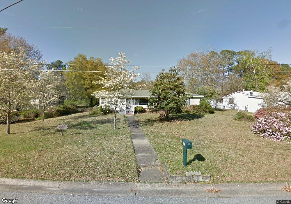
1992 Sullivan Dr Dothan, AL 36303
Estimated Value: $163,000 - $192,293
3
Beds
2
Baths
1,986
Sq Ft
$91/Sq Ft
Est. Value
About This Home
This home is located at 1992 Sullivan Dr, Dothan, AL 36303 and is currently estimated at $181,073, approximately $91 per square foot. 1992 Sullivan Dr is a home located in Houston County with nearby schools including Dothan City Early Education Center, Dothan 6th Grade Center, and Girard Elementary School.
Ownership History
Date
Name
Owned For
Owner Type
Purchase Details
Closed on
Jun 29, 2018
Sold by
Lancaster Allen Robert H and Lancaster Allen Deborah
Bought by
Gonzales Gehu and Fernansez Aurelia
Current Estimated Value
Purchase Details
Closed on
Mar 14, 2016
Sold by
Allen Deborah Lancaster
Bought by
Allen Robert H and Allen Deborah Lancaster
Purchase Details
Closed on
Feb 26, 2014
Sold by
Warnette V Warnette V
Bought by
Allen Deborah Lancaster
Purchase Details
Closed on
Sep 25, 2009
Sold by
Lancaster Robert J and Warnette Lancaster V
Bought by
Lancaster V Warnette
Create a Home Valuation Report for This Property
The Home Valuation Report is an in-depth analysis detailing your home's value as well as a comparison with similar homes in the area
Home Values in the Area
Average Home Value in this Area
Purchase History
| Date | Buyer | Sale Price | Title Company |
|---|---|---|---|
| Gonzales Gehu | $86,000 | None Available | |
| Allen Robert H | -- | None Available | |
| Allen Deborah Lancaster | $97,300 | -- | |
| Lancaster V Warnette | -- | -- |
Source: Public Records
Tax History Compared to Growth
Tax History
| Year | Tax Paid | Tax Assessment Tax Assessment Total Assessment is a certain percentage of the fair market value that is determined by local assessors to be the total taxable value of land and additions on the property. | Land | Improvement |
|---|---|---|---|---|
| 2024 | $440 | $12,760 | $0 | $0 |
| 2023 | $400 | $11,600 | $0 | $0 |
| 2022 | $369 | $10,700 | $0 | $0 |
| 2021 | $369 | $10,700 | $0 | $0 |
| 2020 | $331 | $9,600 | $0 | $0 |
| 2019 | $324 | $9,380 | $0 | $0 |
| 2018 | $633 | $18,360 | $0 | $0 |
| 2017 | $656 | $19,020 | $0 | $0 |
| 2016 | $656 | $0 | $0 | $0 |
| 2015 | $658 | $0 | $0 | $0 |
| 2014 | $151 | $0 | $0 | $0 |
Source: Public Records
Map
Nearby Homes
- 1922 Sullivan Dr
- 1906 Sullivan Dr
- 706 Wildwood Ave
- 2003 Baker Trace
- 1404 Hiawatha Dr
- 1700 Randall Rd
- 2110 Baker Trace
- 408 Rebecca Ave
- 1106 N Pontiac Ave
- 1804 Azure Dr
- 2102 Centenial Dr
- 907 N Cherokee Ave
- 207 Seeba Dr
- 1935 Denton Rd
- 1104 Cornell Ave
- 1515 Plaza Dr
- 409 Sequoyah Dr
- 1702 Impala Dr
- 1709 & 1711 Verde Trail
- 1638 Denton Rd
- 1924 Sullivan Dr
- 1920 Sullivan Dr
- 1994 Sullivan Dr
- 1925 Charlton Dr
- 1918 Sullivan Dr
- 1923 Charlton Dr
- 1926 Sullivan Dr
- 1927 Sullivan Dr
- 1925 Sullivan Dr
- 1995 Sullivan Dr
- 1923 Sullivan Dr
- 1929 Sullivan Dr
- 1927 Charlton Dr
- 1921 Sullivan Dr
- 1916 Sullivan Dr
- 1921 Charlton Dr
- 1928 Sullivan Dr
- 1919 Sullivan Dr
- 1929 Charlton Dr
- 1914 Sullivan Dr