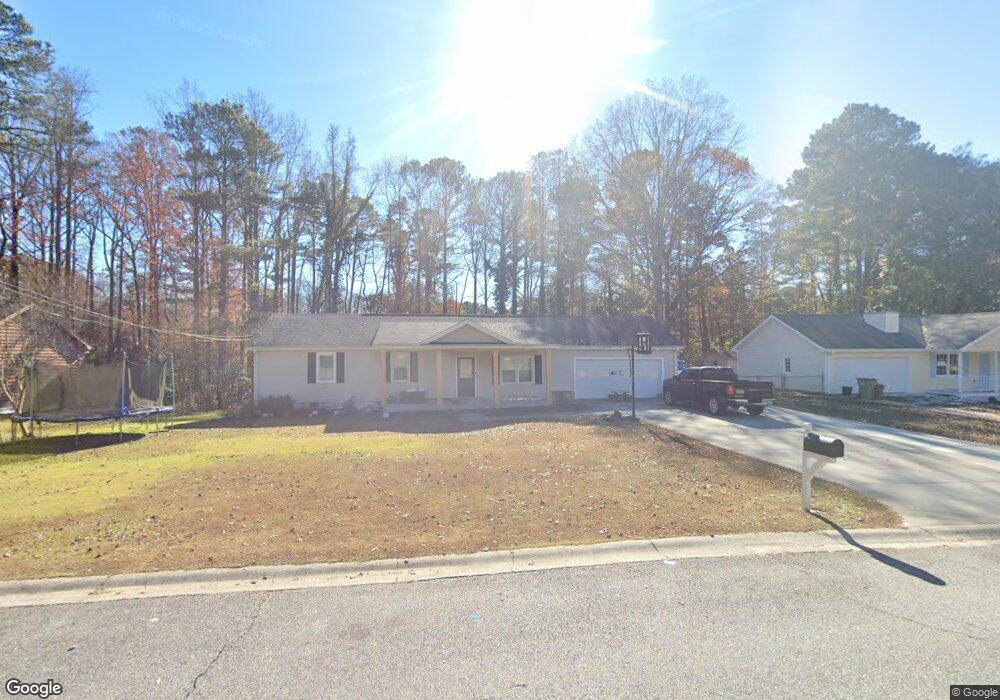
1993 Anchor Way Buford, GA 30518
Estimated Value: $345,083 - $391,000
3
Beds
2
Baths
1,450
Sq Ft
$253/Sq Ft
Est. Value
About This Home
This home is located at 1993 Anchor Way, Buford, GA 30518 and is currently estimated at $367,271, approximately $253 per square foot. 1993 Anchor Way is a home located in Gwinnett County with nearby schools including Buford Elementary School, Buford Academy, and Buford Senior Academy.
Ownership History
Date
Name
Owned For
Owner Type
Purchase Details
Closed on
May 21, 2020
Sold by
Cabrera Francisco
Bought by
Cabrera Medrano Francisco and Cabrera Martha E
Current Estimated Value
Home Financials for this Owner
Home Financials are based on the most recent Mortgage that was taken out on this home.
Original Mortgage
$161,000
Outstanding Balance
$142,668
Interest Rate
3.3%
Mortgage Type
New Conventional
Estimated Equity
$224,603
Purchase Details
Closed on
Dec 4, 2009
Sold by
Salesforce Inc
Bought by
Cabrera Francisco
Home Financials for this Owner
Home Financials are based on the most recent Mortgage that was taken out on this home.
Original Mortgage
$134,518
Interest Rate
5.01%
Mortgage Type
FHA
Purchase Details
Closed on
Jun 2, 2009
Sold by
Bartlett Susan M
Bought by
Sales Force Inc
Create a Home Valuation Report for This Property
The Home Valuation Report is an in-depth analysis detailing your home's value as well as a comparison with similar homes in the area
Home Values in the Area
Average Home Value in this Area
Purchase History
| Date | Buyer | Sale Price | Title Company |
|---|---|---|---|
| Cabrera Medrano Francisco | -- | -- | |
| Cabrera Francisco | $137,000 | -- | |
| Sales Force Inc | $15,472 | -- |
Source: Public Records
Mortgage History
| Date | Status | Borrower | Loan Amount |
|---|---|---|---|
| Open | Cabrera Medrano Francisco | $161,000 | |
| Previous Owner | Cabrera Francisco | $134,518 |
Source: Public Records
Tax History Compared to Growth
Tax History
| Year | Tax Paid | Tax Assessment Tax Assessment Total Assessment is a certain percentage of the fair market value that is determined by local assessors to be the total taxable value of land and additions on the property. | Land | Improvement |
|---|---|---|---|---|
| 2025 | $1,624 | $113,160 | $32,000 | $81,160 |
| 2024 | $1,644 | $114,560 | $25,200 | $89,360 |
| 2023 | $1,644 | $108,480 | $22,000 | $86,480 |
| 2022 | $1,370 | $95,480 | $17,600 | $77,880 |
| 2021 | $1,208 | $84,200 | $17,600 | $66,600 |
| 2020 | $1,095 | $76,280 | $15,200 | $61,080 |
| 2019 | $752 | $58,000 | $12,000 | $46,000 |
| 2018 | $752 | $58,000 | $12,000 | $46,000 |
| 2016 | $624 | $48,680 | $12,000 | $36,680 |
| 2015 | $458 | $34,520 | $6,600 | $27,920 |
| 2014 | $466 | $34,520 | $6,600 | $27,920 |
Source: Public Records
Map
Nearby Homes
- 1983 Anchor Way Unit 1
- 5774 Harbor Dr
- 1920 Patrick Mill Place
- 5820 Elm Tree Dr Unit 1
- 5600 Creek Dale Way
- 5601 Creek Dale Way
- 2243 Bedstone Dr Unit 2
- 5871 Dolvin Ln
- 2030 Buford Dam Rd
- 6265 Lake Windsor Pkwy
- 1770 Patrick Mill Place
- 5552 Little Mill Rd
- 2015 Buford Dam Rd
- 1930 Marina Way
- 5984 Dolvin Ln
- 2075 Pine Tree Dr Unit B2
- 2075 Pine Tree Dr Unit A3
- 6205 Ambercrest Ct
- 5995 Lake Windsor Pkwy Unit 1
- 5735 Lake Windsor Pkwy
- 2003 Anchor Way
- 1973 Anchor Way
- 2008 Shipwreck Ct
- 1998 Shipwreck Ct
- 1994 Anchor Way
- 2018 Shipwreck Ct
- 1988 Shipwreck Ct Unit 2
- 2004 Anchor Way
- 1984 Anchor Way
- 2023 Anchor Way
- 1963 Anchor Way
- 1974 Anchor Way
- 1978 Shipwreck Ct
- 2028 Shipwreck Ct
- 1968 Shipwreck Ct Unit 2
- 1953 Anchor Way
- 1964 Anchor Way
- 2024 Anchor Way
- 5742 Port Dr Unit 1
- 2038 Shipwreck Ct