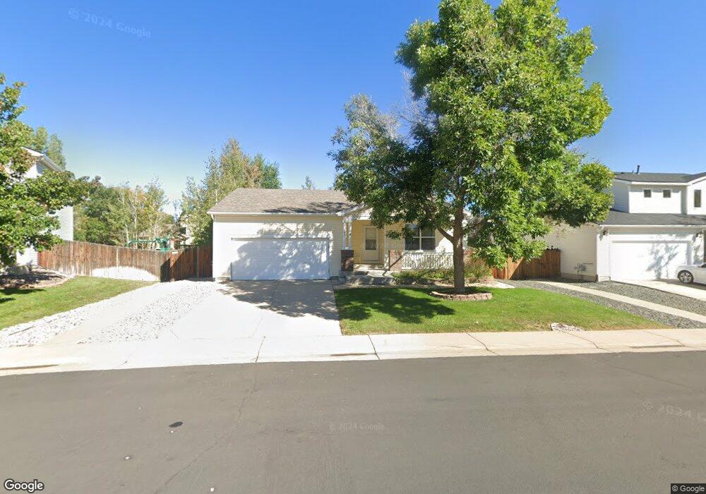
1993 E 126th Ct Thornton, CO 80241
Eastlake Village NeighborhoodEstimated Value: $471,000 - $482,000
3
Beds
2
Baths
1,190
Sq Ft
$399/Sq Ft
Est. Value
About This Home
This home is located at 1993 E 126th Ct, Thornton, CO 80241 and is currently estimated at $475,220, approximately $399 per square foot. 1993 E 126th Ct is a home located in Adams County with nearby schools including Stellar Elementary School, Century Middle School, and Mountain Range High School.
Ownership History
Date
Name
Owned For
Owner Type
Purchase Details
Closed on
Mar 26, 2009
Sold by
Us Bank National Association
Bought by
Harsch Ronald M and Harsch Mariane T
Current Estimated Value
Home Financials for this Owner
Home Financials are based on the most recent Mortgage that was taken out on this home.
Original Mortgage
$120,000
Outstanding Balance
$76,670
Interest Rate
5.14%
Mortgage Type
Unknown
Estimated Equity
$398,550
Purchase Details
Closed on
Dec 2, 2008
Sold by
Davis Patrick W and Davis Anne M
Bought by
U S Bank National Association
Purchase Details
Closed on
May 9, 2001
Sold by
Meale Babette M
Bought by
Davis Patrick W and Davis Anne M
Purchase Details
Closed on
May 30, 2000
Sold by
Centex Homes
Bought by
Meale Babette M
Home Financials for this Owner
Home Financials are based on the most recent Mortgage that was taken out on this home.
Original Mortgage
$149,600
Interest Rate
8.17%
Create a Home Valuation Report for This Property
The Home Valuation Report is an in-depth analysis detailing your home's value as well as a comparison with similar homes in the area
Home Values in the Area
Average Home Value in this Area
Purchase History
| Date | Buyer | Sale Price | Title Company |
|---|---|---|---|
| Harsch Ronald M | $150,000 | Security Title | |
| U S Bank National Association | -- | None Available | |
| Davis Patrick W | $179,000 | Stewart Title | |
| Meale Babette M | $157,506 | -- |
Source: Public Records
Mortgage History
| Date | Status | Borrower | Loan Amount |
|---|---|---|---|
| Open | Harsch Ronald M | $120,000 | |
| Previous Owner | Meale Babette M | $149,600 |
Source: Public Records
Tax History Compared to Growth
Tax History
| Year | Tax Paid | Tax Assessment Tax Assessment Total Assessment is a certain percentage of the fair market value that is determined by local assessors to be the total taxable value of land and additions on the property. | Land | Improvement |
|---|---|---|---|---|
| 2024 | $3,115 | $28,560 | $6,500 | $22,060 |
| 2023 | $3,083 | $34,430 | $6,020 | $28,410 |
| 2022 | $2,495 | $22,650 | $6,190 | $16,460 |
| 2021 | $2,578 | $22,650 | $6,190 | $16,460 |
| 2020 | $2,601 | $23,310 | $6,360 | $16,950 |
| 2019 | $2,606 | $23,310 | $6,360 | $16,950 |
| 2018 | $2,245 | $19,510 | $6,480 | $13,030 |
| 2017 | $2,041 | $19,510 | $6,480 | $13,030 |
| 2016 | $1,624 | $15,110 | $3,580 | $11,530 |
| 2015 | $1,622 | $15,110 | $3,580 | $11,530 |
| 2014 | -- | $14,530 | $2,950 | $11,580 |
Source: Public Records
Map
Nearby Homes
- 12829 Claude Place
- 12811 Josephine Ct
- 2275 E 129th Ave
- 2420 E 127th Ave
- 12534 2nd St
- 12905 Lafayette St Unit H
- 2552 E 126th Way
- 12931 Lafayette St Unit G
- 12380 York St
- 12351 Farmview Ln
- 1162 E 130th Ave Unit B
- 12364 Irma Dr
- 2746 E 132nd Place
- 2691 E 132nd Ave
- 13398 Race St
- 1719 Zelda Ln
- 12237 Karl's Ln
- 2788 E 132nd Cir
- 1089 E 131st Dr
- 3225 E 124th Ave
- 2013 E 126th Ct
- 1973 E 126th Ct
- 2000 E 127th Cir
- 2040 E 127th Cir
- 1980 E 127th Cir
- 1972 E 126th Ct
- 12660 Eastlake Dr
- 2002 E 126th Ct
- 1953 E 126th Ct
- 1960 E 127th Cir
- 12640 Eastlake Dr
- 12680 Eastlake Dr
- 1952 E 126th Ct
- 12600 Eastlake Dr
- 12700 Eastlake Dr
- 1933 E 126th Ct
- 1940 E 127th Cir
- 2025 E 127th Cir
- 12590 Eastlake Dr
- 2075 E 125th Place