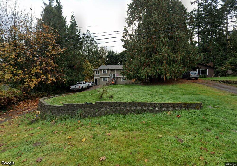
1993 NW Kimball Rd Poulsbo, WA 98370
Lofall NeighborhoodEstimated Value: $465,000 - $554,000
2
Beds
2
Baths
906
Sq Ft
$558/Sq Ft
Est. Value
About This Home
This home is located at 1993 NW Kimball Rd, Poulsbo, WA 98370 and is currently estimated at $505,214, approximately $557 per square foot. 1993 NW Kimball Rd is a home located in Kitsap County with nearby schools including Vinland Elementary School, Poulsbo Middle School, and North Kitsap High School.
Ownership History
Date
Name
Owned For
Owner Type
Purchase Details
Closed on
May 9, 2005
Sold by
Bodin Joseph E
Bought by
Trunnell Lee R and Trunnell Brooke J
Current Estimated Value
Home Financials for this Owner
Home Financials are based on the most recent Mortgage that was taken out on this home.
Original Mortgage
$151,920
Outstanding Balance
$79,365
Interest Rate
5.87%
Mortgage Type
Purchase Money Mortgage
Estimated Equity
$425,849
Purchase Details
Closed on
Apr 19, 2002
Sold by
Delacruz Alita Eleanor and Danielson Alita
Bought by
Bodin Joseph E
Home Financials for this Owner
Home Financials are based on the most recent Mortgage that was taken out on this home.
Original Mortgage
$130,945
Interest Rate
7.08%
Mortgage Type
FHA
Purchase Details
Closed on
Dec 17, 1997
Sold by
Danielson Stephen C
Bought by
Danielson Alita
Create a Home Valuation Report for This Property
The Home Valuation Report is an in-depth analysis detailing your home's value as well as a comparison with similar homes in the area
Home Values in the Area
Average Home Value in this Area
Purchase History
| Date | Buyer | Sale Price | Title Company |
|---|---|---|---|
| Trunnell Lee R | $189,900 | Pacific Nw Title | |
| Bodin Joseph E | $133,000 | First American Title Ins | |
| Danielson Alita | -- | Chicago Title Insurance Co |
Source: Public Records
Mortgage History
| Date | Status | Borrower | Loan Amount |
|---|---|---|---|
| Open | Trunnell Lee R | $151,920 | |
| Previous Owner | Bodin Joseph E | $130,945 |
Source: Public Records
Tax History Compared to Growth
Tax History
| Year | Tax Paid | Tax Assessment Tax Assessment Total Assessment is a certain percentage of the fair market value that is determined by local assessors to be the total taxable value of land and additions on the property. | Land | Improvement |
|---|---|---|---|---|
| 2026 | $3,717 | $412,900 | $98,970 | $313,930 |
| 2025 | $3,717 | $412,900 | $98,970 | $313,930 |
| 2024 | $3,069 | $349,770 | $86,190 | $263,580 |
| 2023 | $3,117 | $349,770 | $86,190 | $263,580 |
| 2022 | $2,702 | $286,780 | $71,640 | $215,140 |
| 2021 | $2,567 | $251,930 | $62,690 | $189,240 |
| 2020 | $2,483 | $240,110 | $59,890 | $180,220 |
| 2019 | $2,334 | $224,930 | $55,970 | $168,960 |
| 2018 | $2,377 | $195,410 | $55,970 | $139,440 |
| 2017 | $2,265 | $195,410 | $55,970 | $139,440 |
| 2016 | $2,266 | $180,140 | $55,970 | $124,170 |
| 2015 | $2,114 | $168,950 | $55,970 | $112,980 |
| 2014 | -- | $162,840 | $55,970 | $106,870 |
| 2013 | -- | $162,840 | $55,970 | $106,870 |
Source: Public Records
Map
Nearby Homes
- 1841 NW Russell St
- 1918 NW Russell St
- 26495 NW Edgewater Blvd
- 23490 Marinwood Cir NE Unit 1212
- 1799 NW Mulholland Blvd
- 25749 Pyramid Ln NW
- 1881 NW Seclusion Cove Way
- 0 State Hwy 3 NE Unit NWM2410405
- 25443 Pioneer Way NW
- 27405 Lofall Ct NW
- 1870 NW Vaa Rd
- 0 XXX Sanderling Place NE
- 2 XXX NW Park St
- 27272 Big Valley Rd NE
- 24028 Vinland Terrace NW
- 23607 Coburg Place NW
- 23600 Dunbar Place NW
- 23587 Monument Place NW
- 24478 Johnson Rd NW
- 28389 State Highway 3 NE
- 1975 NW Kimball Rd
- 2011 NW Kimball Rd
- 26331 Edgewater Blvd NW
- 1963 NW Kimball Rd
- 2050 NW Swanlund St
- 2034 NW Swanlund St
- 2080 NW Swanlund St
- 1990 NW Kimball Rd
- 1949 NW Kimball Rd
- 2012 NW Kimball Rd
- 1974 NW Kimball Rd
- 1976 NW Kimball Rd
- 1962 NW Kimball Rd
- 2026 NW Swanlund St
- 1933 NW Kimball Rd
- 1942 NW Kimball Rd
- 26411 Edgewater Blvd NW
- 26352 Edgewater Blvd NW
- 2049 NW Swanlund St