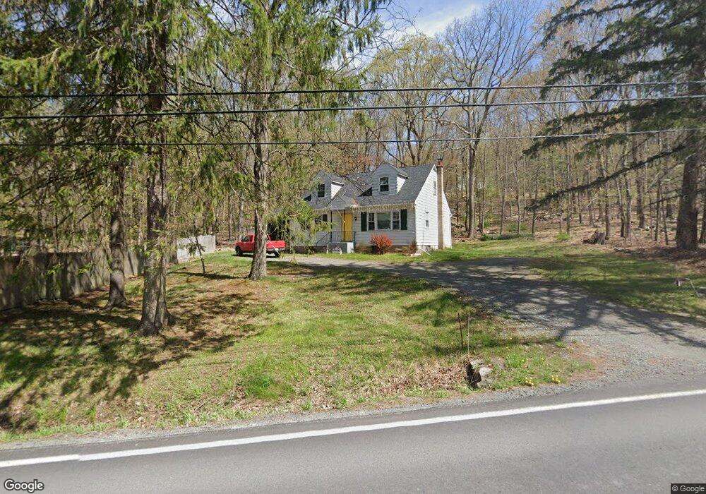
1993 Route 590 Hawley, PA 18428
Estimated Value: $215,000 - $216,922
3
Beds
2
Baths
2,044
Sq Ft
$106/Sq Ft
Est. Value
About This Home
This home is located at 1993 Route 590, Hawley, PA 18428 and is currently estimated at $215,961, approximately $105 per square foot. 1993 Route 590 is a home located in Pike County with nearby schools including Wallenpaupack Area High School and Son-Shine Christian School.
Ownership History
Date
Name
Owned For
Owner Type
Purchase Details
Closed on
Dec 1, 2022
Sold by
Garrity Kenneth E
Bought by
Raineday Llc
Current Estimated Value
Purchase Details
Closed on
May 4, 2011
Sold by
Keller David
Bought by
Garrity Kenneth E and Garrity Teresa M
Home Financials for this Owner
Home Financials are based on the most recent Mortgage that was taken out on this home.
Original Mortgage
$74,720
Interest Rate
5.5%
Mortgage Type
FHA
Purchase Details
Closed on
Nov 15, 2008
Sold by
Pike County Tax Claim Bureau
Bought by
Keller David
Create a Home Valuation Report for This Property
The Home Valuation Report is an in-depth analysis detailing your home's value as well as a comparison with similar homes in the area
Home Values in the Area
Average Home Value in this Area
Purchase History
| Date | Buyer | Sale Price | Title Company |
|---|---|---|---|
| Raineday Llc | $145,900 | -- | |
| Garrity Kenneth E | $70,000 | None Available | |
| Keller David | $4,673 | None Available |
Source: Public Records
Mortgage History
| Date | Status | Borrower | Loan Amount |
|---|---|---|---|
| Previous Owner | Garrity Kenneth E | $74,720 |
Source: Public Records
Tax History Compared to Growth
Tax History
| Year | Tax Paid | Tax Assessment Tax Assessment Total Assessment is a certain percentage of the fair market value that is determined by local assessors to be the total taxable value of land and additions on the property. | Land | Improvement |
|---|---|---|---|---|
| 2025 | $2,076 | $17,440 | $590 | $16,850 |
| 2024 | $2,076 | $17,440 | $590 | $16,850 |
| 2023 | $2,002 | $17,440 | $590 | $16,850 |
| 2022 | $1,958 | $17,440 | $590 | $16,850 |
| 2021 | $1,923 | $17,440 | $590 | $16,850 |
| 2020 | $1,923 | $17,440 | $590 | $16,850 |
| 2019 | $1,866 | $17,440 | $590 | $16,850 |
| 2018 | $1,837 | $17,440 | $590 | $16,850 |
| 2017 | $1,784 | $17,440 | $590 | $16,850 |
| 2016 | $0 | $17,440 | $590 | $16,850 |
| 2014 | -- | $17,440 | $590 | $16,850 |
Source: Public Records
Map
Nearby Homes
- Lot 21 Woodledge Hills Dr
- 1936 Route 590
- 20 Chuck Foster Dr
- Lot 9 Tamarack Dr
- 43 Woodledge East Lake Dr
- Lot 116 Beech Tree Ct
- 56 Cedar Ridge
- Lot 3 Cedar Ridge Rd
- 0 Cedar Ridge Rd
- Woodledge Village Meadows Ct
- 155 Tink Wig Dr
- 155 Tink Wig Dr
- 22 Meadows Dr
- Lot 21 Ridge View Rd
- 104 Cedar Ln
- Lot 109 Oriole Ct
- Lot 8 Woodledge East Lake Dr
- 0 Creek Rd
- 390 Creek Ct
- Lot 35 Ponderosa Pine Rd
- 1993 Pennsylvania 590
- 1995 Route 590
- 1996 Route 590
- 1996 Route 590
- 1988 Route 590
- 105 Catamount Dr
- Lot 628 Catamount Dr
- Lot 621 Catamount Dr
- 632 Catamount Dr
- 623 Catamount Dr
- 108 Catamount Dr
- 123 Vanwyk Farm Rd
- 1977 Route 590
- 1977 Route 590
- 1974 Route 590
- 132 Cloudcrest Dr
- 614 Bluebird Ct
- 1972 Pa-590
- 1972 Route 590
- 50 Woodledge Hills Dr