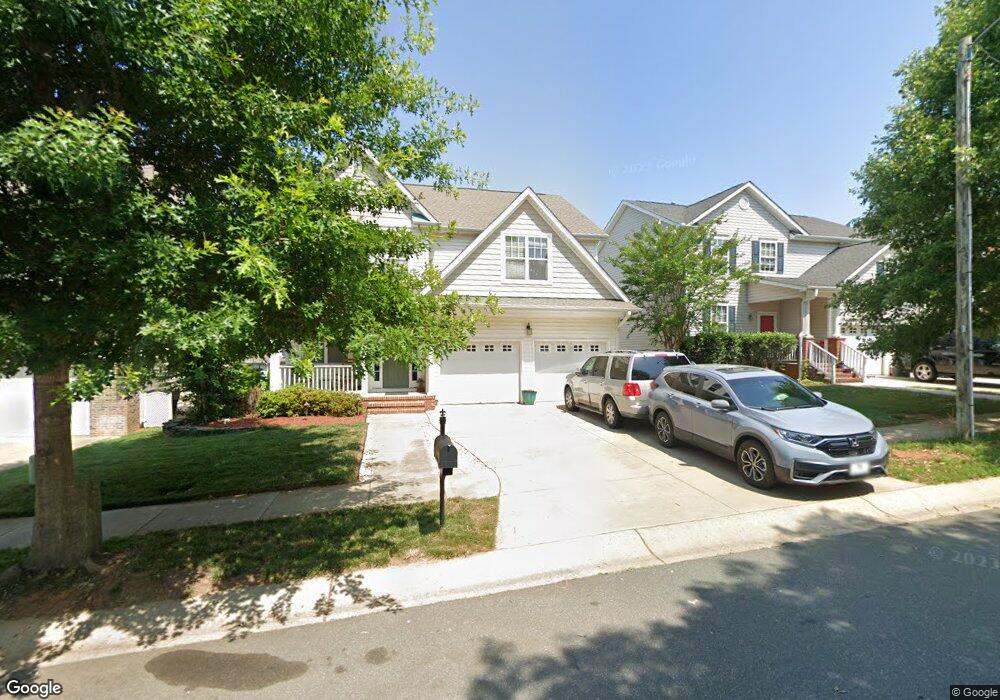
1993 Sinclair Trace Avalon 73 Burlington, NC 27215
Southwest Burlington NeighborhoodEstimated Value: $327,451 - $393,000
4
Beds
3
Baths
2,191
Sq Ft
$161/Sq Ft
Est. Value
About This Home
This home is located at 1993 Sinclair Trace Avalon 73, Burlington, NC 27215 and is currently estimated at $351,863, approximately $160 per square foot. 1993 Sinclair Trace Avalon 73 is a home located in Alamance County with nearby schools including Highland Elementary School, Turrentine Middle School, and Walter M. Williams High School.
Ownership History
Date
Name
Owned For
Owner Type
Purchase Details
Closed on
Jun 20, 2014
Sold by
Stamm Peter W and Stamm Karen
Bought by
Stamm Trustee Peter W and Stamm Family Trust
Current Estimated Value
Purchase Details
Closed on
Sep 30, 2008
Sold by
Perry Builders Inc
Bought by
Stamm Peter W
Home Financials for this Owner
Home Financials are based on the most recent Mortgage that was taken out on this home.
Original Mortgage
$170,000
Interest Rate
6.45%
Mortgage Type
New Conventional
Create a Home Valuation Report for This Property
The Home Valuation Report is an in-depth analysis detailing your home's value as well as a comparison with similar homes in the area
Home Values in the Area
Average Home Value in this Area
Purchase History
We collect this data history from publicly available records. To have your information removed, we recommend requesting removal directly through your county’s website.
| Date | Buyer | Sale Price | Title Company |
|---|---|---|---|
| Stamm Trustee Peter W | -- | -- | |
| Stamm Peter W | $205,000 | -- |
Source: Public Records
Mortgage History
We collect this data history from publicly available records. To have your information removed, we recommend requesting removal directly through your county’s website.
| Date | Status | Borrower | Loan Amount |
|---|---|---|---|
| Previous Owner | Stamm Peter W | $170,000 |
Source: Public Records
Tax History
| Year | Tax Paid | Tax Assessment Tax Assessment Total Assessment is a certain percentage of the fair market value that is determined by local assessors to be the total taxable value of land and additions on the property. | Land | Improvement |
|---|---|---|---|---|
| 2025 | $1,608 | $325,526 | $60,000 | $265,526 |
| 2024 | $1,527 | $325,526 | $60,000 | $265,526 |
| 2023 | $2,966 | $325,526 | $60,000 | $265,526 |
| 2022 | $2,346 | $189,070 | $40,000 | $149,070 |
| 2021 | $2,365 | $189,070 | $40,000 | $149,070 |
| 2020 | $2,384 | $189,070 | $40,000 | $149,070 |
| 2019 | $2,390 | $189,070 | $40,000 | $149,070 |
| 2018 | $1,124 | $189,070 | $40,000 | $149,070 |
| 2017 | $1,091 | $189,070 | $40,000 | $149,070 |
| 2016 | $2,319 | $199,876 | $40,000 | $159,876 |
| 2015 | $1,153 | $199,876 | $40,000 | $159,876 |
| 2014 | -- | $199,876 | $40,000 | $159,876 |
Source: Public Records
Map
Nearby Homes
- 4050 Forbes Way
- 2050 Sinclair Trace
- 4007 Cullen Ct
- 1947 Huntley Way
- 3334 Castlerock Dr
- 1841 Dunbar Place
- 4104 Hansel Trace
- 197 Elgin Ct
- 3935 Kincade Dr
- 346 Sapphire Rd
- 275 Sapphire Rd
- 1086 Salters St
- 135 Glenfield Ln
- 1284 Lael Forest Trail
- 1216 Kerr St
- 2331 Campbell Loop
- 2207 Campbell Loop
- 1168 Cardross St
- 1259 Lael Forest Trail
- 1069 Kerr St
- 1993 Sinclair Trace
- 1989 Sinclair Trace
- 1997 Sinclair Trace Avalon 72
- 1997 Sinclair Trace
- 4010 Forbes Way
- 1985 Sinclair Trace
- 2005 Sinclair Trace Avalon 71
- 2005 Sinclair Trace
- 4014
- 4014 Forbes Way
- 4006 Forbes Way
- 1992 Sinclair Trace
- 2009 Sinclair Trace
- 4018 Forbes Way
- 1988 Sinclair Trace
- 2002 Sinclair Trace
- 1973 Sinclair Trace
- 1984 Sinclair Trace
- 2006 Sinclair Trace
- 4022 Forbes Way
Your Personal Tour Guide
Ask me questions while you tour the home.