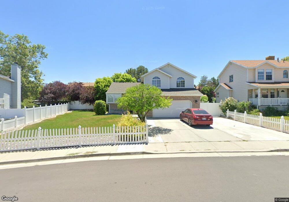
1993 W 5620 S Salt Lake City, UT 84129
Estimated Value: $555,000 - $638,000
5
Beds
3
Baths
2,327
Sq Ft
$248/Sq Ft
Est. Value
About This Home
This home is located at 1993 W 5620 S, Salt Lake City, UT 84129 and is currently estimated at $576,661, approximately $247 per square foot. 1993 W 5620 S is a home located in Salt Lake County with nearby schools including Vista Elementary School, Eisenhower Jr High School, and Taylorsville High School.
Ownership History
Date
Name
Owned For
Owner Type
Purchase Details
Closed on
May 20, 2015
Sold by
Clifford Clark K and Clifford Adrianne B
Bought by
Yamashita Cory and Yamashita Kaylee
Current Estimated Value
Home Financials for this Owner
Home Financials are based on the most recent Mortgage that was taken out on this home.
Original Mortgage
$263,145
Outstanding Balance
$202,349
Interest Rate
3.63%
Mortgage Type
FHA
Estimated Equity
$374,312
Purchase Details
Closed on
May 30, 2007
Sold by
Shimp Allen R and Shimp Casey D
Bought by
Clifford Clark K and Clifford Adrianne B
Home Financials for this Owner
Home Financials are based on the most recent Mortgage that was taken out on this home.
Original Mortgage
$225,600
Interest Rate
6.12%
Mortgage Type
New Conventional
Create a Home Valuation Report for This Property
The Home Valuation Report is an in-depth analysis detailing your home's value as well as a comparison with similar homes in the area
Home Values in the Area
Average Home Value in this Area
Purchase History
| Date | Buyer | Sale Price | Title Company |
|---|---|---|---|
| Yamashita Cory | -- | Title Guarantee S Jordan | |
| Clifford Clark K | -- | Affiliated First Title |
Source: Public Records
Mortgage History
| Date | Status | Borrower | Loan Amount |
|---|---|---|---|
| Open | Yamashita Cory | $263,145 | |
| Previous Owner | Clifford Clark K | $225,600 |
Source: Public Records
Tax History Compared to Growth
Tax History
| Year | Tax Paid | Tax Assessment Tax Assessment Total Assessment is a certain percentage of the fair market value that is determined by local assessors to be the total taxable value of land and additions on the property. | Land | Improvement |
|---|---|---|---|---|
| 2025 | $3,146 | $544,800 | $158,900 | $385,900 |
| 2024 | $3,146 | $516,000 | $150,500 | $365,500 |
| 2023 | $3,146 | $493,500 | $144,700 | $348,800 |
| 2022 | $2,991 | $485,400 | $141,800 | $343,600 |
| 2021 | $2,622 | $370,600 | $109,100 | $261,500 |
| 2020 | $2,502 | $334,600 | $109,100 | $225,500 |
| 2019 | $2,506 | $327,300 | $102,900 | $224,400 |
| 2018 | $2,424 | $293,200 | $102,900 | $190,300 |
| 2017 | $2,048 | $271,000 | $102,900 | $168,100 |
| 2016 | $1,887 | $249,500 | $102,900 | $146,600 |
| 2015 | $1,897 | $234,400 | $102,700 | $131,700 |
| 2014 | $1,856 | $225,300 | $99,600 | $125,700 |
Source: Public Records
Map
Nearby Homes
- 5552 Hew Wood Dr
- 2127 Cedar Breaks Dr
- 2016 W Hew Wood Ct
- 2320 W 5400 S
- 1886 W Champagne Ave
- 2093 W Chateau Ave
- 2322 W Surrey Rd
- 2113 W Surrey Cir
- 1891 S Jordan Canal Rd
- 1997 Rocky Rd
- 1844 W Leisure Ln
- 5574 Easton St
- 1401 Beacon Hill Dr Unit 118
- 1381 Beacon Hill Dr
- 5748 2730 West St
- 2045 W 6200 S
- 1380 W Ocean Ct
- 2091 W 6200 S
- 1388 W Ocean Ct
- 1354 W Telegraph Hill Dr Unit 37
- 1981 W 5620 S
- 2005 W 5620 S
- 1988 W 5620 S
- 1969 W 5620 S
- 2021 W 5620 S
- 2006 W 5620 S
- 2022 W 5620 S
- 5595 Hew Wood Dr
- 5592 Hew Wood Dr
- 2037 W 5620 S
- 1999 Cedar Breaks Dr
- 2036 W 5620 S
- 5593 Hew Wood Dr
- 2013 Cedar Breaks Dr
- 2051 W 5620 S
- 2029 W Cedar Breaks Dr
- 2029 Cedar Breaks Dr
- 2050 W 5620 S
- 5581 Hew Wood Dr
- 0 5639 South 1900 W