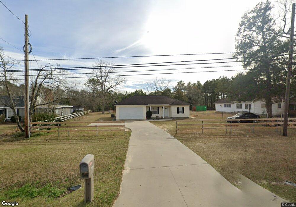
1995 Camilla Hwy Moultrie, GA 31768
Estimated Value: $175,479 - $230,000
--
Bed
2
Baths
1,283
Sq Ft
$163/Sq Ft
Est. Value
About This Home
This home is located at 1995 Camilla Hwy, Moultrie, GA 31768 and is currently estimated at $209,620, approximately $163 per square foot. 1995 Camilla Hwy is a home located in Colquitt County with nearby schools including Funston Elementary School, C.A. Gray Junior High School, and Willie J. Williams Middle School.
Ownership History
Date
Name
Owned For
Owner Type
Purchase Details
Closed on
Aug 24, 2017
Sold by
Saunders Glenn D
Bought by
Nunez Ana I
Current Estimated Value
Purchase Details
Closed on
Apr 11, 2014
Sold by
Saunders Glenn D
Bought by
Saunders Glenn D and Saunders Judith R
Purchase Details
Closed on
May 12, 2006
Sold by
Knight Geraltine C
Bought by
Saunders Glenn D and Laporte Carole S
Purchase Details
Closed on
Mar 4, 1996
Bought by
Knight W L
Purchase Details
Closed on
Aug 18, 1955
Bought by
Moore Raymon E Mrs
Create a Home Valuation Report for This Property
The Home Valuation Report is an in-depth analysis detailing your home's value as well as a comparison with similar homes in the area
Home Values in the Area
Average Home Value in this Area
Purchase History
| Date | Buyer | Sale Price | Title Company |
|---|---|---|---|
| Nunez Ana I | $122,500 | -- | |
| Saunders Glenn D | -- | -- | |
| Saunders Glenn D | -- | -- | |
| Saunders Glenn D | $105,000 | -- | |
| Knight W L | $65,000 | -- | |
| Moore Raymon E Mrs | -- | -- |
Source: Public Records
Tax History Compared to Growth
Tax History
| Year | Tax Paid | Tax Assessment Tax Assessment Total Assessment is a certain percentage of the fair market value that is determined by local assessors to be the total taxable value of land and additions on the property. | Land | Improvement |
|---|---|---|---|---|
| 2024 | $2,421 | $64,839 | $3,520 | $61,319 |
| 2023 | $1,957 | $44,514 | $3,520 | $40,994 |
| 2022 | $1,472 | $43,972 | $3,520 | $40,452 |
| 2021 | $1,363 | $40,182 | $3,520 | $36,662 |
| 2020 | $1,386 | $40,182 | $3,520 | $36,662 |
| 2019 | $1,563 | $40,258 | $3,520 | $36,738 |
| 2018 | $1,608 | $40,258 | $3,520 | $36,738 |
| 2017 | $1,547 | $40,280 | $3,520 | $36,760 |
| 2016 | $1,609 | $40,280 | $3,520 | $36,760 |
| 2015 | $1,613 | $40,280 | $3,520 | $36,760 |
| 2014 | $1,650 | $41,598 | $3,520 | $38,078 |
| 2013 | -- | $41,597 | $3,520 | $38,077 |
Source: Public Records
Map
Nearby Homes
- 2393 Georgia 37
- 216 Circle Rd
- 410 West Bypass NW
- 1321 Hallmark Dr
- 410 W Bypass Pass NW
- 722 Martin Luther King jr Dr
- 417 9th St NW
- 408 9th St NW
- 1208 Maple St
- 610 1st Ave NW
- 2010 West Blvd
- 618 2nd Ave SW
- 521 5th Ave NW
- 316 5th Ave NW
- 610 4th Ave SW
- 515 8th St SW
- 00 1st Ave SW
- 118 5th St SW
- 221 6th St SW
- 601 4th Ave SW
- 2003 Camilla Hwy
- 1925 Camilla Hwy
- 1921 Camilla Hwy
- 2019 Camilla Hwy
- 1928 Camilla Hwy
- 1924 Camilla Hwy
- 2004 Camilla Hwy
- 1920 Camilla Hwy
- 2008 Camilla Hwy
- 1917 Camilla Hwy
- 2021 Camilla Hwy
- 2012 Camilla Hwy
- 1927 Magnolia Ave
- 1923 Magnolia Ave
- 1912 Camilla Hwy
- 2025 Camilla Hwy
- 2016 Camilla Hwy
- 1919 Magnolia Ave
- 2007 Magnolia Ave
- 1915 Camilla Hwy