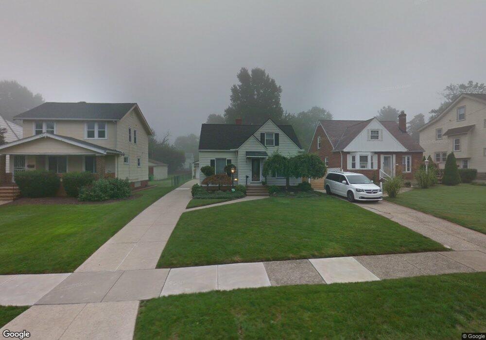
1995 E 224th St Euclid, OH 44117
Estimated Value: $141,000 - $174,000
3
Beds
1
Bath
1,261
Sq Ft
$126/Sq Ft
Est. Value
About This Home
This home is located at 1995 E 224th St, Euclid, OH 44117 and is currently estimated at $158,722, approximately $125 per square foot. 1995 E 224th St is a home located in Cuyahoga County with nearby schools including Thomas Jefferson Elementary School, Euclid Middle School, and Euclid High School.
Ownership History
Date
Name
Owned For
Owner Type
Purchase Details
Closed on
Apr 26, 1996
Sold by
Fitzgerald Joan E
Bought by
Rice
Current Estimated Value
Home Financials for this Owner
Home Financials are based on the most recent Mortgage that was taken out on this home.
Original Mortgage
$74,610
Interest Rate
7.91%
Mortgage Type
New Conventional
Purchase Details
Closed on
May 20, 1987
Sold by
Donald F Schultz
Bought by
Fitzgerald Joan E
Purchase Details
Closed on
Nov 24, 1982
Sold by
Schultz Marguerite M
Bought by
Donald F Schultz
Purchase Details
Closed on
Dec 4, 1980
Sold by
Schultz Marguerite M and C E
Bought by
Schultz Marguerite M
Purchase Details
Closed on
Jan 1, 1975
Bought by
Schultz Marguerite M and C E
Create a Home Valuation Report for This Property
The Home Valuation Report is an in-depth analysis detailing your home's value as well as a comparison with similar homes in the area
Home Values in the Area
Average Home Value in this Area
Purchase History
| Date | Buyer | Sale Price | Title Company |
|---|---|---|---|
| Rice | $82,900 | -- | |
| Fitzgerald Joan E | $64,000 | -- | |
| Donald F Schultz | -- | -- | |
| Schultz Marguerite M | -- | -- | |
| Schultz Marguerite M | -- | -- |
Source: Public Records
Mortgage History
| Date | Status | Borrower | Loan Amount |
|---|---|---|---|
| Previous Owner | Rice | $74,610 |
Source: Public Records
Tax History
| Year | Tax Paid | Tax Assessment Tax Assessment Total Assessment is a certain percentage of the fair market value that is determined by local assessors to be the total taxable value of land and additions on the property. | Land | Improvement |
|---|---|---|---|---|
| 2024 | $3,317 | $48,300 | $10,395 | $37,905 |
| 2023 | $2,785 | $32,130 | $8,120 | $24,010 |
| 2022 | $2,721 | $32,130 | $8,120 | $24,010 |
| 2021 | $3,031 | $32,130 | $8,120 | $24,010 |
| 2020 | $2,874 | $27,690 | $7,000 | $20,690 |
| 2019 | $2,583 | $79,100 | $20,000 | $59,100 |
| 2018 | $2,612 | $27,690 | $7,000 | $20,690 |
| 2017 | $3,038 | $27,060 | $5,600 | $21,460 |
| 2016 | $3,045 | $27,060 | $5,600 | $21,460 |
| 2015 | $2,771 | $27,060 | $5,600 | $21,460 |
| 2014 | $2,771 | $27,060 | $5,600 | $21,460 |
Source: Public Records
Map
Nearby Homes
- 1754 E 236th St
- 22601 Harms Rd
- 22791 Harms Rd
- 21950 Euclid Ave
- 1765 E 238th St
- 23501 Effingham Blvd
- 1554 E 221st St
- 1545 E 214th St
- 1775 Sherwood Blvd
- 24105 Chardon Rd
- 1734 Glenridge Rd
- 1732 Glenridge Rd
- 24 Washington Square Unit 15
- 363 Balmoral Dr
- 20021 Green Oak Dr
- 1721 Grand Blvd
- 1524 E 204th St
- 209 Greenbriar Ct
- 24801 Highland Rd
- 19871 Upper Valley Dr
- 1991 E 224th St
- 2005 E 224th St
- 1985 E 224th St
- 2007 E 224th St
- 1981 E 224th St
- 2011 E 224th St
- 1977 E 224th St
- 2021 E 224th St
- 1996 E 226th St
- 1990 E 226th St
- 1984 E 226th St
- 2004 E 226th St
- 1980 E 226th St
- 1975 E 224th St
- 2025 E 224th St
- 2010 E 226th St
- 1994 E 224th St
- 1990 E 224th St
- 2004 E 224th St
- 1976 E 226th St
Your Personal Tour Guide
Ask me questions while you tour the home.