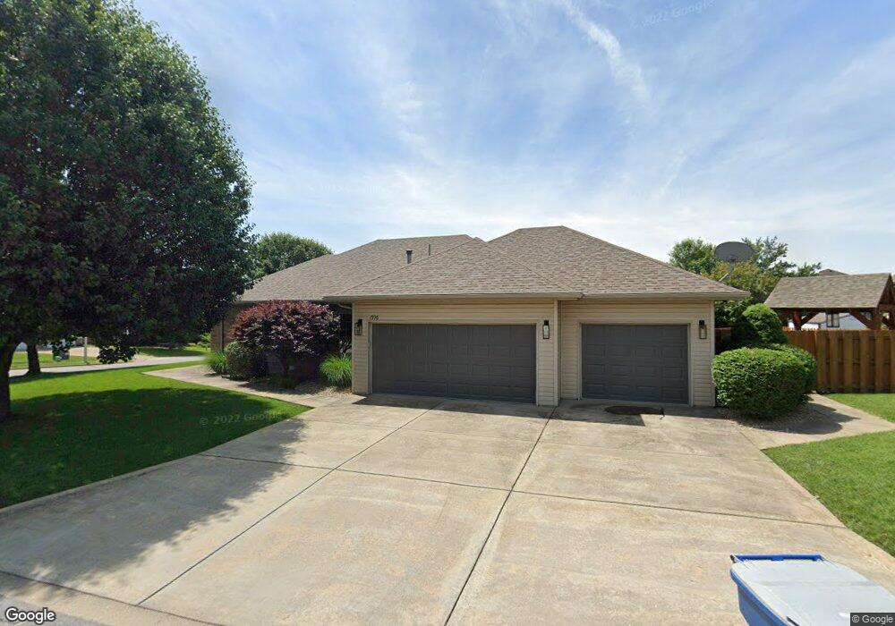
1996 E Wheatridge Dr Springfield, MO 65803
Estimated Value: $257,000 - $318,835
3
Beds
3
Baths
1,707
Sq Ft
$174/Sq Ft
Est. Value
About This Home
This home is located at 1996 E Wheatridge Dr, Springfield, MO 65803 and is currently estimated at $297,459, approximately $174 per square foot. 1996 E Wheatridge Dr is a home located in Greene County with nearby schools including Pleasant View K-8 School, Hillcrest High School, and Dayspring Christian School.
Ownership History
Date
Name
Owned For
Owner Type
Purchase Details
Closed on
Jun 16, 2012
Sold by
Sneed Murray G and Sneed Paula M
Bought by
Sneed Brenda M and Brenda M Sneed Living Trust
Current Estimated Value
Purchase Details
Closed on
Apr 14, 2009
Sold by
Sneed Brenda M
Bought by
Sneed Brenda M and Brenda M Sneed Sneed
Home Financials for this Owner
Home Financials are based on the most recent Mortgage that was taken out on this home.
Original Mortgage
$141,475
Interest Rate
5.24%
Mortgage Type
New Conventional
Purchase Details
Closed on
Jul 14, 2005
Sold by
Sneed Brenda
Bought by
Sneed Brenda M
Create a Home Valuation Report for This Property
The Home Valuation Report is an in-depth analysis detailing your home's value as well as a comparison with similar homes in the area
Purchase History
| Date | Buyer | Sale Price | Title Company |
|---|---|---|---|
| Sneed Brenda M | -- | None Available | |
| Sneed Brenda M | -- | Fidelity Title Agency | |
| Sneed Brenda M | -- | None Available | |
| Sneed Brenda M | -- | None Available |
Source: Public Records
Mortgage History
| Date | Status | Borrower | Loan Amount |
|---|---|---|---|
| Previous Owner | Sneed Brenda M | $141,475 |
Source: Public Records
Tax History
| Year | Tax Paid | Tax Assessment Tax Assessment Total Assessment is a certain percentage of the fair market value that is determined by local assessors to be the total taxable value of land and additions on the property. | Land | Improvement |
|---|---|---|---|---|
| 2025 | $2,514 | $49,180 | $7,700 | $41,480 |
| 2024 | $2,514 | $43,420 | $5,700 | $37,720 |
| 2023 | $2,501 | $43,420 | $5,700 | $37,720 |
| 2022 | $2,284 | $38,860 | $5,700 | $33,160 |
| 2021 | $2,184 | $38,860 | $5,700 | $33,160 |
| 2020 | $2,201 | $37,180 | $5,700 | $31,480 |
| 2019 | $2,140 | $37,180 | $5,700 | $31,480 |
| 2018 | $2,179 | $37,680 | $5,320 | $32,360 |
| 2017 | $2,160 | $37,680 | $5,320 | $32,360 |
| 2016 | $2,156 | $37,680 | $5,320 | $32,360 |
| 2015 | $2,140 | $37,680 | $5,320 | $32,360 |
| 2014 | $2,111 | $37,200 | $5,320 | $31,880 |
Source: Public Records
Map
Nearby Homes
- 2393 E Valley Water Mill Rd
- 1923 E Valley Water Mill Rd
- 3424 N Darwin Ave
- 3839 N Stewart Ave
- 3975 N Stewart Ave
- 4260 N State Highway H
- Tract C N Farm Road 173
- 4541b N Lanier Ln
- 4541 N Lanier Ln
- 3538 N Prince Ln
- 3749 N Pickwick Ave
- 3753 N Pickwick Ave
- 3983 N Courtney Cir
- 3333 N Delaware Ave
- 1349 E Stoneridge St
- 3107 N Neergard Ave
- 1270 E Ogorman Ct
- 1502 E McClernon St
- 1414 E Smith St
- 1626 E Farm Road 92
- 0 N Valley Place
- 3765 N Valley Place
- 3774 N Mill Ridge Ave
- 3762 N Mill Ridge Ave
- 1995 E Wheatridge Dr
- 3776 N Valley Place
- 1989 E Wheatridge Dr
- 3786 N Valley Place
- 3768 N Valley Place
- 3759 N Valley Place
- 3750 N Mill Ridge Ave
- 3762 N Valley Place
- 3780 N Valley Place
- 3814 N Mill Ridge Ave
- 3738 N Mill Ridge Ave
- 2000 E Burntwood Dr
- 1994 E Burntwood Dr
- 1978 E Wheatridge Dr
- 3763 N Mill Ridge Ave
- 3826 N Mill Ridge Ave
Your Personal Tour Guide
Ask me questions while you tour the home.