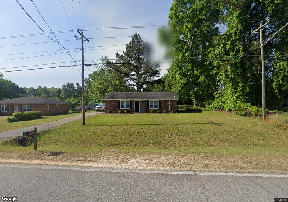
1996 Mcdade Rd Hephzibah, GA 30815
McDade NeighborhoodEstimated Value: $160,000 - $193,000
3
Beds
2
Baths
1,174
Sq Ft
$151/Sq Ft
Est. Value
About This Home
This home is located at 1996 Mcdade Rd, Hephzibah, GA 30815 and is currently estimated at $177,216, approximately $150 per square foot. 1996 Mcdade Rd is a home located in Richmond County with nearby schools including Goshen Elementary School, Pine Hill Middle School, and Johnson Magnet.
Ownership History
Date
Name
Owned For
Owner Type
Purchase Details
Closed on
Jun 7, 2002
Sold by
Southern Rentals & Development Llc
Bought by
Kolb James
Current Estimated Value
Home Financials for this Owner
Home Financials are based on the most recent Mortgage that was taken out on this home.
Original Mortgage
$54,150
Outstanding Balance
$22,576
Interest Rate
6.75%
Mortgage Type
FHA
Estimated Equity
$154,640
Purchase Details
Closed on
Oct 2, 2001
Sold by
Herrington Shirley A and United States Department Of Ag
Bought by
Southern Rentals & Development
Home Financials for this Owner
Home Financials are based on the most recent Mortgage that was taken out on this home.
Original Mortgage
$33,800
Interest Rate
6.5%
Create a Home Valuation Report for This Property
The Home Valuation Report is an in-depth analysis detailing your home's value as well as a comparison with similar homes in the area
Home Values in the Area
Average Home Value in this Area
Purchase History
| Date | Buyer | Sale Price | Title Company |
|---|---|---|---|
| Kolb James | $55,000 | -- | |
| Southern Rentals & Development | $33,800 | -- |
Source: Public Records
Mortgage History
| Date | Status | Borrower | Loan Amount |
|---|---|---|---|
| Open | Kolb James | $54,150 | |
| Previous Owner | Southern Rentals & Development | $33,800 |
Source: Public Records
Tax History Compared to Growth
Tax History
| Year | Tax Paid | Tax Assessment Tax Assessment Total Assessment is a certain percentage of the fair market value that is determined by local assessors to be the total taxable value of land and additions on the property. | Land | Improvement |
|---|---|---|---|---|
| 2025 | $1,980 | $61,184 | $4,200 | $56,984 |
| 2024 | $1,980 | $53,308 | $4,200 | $49,108 |
| 2023 | $1,032 | $47,916 | $4,200 | $43,716 |
| 2022 | $1,337 | $38,629 | $4,200 | $34,429 |
| 2021 | $983 | $24,112 | $4,200 | $19,912 |
| 2020 | $972 | $24,112 | $4,200 | $19,912 |
| 2019 | $1,014 | $24,112 | $4,200 | $19,912 |
| 2018 | $1,019 | $24,112 | $4,200 | $19,912 |
| 2017 | $990 | $24,112 | $4,200 | $19,912 |
| 2016 | $991 | $24,112 | $4,200 | $19,912 |
| 2015 | $996 | $24,112 | $4,200 | $19,912 |
| 2014 | $997 | $24,112 | $4,200 | $19,912 |
Source: Public Records
Map
Nearby Homes
- 2031 Mcdade Rd
- 1894 Mcdade Rd
- 2039 McDade Farm Rd
- 1943 McDade Farm Rd
- 1943 McDade Farm Rd Unit F
- 1898 McDade Farm Rd
- 2237 Sunny Day Dr
- 2319 Peach Blossom Pass
- 2316 Peach Blossom Pass
- 2107 Brown Rd
- 2125 Brown Rd
- 2053 Brown Rd
- 2405 Orchard Dr
- 3926 Union Grove Cir
- 328 Suncrest Ct
- 324 Suncrest Ct
- 320 Suncrest Ct
- 323 Suncrest Ct
- 316 Suncrest Ct
- 312 Suncrest Ct
- 1994 Mcdade Rd
- 3994 Bridle Path Dr
- 3992 Bridle Path Dr
- 3996 Bridle Path Dr
- 1988 Mcdade Rd
- 3998 Bridle Path Dr
- 4000 Bridle Path Dr
- 1986 McDade Farm Rd
- 1986 Mcdade Rd
- 2004 McDade Farm Rd
- 1995 Mcdade Rd
- 2004 Mcdade Rd
- 4004 Bridle Path Dr
- 1999 Mcdade Rd
- 4005 Bridle Path Dr
- 2005 Riding Ring Ct
- 4008 Bridle Path Dr
- 2011 McDade Farm Rd
- 2011 Mcdade Rd
- 4095 Smokey Rd