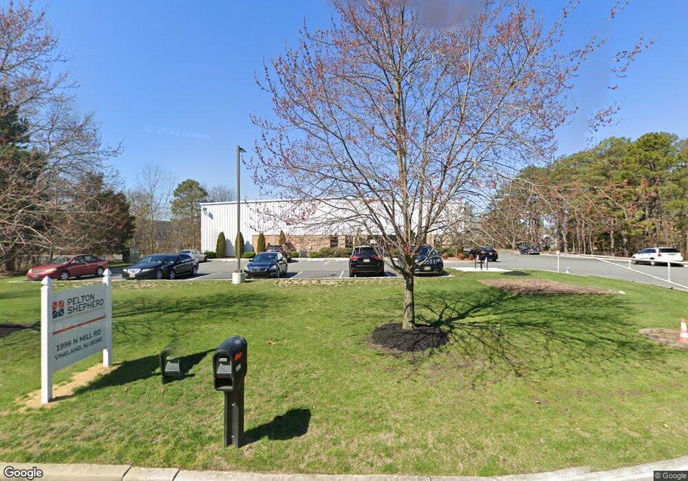
1996 N Mill Rd Vineland, NJ 08360
Estimated Value: $2,336,379
--
Bed
--
Bath
16,000
Sq Ft
$146/Sq Ft
Est. Value
About This Home
This home is located at 1996 N Mill Rd, Vineland, NJ 08360 and is currently estimated at $2,336,379, approximately $146 per square foot. 1996 N Mill Rd is a home located in Cumberland County with nearby schools including Marie D. Durand Elementary School, T.W. Wallace Middle School, and Vineland Senior High School.
Ownership History
Date
Name
Owned For
Owner Type
Purchase Details
Closed on
May 3, 2019
Sold by
Chemglass Realty Llc
Bought by
Shepherd Industrial Props
Current Estimated Value
Purchase Details
Closed on
Sep 28, 2011
Sold by
Nbvw Llc
Bought by
Chemglass Realty V Llc
Purchase Details
Closed on
Dec 22, 2003
Sold by
Lopergolo Rose
Bought by
City Of Vineland
Create a Home Valuation Report for This Property
The Home Valuation Report is an in-depth analysis detailing your home's value as well as a comparison with similar homes in the area
Home Values in the Area
Average Home Value in this Area
Purchase History
| Date | Buyer | Sale Price | Title Company |
|---|---|---|---|
| Shepherd Industrial Props | $1,300,000 | Beacon Title Service Agency | |
| Chemglass Realty V Llc | $1,180,000 | -- | |
| City Of Vineland | $275,095 | -- |
Source: Public Records
Tax History Compared to Growth
Tax History
| Year | Tax Paid | Tax Assessment Tax Assessment Total Assessment is a certain percentage of the fair market value that is determined by local assessors to be the total taxable value of land and additions on the property. | Land | Improvement |
|---|---|---|---|---|
| 2025 | $54,892 | $1,724,000 | $152,500 | $1,571,500 |
| 2024 | $54,892 | $1,724,000 | $152,500 | $1,571,500 |
| 2023 | $54,530 | $1,724,000 | $152,500 | $1,571,500 |
| 2022 | $52,910 | $1,724,000 | $152,500 | $1,571,500 |
| 2021 | $34,044 | $1,129,900 | $152,500 | $977,400 |
| 2020 | $33,072 | $1,129,900 | $152,500 | $977,400 |
| 2019 | $32,620 | $1,129,900 | $152,500 | $977,400 |
| 2018 | $31,761 | $1,129,900 | $152,500 | $977,400 |
| 2017 | $30,168 | $1,129,900 | $152,500 | $977,400 |
| 2016 | $29,106 | $1,129,900 | $152,500 | $977,400 |
| 2015 | $12,149 | $489,700 | $152,500 | $337,200 |
| 2014 | $11,488 | $489,700 | $152,500 | $337,200 |
Source: Public Records
Map
Nearby Homes
- 1469 N Mill Rd
- 829 W Garden Rd
- 1811 N Delsea Dr Unit 4
- 1252 W Oak Rd
- 1489 N Delsea Dr
- 2851 Nicolette Ct
- 1887 N Delsea Dr Unit 39
- 1887 N Delsea Dr Unit 135 HOLLY HOCK DR.
- 1887 N Delsea Dr Unit 19
- 2246 N West Ave
- 733 W Forest Grove Rd
- 663 Wayne Ave
- 47 Maple Shade Ln
- 659 W Forest Grove Rd
- 3332 N Delsea Dr
- 70 Steinfeld Ave
- 3397 N Delsea Dr
- 550 Northwest Ave
- 0 Levishohn St
- 834 Gershal Ave
- 7801 Leamings Mill Rd
- 2050 N Mill Rd
- 2035 N Mill Rd
- 2087 N Mill Rd
- 1905 N Mill Rd
- 2137 N Mill Rd
- 2225 N Mill Rd
- 1867 W Garden Rd
- 2111 Industrial Way
- 2035 W Garden Rd
- 1803 W Garden Rd
- 2105 W Garden Rd
- 1675 W Garden Rd
- 1837 W Garden Rd
- 1739 W Garden Rd
- 1872 W Garden Rd
- 1848 W Garden Rd
- 1830 W Garden Rd
- 1814 W Garden Rd
- 2800 Industrial Way Unit 3